Pilanesberg International Airport
| Pilanesberg International Airport | |||||||||||
|---|---|---|---|---|---|---|---|---|---|---|---|
| IATA: NTY – ICAO: FAPN | |||||||||||
| Summary | |||||||||||
| Airport type | Public | ||||||||||
| Owner/Operator | North West Provincial Government (NWPG)[1] | ||||||||||
| Serves | Sun City, North West, South Africa | ||||||||||
| Elevation AMSL | 3,412 ft / 1,040 m | ||||||||||
| Coordinates | 25°20′01″S 027°10′24″E / 25.33361°S 27.17333°ECoordinates: 25°20′01″S 027°10′24″E / 25.33361°S 27.17333°E | ||||||||||
| Website | www.acsa.co.za/... | ||||||||||
| Map | |||||||||||
 FAPN Location of airport in North West province Location of North West in South Africa 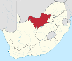 | |||||||||||
| Runways | |||||||||||
| |||||||||||
Pilanesberg International Airport (IATA: NTY, ICAO: FAPN) is an airport serving Sun City in the North West province of South Africa. It is located adjacent to the Pilanesberg Game Reserve.
Facilities
The airport resides at an elevation of 3,412 feet (1,040 m) above mean sea level. It has one runway designated 05/23 with an asphalt surface measuring 2,750 by 30 metres (9,022 ft × 98 ft).[2]
Airlines and destinations
| Airlines | Destinations |
|---|---|
| South African Express | Cape Town, Johannesburg-O. R. Tambo |
Communication
The Communication Frequency for Pilanesberg International Airport is 118.40 MHz. Runway lights can be activated by making 3-7 clicks on 118.40 MHz.[5] The control tower can be contacted on +27 (0)14 55 22154.
Nearby airports
See also
References
- ↑ "ACSA hands Pilanesberg International Airport back to North West Province". Airports Company South Africa. 22 September 2011. Retrieved 23 December 2011.
- 1 2 "Aerodrome chart for FAPN – PILANESBERG INTL (SUN CITY)" (PDF). South African Civil Aviation Authority. Effective 8 July 2004. Check date values in:
|date=(help) - ↑ Airport information for FAPN from DAFIF (effective October 2006)
- ↑ Airport information for NTY at Great Circle Mapper. Source: DAFIF (effective October 2006).
- ↑ AVIMAP Frequency Chart September 2011, AVIMAP Frequency Chart link retrieved 23 December 2011
External links
- Pilanesberg International Airport at Airports Company South Africa
- Private website about Pilanesberg International Airport
- Aeronautical chart for FAPN at SkyVector
- Current weather for FAPN at NOAA/NWS
- Accident history for NTY at Aviation Safety Network
This article is issued from Wikipedia - version of the 12/4/2016. The text is available under the Creative Commons Attribution/Share Alike but additional terms may apply for the media files.