Piedimulera
| Piedimulera | |
|---|---|
| Comune | |
| Comune di Piedimulera | |
_-_BEIC_6331042.jpg) | |
 Piedimulera Location of Piedimulera in Italy | |
| Coordinates: 46°1′N 8°16′E / 46.017°N 8.267°ECoordinates: 46°1′N 8°16′E / 46.017°N 8.267°E | |
| Country | Italy |
| Region | Piedmont |
| Province / Metropolitan city | Province of Verbano-Cusio-Ossola (VB) |
| Frazioni | Cimamulera, Mezzamulera, Meggiana, Gozzi sopra, Gozzi sotto, Morlongo, Madonna, Colletto, Apri', La piana, Pairazzi, San giuseppe, Catarnallo, Crosa |
| Area | |
| • Total | 7.6 km2 (2.9 sq mi) |
| Elevation | 248 m (814 ft) |
| Population (Dec. 2004) | |
| • Total | 1,661 |
| • Density | 220/km2 (570/sq mi) |
| Demonym(s) | Piedimuleresi |
| Time zone | CET (UTC+1) |
| • Summer (DST) | CEST (UTC+2) |
| Postal code | 28885 |
| Dialing code | 0324 |
Piedimulera is a comune (municipality) in the Province of Verbano-Cusio-Ossola in the Italian region Piedmont, located about 110 kilometres (68 mi) northeast of Turin and about 25 kilometres (16 mi) northwest of Verbania. As of 31 December 2004, it had a population of 1,661 and an area of 7.6 square kilometres (2.9 sq mi).[1]
Divisions
The municipality of Piedimulera contains the frazioni (subdivisions, mainly villages and hamlets) Cimamulera, Mezzamulera, Meggiana, Gozzi sopra, Gozzi sotto, Morlongo, Madonna, Colletto, Apri', La piana, Pairazzi, San giuseppe, Catarnallo, and Crosa.
Piedimulera borders the following municipalities: Calasca-Castiglione, Pallanzeno, Pieve Vergonte, Vogogna, Seppiana.
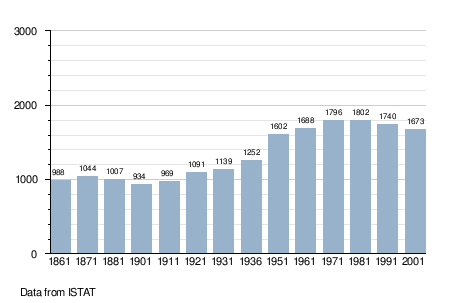
Demographic evolution
References
This article is issued from Wikipedia - version of the 4/13/2016. The text is available under the Creative Commons Attribution/Share Alike but additional terms may apply for the media files.