Pico de São Tomé
| Pico de São Tomé | |
|---|---|
 Pico de São Tomé | |
| Highest point | |
| Elevation | 2,024 m (6,640 ft) [1] |
| Prominence | 2,024 m (6,640 ft) [1] |
| Listing |
Country high point Ultra |
| Coordinates | 0°16′03″N 6°32′36″E / 0.26750°N 6.54333°ECoordinates: 0°16′03″N 6°32′36″E / 0.26750°N 6.54333°E [2] |
| Geography | |
| Location | São Tomé Island, São Tomé and Príncipe |
| Geology | |
| Age of rock | Holocene? |
| Mountain type | Shield volcano |
| Last eruption | Unknown |
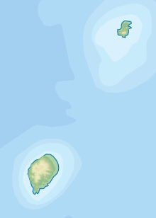
Pico de São Tomé is the highest mountain in São Tomé and Príncipe at 2,024 metres. It lies just west of the centre of São Tomé Island in the Obo National Park. The second highest point, Pico Ana Chaves, lies to its south east.[3]
The entire island of São Tomé is a massive shield volcano which rises from the floor of the Atlantic Ocean, over 3,000 m (10,000 ft) below sea level. It formed along the Cameroon line, a linear rift zone extending from Cameroon southwest into the Atlantic Ocean. Most of the lava erupted on São Tomé over the last million years has been basalt. The youngest dated rock on the island is about 100,000 years old, but numerous more recent cinder cones are found on the southeast side of the island.[4]
On old maps of São Tomé and Príncipe, the mountain is named "Pico Gago Coutinho", after Portuguese naval officer Carlos Viegas Gago Coutinho (1869–1959) who, together with Sacadura Cabral (1881–1924), was the first to cross the South Atlantic Ocean by air.[5]
The mountain is clad in forest. On the lower slopes are plantations of coffee and cocoa, and higher up are large trees swathed in orchids, lichens and other epiphytes. The upper parts of the mountain are often swathed in mist. It can be climbed from two sides. One way starts above the Ponta Figo plantation and necessitates a camp at Pico Mesa at 1,875 m (6,152 ft). The summit can then be reached in about an hour before descending via Carvalho to the Bombaim Plantation house. The other route ascends from the botanic garden at Bom Sucesso to Carvalho where there is a rest area and camping facilities. On the next day, the summit can be reached with a descent being made to Ponta Figo. The ascent can be made in a single eighteen hour hike from Ponta Figo, but this does not allow much time for viewing the flora and fauna. The trek is not difficult but the often rainy weather tends to make the path very slippery.[5]
References
- 1 2 "Pico de São Tomé" on Peakbagger.com, retrieved 29 September 2011
- ↑ "Pico de Sao Tome" on Africa Ultra-Prominences Peaklist.org, retrieved 29 September 2011
- ↑ Philip's (1994). Atlas of the World. Reed International. p. 103. ISBN 0-540-05831-9.
- ↑ Becker, Kathleen (2014), São Tomé and Príncipe, Bradt Travel Guides, p. 3, retrieved 19 November 2016
- 1 2 Becker, Kathleen (2014). São Tomé and Príncipe. Bradt Travel Guides. pp. 147–148. ISBN 978-1-84162-486-0.