Pic de Montferrat
| Pic de Montferrat | |
|---|---|
 | |
| Highest point | |
| Elevation | 3,219 m (10,561 ft) [1] |
| Coordinates | 42°46′01″N 0°08′18″E / 42.76694°N 0.13833°ECoordinates: 42°46′01″N 0°08′18″E / 42.76694°N 0.13833°E [1] |
| Geography | |
| Parent range |
Massif du Vignemale Pyrenees |
| Climbing | |
| First ascent | 1792 par des bergers ? |
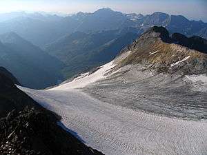
The Pic de Montferrat, culminating at 3,129 m (10,266 ft), is a crest summit on the Franco-Spanish border, in the massif du Vignemale in the Pyrenees.
Topography
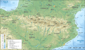
It is located in the Hautes-Pyrénées department, between Cauterets eand Gavarnie, arrondissement of Argelès-Gazost in the Pyrenees National Park. It is bordered to the north by the glacier d'Ossoue and by le petit glacier du Montferrat to the south-east.
History
The first ascension was carried out by shepherds, on August 1, 1792, who built a turret on the summit, ordered by Louis-Philippe Reinhart Junker who led a team of geodesists in charge of defining the Franco-Spanish border path.
See also
References
This article is issued from Wikipedia - version of the 6/14/2014. The text is available under the Creative Commons Attribution/Share Alike but additional terms may apply for the media files.