Phu Wiang District
| Phu Wiang ภูเวียง | |
|---|---|
| Amphoe | |
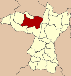 Amphoe location in Khon Kaen Province | |
| Coordinates: 16°39′16″N 102°22′37″E / 16.65444°N 102.37694°ECoordinates: 16°39′16″N 102°22′37″E / 16.65444°N 102.37694°E | |
| Country |
|
| Province | Khon Kaen |
| Seat | Phu Wiang |
| Area | |
| • Total | 621.6 km2 (240.0 sq mi) |
| Population (2008) | |
| • Total | 71,597 |
| • Density | 115.1/km2 (298/sq mi) |
| Time zone | THA (UTC+7) |
| Postal code | 40150 |
| Geocode | 4016 |
Phu Wiang (Thai: ภูเวียง, pronounced [pʰūː wīa̯ŋ]) is a district (Amphoe) in the northwestern part of Khon Kaen Province, northeastern Thailand.
Geography
Neighboring districts are (from the northeast clockwise) Ubolratana, Nong Ruea, Chum Phae, Wiang Kao, Nong Na Kham of Khon Kaen Province and Non Sang of Nongbua Lamphu Province.
A prehistoric Iron Age archaeological site, None Nok Tha (โนนนกทา) is located in the district, as is the Phu Wiang National Park.
Administration
The district is subdivided into 11 subdistricts (tambon), which are further subdivided into 114 villages (muban). Phu Wiang is a subdistrict municipality (thesaban tambon) and covers parts of tambon Phu Wiang. There is further 11 Tambon administrative organizations (TAO).
| No. | Name | Thai | Villages | Inh.[1] |
|---|---|---|---|---|
| 1. | Ban Ruea | บ้านเรือ | 9 | 3,736 |
| 4. | Wa Thong | หว้าทอง | 8 | 5,234 |
| 5. | Kut Khon Kaen | กุดขอนแก่น | 15 | 9,178 |
| 6. | Na Chum Saeng | นาชุมแสง | 12 | 6,568 |
| 7. | Na Wa | นาหว้า | 11 | 8,145 |
| 10. | Nong Kung Thanasan | หนองกุงธนสาร | 16 | 9,297 |
| 12. | Nong Kung Soen | หนองกุงเซิน | 9 | 6,073 |
| 13. | Song Pueai | สงเปือย | 11 | 6,467 |
| 14. | Thung Chomphu | ทุ่งชมพู | 8 | 4,495 |
| 16. | Din Dam | ดินดำ | 7 | 4,691 |
| 17. | Phu Wiang | ภูเวียง | 8 | 7,713 |
Missing numbers are tambon which now form the districts Wiang Kao and Nong Na Kham.
References
- ↑ "Population statistics 2008". Department of Provincial Administration.
External links
- amphoe.com (Thai)