Phra Khanong District
| Phra Khanong พระโขนง | |
|---|---|
| Khet | |
|
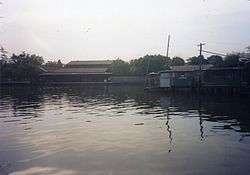
Phra Khanong Canal View from Wat Maha But famous in the legend of Mae Nak. | |
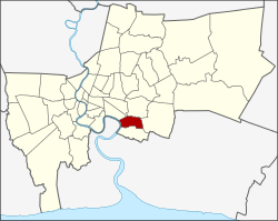 Khet location in Bangkok | |
| Coordinates: 13°42′8″N 100°36′6″E / 13.70222°N 100.60167°ECoordinates: 13°42′8″N 100°36′6″E / 13.70222°N 100.60167°E | |
| Country |
|
| Province | Bangkok |
| Seat | Bang Chak |
| Khwaeng | 1 |
| Area | |
| • Total | 13.986 km2 (5.400 sq mi) |
| Population (2015) | |
| • Total | 92,197 |
| • Density | 6,592.09/km2 (17,073.4/sq mi) |
| Time zone | THA (UTC+7) |
| Postal code |
10260 Mu 2-6 of Bang Chak: 10250 |
| Geocode | 1009 |
Phra Khanong (Thai: พระโขนง; IPA: [pʰráʔ kʰà.nǒːŋ]) is one of the 50 districts (Khet) of Bangkok, Thailand. Its neighbor, clockwise from north, are Suan Luang, Prawet, and Bang Na districts of Bangkok, Amphoe Phra Pradaeng of Samut Prakan Province (across Chao Phraya River), Khlong Toei and Watthana of Bangkok.
History
Phra Khanong was an amphoe of Nakhon Khuean Khan back in 1902. Nakhon Khuean Khan was renamed to Phra Pradaeng in 1914. In 1927 Phra Khanong was transferred from the then Phra Pradaeng province to Bangkok. It was once very big but it has since been split into several small districts. The districts Khlong Toei, Watthana, Suan Luang, Prawet and Bang Na were all once part of Phra Khanong. Khlong Toei (later split out Watthana) and Prawet (later separate out Suan Luang) districts were carved out of Phra Khanong in 1989. Bang Na was the last district to leave Phra Khanong in 1998.
Even though the administration has been changed, many surrounding areas are still often referred to as Phra Khanong. The Phra Khanong station of Bangkok Skytrain, opened in 1999, is actually outside the Phra Khanong district and located instead in the Phra Khanong Nuea sub-district of Watthana district.
The word Khanong originates from Khmer language and means eyebrow but it was speculated that it may be from Khanon (ขนอน) meaning customhouse. The area has been important gateway from the sea for very long time and the history of Phra Pradaeng dated back to over 1,000 years ago when the area was still ruled by Khmer empire.
The shrine dedicated to Mae Nak Phra Khanong at Wat Mahabut was situated in the Phra Khanong district until a 1997 boundary change placed it in neighboring Suan Luang district - much to the consternation of the people of Phra Khanong.
Administration
The district has only one sub-district (Kwaeng).
| 1. | Bang Chak | บางจาก |
Places
Wat Thammamongkhon (วัดธรรมมงคล) is a landmark in Phra Khanong. The temple has the tallest chedi of its kind in Thailand named Phra Wiriya Mongkhon Maha Chedi (พระวิริยะมงคลมหาเจดีย์). It is a square chedi built to the style of Mahabodhi Temple in Bodh Gaya, India. On the top is decorated with 17 kg of gold and 1,063 diamonds. It also houses large jade Buddha and Kuan Yin images.
Wat Wachiratham Sathit (วัดวชิรธรรมสาธิต), formally called Wat Thung (วัดทุ่ง), is an important temple to the local community. Events are held during Songkran festival in April.
Transportation
The BTS Skytrain route extension has been completed, with 2 new stations in Phra Khanong district: Bang Chak and Punnawithi. It opened for public service in August 2011.
Education

The Anglo Singapore International School has its Campus 64 in the district.[1] Wells International School operates its On Nut Campus, with primary and secondary classes, in Phra Khanong District.[2]
References
- ↑ "Contact Information" (Archive). Anglo Singapore International School Campus 64. Retrieved on May 27, 2014. "Anglo Singapore International School – Campus 64 Sukhumvit 64, Bangchak, Prakanong, Bangkok 10260, Thailand"
- ↑ "Contact Us." Wells International School. Retrieved on 7 March 2013. "Wells International School On Nut Campus (G1 – G12) 2209 Sukhumvit Road, Bangchak Prakhanong, Bangkok 10260"
External links
- Official website of the district (Thai only)
- BMA website with the touristical landmarks of Phra Khanong
- BTS route extension plan (Thai only)
.svg.png)