Phon District
| Phon พล | |
|---|---|
| Amphoe | |
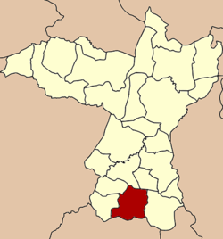 Amphoe location in Khon Kaen Province | |
| Coordinates: 15°48′57″N 102°35′55″E / 15.81583°N 102.59861°ECoordinates: 15°48′57″N 102°35′55″E / 15.81583°N 102.59861°E | |
| Country |
|
| Province | Khon Kaen |
| Area | |
| • Total | 872.9 km2 (337.0 sq mi) |
| Population (2005) | |
| • Total | 86,911 |
| • Density | 99.6/km2 (258/sq mi) |
| Time zone | THA (UTC+7) |
| Postal code | 40120 |
| Geocode | 4012 |
Phon (Thai: พล, pronounced [pʰōn]) is a district (Amphoe) in the southern part of Khon Kaen Province, northeastern Thailand.
Geography
Neighboring districts are (from the west clockwise) Waeng Noi, Waeng Yai, Chonnabot, Non Sila and Nong Song Hong of Khon Kaen Province, Bua Lai and Prathai of Nakhon Ratchasima Province.
Administration
The district is subdivided into 12 subdistricts (tambon), which are further subdivided into 131 villages (muban). Mueang Phon is a town (thesaban mueang) which covers parts of tambon Mueang Phon. There are further 12 Tambon Administrative Organizations (TAO).
| No. | Name | Thai name | Villages | Inh. | |
|---|---|---|---|---|---|
| 1. | Mueang Phon | เมืองพล | 11 | 19,173 | |
| 3. | Chot Nong Kae | โจดหนองแก | 14 | 7,955 | |
| 4. | Kao Ngio | เก่างิ้ว | 11 | 5,360 | |
| 5. | Nong Makhuea | หนองมะเขือ | 9 | 4,091 | |
| 6. | Nong Waeng Sok Phra | หนองแวงโสกพระ | 14 | 7,178 | |
| 7. | Phek Yai | เพ็กใหญ่ | 10 | 6,969 | |
| 8. | Khok Sa-nga | โคกสง่า | 10 | 6,234 | |
| 9. | Nong Waeng Nang Bao | หนองแวงนางเบ้า | 13 | 6,962 | |
| 10. | Lom Khom | ลอมคอม | 11 | 6,932 | |
| 11. | Non Kha | โนนข่า | 9 | 6,285 | |
| 12. | Sok Nok Ten | โสกนกเต็น | 11 | 6,442 | |
| 13. | Hua Thung | หัวทุ่ง | 8 | 3,330 |
Geocode 2 is not used.
This article is issued from Wikipedia - version of the 3/2/2016. The text is available under the Creative Commons Attribution/Share Alike but additional terms may apply for the media files.