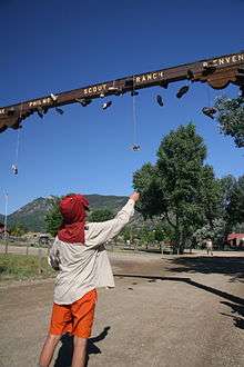
Philmont Scout Ranch camps
| Philmont Scout Ranch | |||
|---|---|---|---|
 | |||
| Owner | Boy Scouts of America | ||
| Location | Cimarron, New Mexico | ||
| Country | United States | ||
| Coordinates | 36°27′15″N 104°57′21″W / 36.45417°N 104.95583°W | ||
| Founded | 1938 | ||
| Founder | Waite Phillips | ||
|
| |||
Philmont Scout Ranch camps are a group of backpacking camps located in Philmont Scout Ranch, a large property in Colfax County near Cimarron, New Mexico, owned by the Boy Scouts of America and used as a backpacking reservation.[1] Philmont operates from one large Base Camp which includes camping headquarters, the Philmont Training Center and Villa Philmonte, the Seton Museum, fire response facilities, cattle headquarters, and an administration area.[2] As of 2014, there were 76 trail camps and 35 staffed camps. Philmont's camps are generally set no more than a couple of miles apart. Old camps are closed or relocated and new camps are opened every few years. Some camp sites are closed due to changing safety protocols. For example, camps were once located on top of Urraca Mesa and in the Baldy Saddle but these are unlikely to reopen because the locations are at risk for lightning strikes.
Base Camp
Base Camp is the center of all Philmont administration, ingress, and egress. Most of its area is occupied by Camping Headquarters; ancillary facilities include the Seton Museum (devoted to Ernest Thompson Seton's Woodcraft Indians and other works), the Philmont Training Center and Villa Philmonte, the fire response facilities, the cattle headquarters, and the administration area.[2] Its population exceeds that of Cimarron on most nights of the summer, according to the hiker's pamphlet. Mark Anderson is the current head of programs.[3]
The Welcome Center is a large pavilion, which serves as a waiting area for crews arriving or departing from the ranch as well as crews leaving or returning on a trek. The Welcome Center's small office offers check-in instructions and general information. The Camp Administration and Logistical Services manage registration and orchestrate all the ranch's operations.
There are two dining halls, one for campers and one for staff. Services is a large L-shaped building whose facilities include rental and return of gear and issuance of trail food, lockers, in which crews may store gear they do not want to take on the trail, and a post office, which handles mail for staff and crew members.
The infirmary has health officers who communicate with backcountry staff by radio and can dispatch vehicles to retrieve people if necessary. Tooth of Time Traders sells camping and backpacking gear as well as souvenirs. The snack bar is in the same building at the trading post and sells snack foods, ice cream, and beverages.
There are four chapels: Catholic, Protestant, Jewish, and Latter-day Saints. Each chapel holds services every evening for incoming and some outgoing crews.
There are three tent cities: Trailbound, Homebound, and Staff. Each contains several shower houses. The staff tent city's capacity is roughly 900; Trailbound and Homebound each hold between 400 and 500 trekkers.
Staffed camps

There are 34 staffed camps at Philmont, where staff members reside during the summer to run the camp's "program", which consists of a wide variety of activities. Camps often carry a historical or modern theme, such as logging (Crater Lake and Pueblano), mining or blacksmithing (French Henry, Cypher's Mine, and Black Mountain), fur trapping and mountain man life (Miranda, Clear Creek), challenge events (Dan Beard, Head of Dean, and Urraca) or Western Lore (Beaubien, Clark's Fork, or Ponil). The program in a camp is run by staff known as program counselors. These program counselors are supervised by a camp director.
Specific program activities include black-powder rifle loading and shooting, shotgun shooting and reloading, .30-06 rifle shooting, trail rides on horseback, burro packing and racing, rock climbing (on artificial towers as well as natural rock faces at Miner's Park, Cimarroncito and Dean Cow), tomahawk throwing, branding, search and rescue training, mountain bicycling, Mexican homesteading, blacksmithing, gold panning, obstacle courses, archeological sites, spar pole climbing, and a variety of campfires and evening programs.
Most staffed camps contain several campsites of the same sort which appear in trail camps (with the exception of French Henry); however, the primary distinguishing factor is the presence of one or several cabins. There is always a main cabin, where an arriving crew is given a "porch talk" by a staff member. This includes information about available program, location of trash receptacles, and other timely information such as the presence of "problem bears." Camps in the Valle Vidal (Seally Canyon, Ring Place and Whitman Vega) have yurts, large circular semi-permanent tents which allow for bear defense but may be removed in the off-season in the interest of leave no trace camping, rather than cabins.
Most staffed camps have a swap box — a box in which crews may place unwanted food and take anything they might desire. Predictably, swap boxes tend to fill up with foods that people tend not to like, get too much of, or food few want to carry.
With several exceptions, staffed camps accept garbage (not trash), send and receive mail, and offer purified water. The exceptions are those camps which have no road access or where the camps receive their supply shipments by burro. All staffed camps contain radios, by which staff members can communicate with Logistical Services, the Infirmary, or each other. The radio is used for all manner of communication, including notifications of the movements of the ranch's various vehicles, logistical inquiries between camps and Base, major and minor medical issues, and a nightly itinerary read-out which often includes world news and a weather forecast. The ranch's non-stationary staff are assigned unit numbers, by which they identify themselves on the radio. The ranch also employs a variety of esoteric radio ten-codes for rapid communication.
Current staffed camps
- Abreu
- A Mexican homestead beloved for its Cantina, which serves snacks and root beer. Its other program includes a Mexican dinner, goat-milking, and other farm-related activities and maintenance. It is set in the year 1912. Jesus Gil Abreu and his wife Petra, a daughter of Carlos Beaubien, established the Abreu settlement shortly after Lucien Maxwell's departure from the area in 1857; in addition to a successful ranch. Beaubien died in 1864, leaving the Abreus one-twelfth of the Beaubien-Miranda land grant, which in 1867 they sold to Maxwell for $3,500. Gertrude and Ramon Abreu built a house in the same year on the site that is currently Abreu. The house no longer remains, but its foundations serve as the base of the cantina. Waite Phillips largely abandoned the house, but built what is now called Old Abreu Camp to serve as a logging and sheep-raising center. Under BSA ownership, this became a staffed base in the 1960s, until it burned down twice and flooded three times, the last time being a part of the extensive 1965 floods. Program was shifted back to the old homestead site, known as "New Abreu" and later simply as "Abreu", where it was initially a camp for western lore and horse rides, and later for burro-packing, hunter safety, and fishing; in its early days it also served as a commissary. One early program which is still active as of 2007 is the Mexican dinner, though it was moved to Harlan from 1975 to 1990. The cantina program began in 1978 in the old cabin. That same year, with the advent of the adobe program, scouts began construction the current cantina itself as part of the program. It shifted to its present interpretive format in 1989. The new cabin, meant to be an example of a typical house of the period, was built as a conservation project by the cabin restoration crew during the summer and fall of 1998.
- The staff at Abreu interpret the daily life of the family of Petra and Jesus Abreu and work on an example of a small homestead. They interpret characters to explain the history of the area and the family, while leading participants in daily activities, such as goat-milking, adobe brickmaking, animal care and other aspects of homestead life. Also, there is always an opportunity to play with the animals, fish in the creek, or relax in the Cantina. Trekkers usually regard the Cantina as their favorite of the camp. An adobe building with an attached courtyard and grape arbor, it serves as a place for exhausted crews to sit down and relax. A staffer sells root beer, peanuts, other foods, and critical supplies like maps, while also offering games for participants. Special events at Abreu include cantina activities, burro-racing, and baking in an horno (adobe oven).
- Elevation: 7,240 ft (2,210 m).; location: South Country; water: purified from spigot; facilities: showers, latrines.
- Apache Springs
- Located in the far southwest corner of the ranch, Apache Springs sits on the edge of a large alpine meadow. While not an interpretive history camp (staff are not dressed in period clothing) the program relates the history and culture of the Jicarilla Apache who inhabited the region up until the mid 19th century. The camp features a small "village" of teepees where talks are given on the history and lifestyle of the Jicarilla as well as the opportunity to handle genuine artifacts. Scouts have the opportunity to make real arrowheads and experience a "sweat lodge". Apache Springs has the backcountry's only archery course, as well as a commissary where crews can resupply food, and white gas as needed.
- Elevation: 9,400 ft (2,900 m).; location: South Country, 36°23′16″N 105°08′36″W / 36.38778°N 105.14333°W
- Baldy Town
- Baldy Town, at the base of Mount Baldy in Colfax County, New Mexico, was a prominent town in Old West culture and folklore, serving as the base for gold mining operations on the mountain before mining in the area ceased and the town was abandoned. Among the ruins of the town, at an elevation of 10,000 feet (3,000 m), Philmont now runs a staffed camp and commissary, which includes a trading post and showers. Its programs include a history of the town and climbing Baldy Mountain, which is the highest on the ranch at an elevation of 12,441 feet (3,792 m).
- The land around Baldy Town and Mount Baldy was purchased in 1963 by Norton Clapp, vice-president of the National Council of the Boy Scouts of America. The purchase added 10,098 acres (40.87 km2) to Philmont Scout Ranch.
- Beaubien
- Located at the northerly end of wooded Bonita Canyon, Beaubien is the hub of the South Country. Virtually all treks that route through the South Country come here. Some treks spend a "layover" here – they stay here for two nights allowing for rest and relaxation during their trek. The program features the life of the cowboy, both historical and modern, with horseback rides, branding, a chuckwagon dinner partially prepared by the staff, and a western campfire. Many campers choose to brand their hiking boots, belts, and other brandable articles with either the Slash Crazy S and/or the Bar P Crazy S brands of Philmont. Beaubien is named in honor of Carlos Beaubien who, along with Guadalupe Miranda, owned the original Mexican land grant of which Philmont is now a part. Beaubien is Philmont's largest camp, with 34 campsites.
- Black Mountain
.png)
- A log cabin assumed to be constructed in the 1890s as part of a hydraulic mining operation sits next to the blacksmithing forge, campfire ring, and rifle range. Crews who come here take a step back in time in a way that few other interpretive history camps at Philmont are able to do. The program is a hybrid of homesteading, mining, and early western settlement, set in reconstruction era America. Staff portray the roles of civil war veterans who have come west to carve out new lives, work for the Cimarron Indian Agency, and perhaps begin a settlement. Black-powder shooting skills and blacksmithing are taught in a manner where participants can appreciate the range of skills that were necessary to settle the West. Because this camp is inaccessible to vehicles, the staff must bring provisions in and garbage out of camp on foot. For this reason, staff does not accept garbage from crews. The camp is located along the North Fork Urraca Creek at the southwesterly base of Black Mountain, one of the more prominent peaks on the ranch. Latrines are back-to-back and sit in the open.
- Elevation = 9,040 ft (2,760 m); 36°26.58′N 105°05.50′W / 36.44300°N 105.09167°W; water: stream, must be treated
- Carson Meadows
- Opened in the summer of 2004, Carson Meadows was converted to a staff camp during the summer of 2005 it is the southernmost camp on the Ranch. Located above the Rayado Canyon to the south, it is a short hike from Abreu, turning south at the Old Abreu trail camp. Carson Meadows is situated on a gorgeous meadow surrounded by thick woods. From the cabin one has a spectacular view of the Tooth of Time, framed by Fowler Mesa to the west and Urraca Mesa to the east. Carson's program is search and rescue.
- Cimarroncito
- The hub of the Central Country, also known as "Cito", this camp provides rock climbing and an excellent conservation site. Its conservation staff have been working to restore the meadow to its former state to improve the water table for the village of Cimarron. In 2015, the Conservation Department worked on constructing a new trail through Hidden Valley. Cito contains one of the nicer camper shower facilities, and also features chapel services. Cimarroncito was the location of the Central Country commissary until 1979, when Ute Gulch opened slightly to the north. The old commissary building is now occupied by the indoor climbing gym. Cito has 28 campsites.
- Clark's Fork
.png)
- A western program camp set in the year 1950, with horseback rides, branding, chuckwagon dinners and a western campfire. A very busy camp and typically gets extremely crowded with crews moving in both directions. The camp also contains a steer-roping practice area and two sets of horseshoe pits. Due to its proximity to Philmont's base camp and its function as a funnel for crews finishing their treks via the Tooth of Time, Clark's is a large and busy camp. For dinner, Scouts and leaders are served a "chuckwagon" beef stew, a signature of Philmont. Many crews take trail rides on the camps horses. Rides can be reserved in advance by crew leaders. Clark's Fork is a place to get belts, boots and other gear branded with the Philmont horse brand or cattle brand.
- Elevation: 7,530 ft (2,300 m); Sites: 21; 36°28′07″N 105°02′54″W / 36.46861°N 105.04833°W; water: in-camp spigots; facilities: showers; program: Western Lore, Horse Rides, Chuckwagon Dinner.
- Clear Creek
- This camp features the history of the fur trade prior to 1840. Program includes loading and shooting muzzleloading black-powder rifles, a demonstration of beaver trapping techniques, tomahawk throwing, and a talk on the history of the North American fur trade and examination of artifacts in the "trappers cabin". Evening activities consist of the telling of "yarns", or folklore tales from the days of the fur trade. At approximately 10,200 feet (3,100 m), Clear Creek is the highest staffed camp on the ranch. Cold, wet weather (even snow) is not uncommon during the summer months at this elevation. Clear Creek is located near the headwaters of the Rayado River and is named after the original name of Mount Phillips, Clear Creek Mountain. The actual Clear Creek flows off of the north side of Mount Phillips within the Cimarron Canyon Wildlife Area.
- Crater Lake
- This camp sits on a large incline above 8000 feet on the eastern slopes of Fowler Pass between Fowler Mesa and Trail Peak. The theme of the camp is early 20th century logging, and staff portray the historical Continental Tie and Lumber Company, which operated to the north in the Ponil Canyons. Activities include spar pole climbing and hand-hewn railroad tie construction. The staff also hosts a campfire with a clear view of the Tooth of Time. The lake more closely resembles a pond and is not actually located in a crater. It was formed by a rock slide from the slopes of Fowler Mesa which created a natural bowl fed by a spring.
- Crooked Creek
- One of the more primitive staffed camps, Crooked Creek is similar to Black Mountain in that it is not accessible by vehicle. The camp is located on the edge of a large, high meadow and features programs related to the life of the homesteader. Originally a staffed camp, Crooked Creek became a trail camp until 1990, when homesteading was added to Philmont's interpretive history camps. In 1990, Crooked Creek was among the first camps (along with Cimmaroncito and Abreu) in Philmont's history to feature coed staff. Like many other of Philmont's interpretive history camps, the staff live as primitively as the life they portray. Set in the year 1875, Crooked portrays a homesteading family making a living on a small portion of the Maxwell Land Grant
- Cypher's Mine
- This camp is located along the upper reaches of the North Fork Cimarroncito River. The program revolves around gold and other "hard rock" mining that historically occurred in the area. The program highlight is touring of the Contention mine, a failed prospect mine close by. Other program activities include blacksmithing and goldpanning. The camp is named in honor of Charles Cypher, an early miner in the area. Cypher's Mine is the only camp on the ranch where crews do not pitch tents at their campsites. Due to the narrow, rocky canyon in which the camp is located, campsites contain three-walled roofed structures officially referred to as "adirondacks". Local camp vernacular for them, however, is "shacks". A variety of original structures and artifacts from the mining days of the late 19th century are featured at this camp. Cypher's Mine features an evening musical program called a "Stomp" inside one of the old structures, modeled after the evening revelry of miners.
- Dan Beard
- Located in the burn zone from the 2002 Ponil Complex Fire, Dan Beard is a home to a challenge course similar to those found at Urraca and Head of Dean. First used as a staff camp in 1969, the program was Dutch oven cooking. The camp closed and used as a trail camp until 1989, when the current program was started. The program is designed to teach teamwork and critical thinking skills within a group. In 2006, Dan Beard received a new challenge course wall and new campsites to replace those lost in the fire. Three sites are located a short hike up a hill in the canyon, while the rest of the camp sites are nestled in the hills behind the challenge course. During the summer 2011 season, the Dan Beard staff also included a nightly yoga program.
- Elevation: 7,990 ft (2,440 m); location 36°40′42″N 105°05′15″W / 36.67833°N 105.08750°W.
- Dean Cow
- Located just outside the burn area (from the Ponil Complex Fire), this camp offers arguably the most difficult participant rock climbing on the ranch. Other activities include rappelling as well as a traverse wall for use in the evening hours. The cabin offers the famous "porch challenge," a series of climbing holds, ropes, and crimps across the porch. Those who complete the porch challenge usually receive a small prize, such as a pudding cup. Dean Cow's other popular "activity" is its heated showers available to participants. Staff at Dean Cow often spend down time climbing the canyon's multiple, challenging walls. From 1990 to 2009, Dean Cow offered a climbing wall for use during evening hours. For summer 2010, the climbing wall was replaced with a traverse wall. As of August 2010, the old climbing wall still stands, but with the hand-holds removed. The staff will offer a small prize (usually a food item) to a camper who completes the traverse wall.
- Fish Camp
- Formerly known as Rayado Lodge, Fish Camp is the site of the three original hunting and fishing lodge of Waite Phillips, located in the South Country. The camp is interpretive, set in the year 1927, and program includes lodge tours, fly tying, and fly fishing. Fish Camp is notable as one of Waite Phillips's "favorite spots on the Ranch," according to son Chope who visits every year.
- French Henry
- Located in a deep, narrow canyon just below Baldy Mountain, French Henry features programs revolving around the rich mining history of the Baldy Country. Gold panning, blacksmithing, and a tour of a small portion of the massive Aztec mine are featured here. The mine tour is in an access drift within the Ponil 2 drift of the Aztec Mine complex, which at its height contained over 80 miles (130 km) of tunnels and other workings. The main part of this camp contains the foundations of an old ore mill. Waste from this mill results in the only place on Philmont where crews can consistently find actual gold in their pans. The staff lives in original structures built in between the 1860s and the 1920, the oldest of which serves as a mining museum. Numerous artifacts from the mining operations in the area are displayed, as well as geologic maps of the Baldy country. Volunteer geologists working with the staff provide geology talks and gold panning lessons to campers. French Henry is named in honor of Henry Buruel, a Frenchman who mined in the area as early as 1869. Stories of the untimely death of numerous mine workers have led to the rumors that the camp is haunted. Staff often play along by making spooky noises while in the mine, and telling stories about "tommyknockers" to campers. This is the only non-commissary camp with no overnight campers due to the lack of flat areas for campsites.
- Elevation: 9,800 ft (3,000 m).; location: North Country, 36°38′10″N 105°11′00″W / 36.63611°N 105.18333°W.
- Harlan
- Harlan's program is primarily reloading and shooting 12-gauge shotgun shells. However, Harlan's most unique program is burro racing, a popular sport in which each crew packs and loads their burro before racing around certain obstacles in attempt to beat the other crews.
- Head of Dean
- Head of Dean is a crossroad for much of the North Country, with routes passing through from north, south, east, and west.
- Elevation 8,840 ft (2,690 m)
- Hunting Lodge
- Centered on the well-maintained cabin built by Waite Phillips for his many hunting excursions, the Hunting Lodge is located in a busy area of the ranch's central country, and serves as a hub for vehicles and for trekkers passing between Cypher's Mine, Clark's Fork and Cimarroncito. It also serves as a major attraction for the youth participants of the Philmont Training Center.
- Indian Writings
- Indian Writings hosts many petroglyphs on the large rock faces around the camp. There are a few excavation sites and archaeological digs corresponding to these ancient writings, each with their own stories. Campers usually take the hour to an hour and a half tour of the easy-to-reach writings and excavation sites. Crews beginning and ending their trek are the most common, as it is located close to 6-Mile Gate turnaround. Program includes museum tours, tours of the petroglyphs and excavation sites, as well as atlatl throwing. Indian Writings is one of he oldest staff camps on the Ranch, opened in 1939.
- Metcalf Station
- Philmont's newest staff camp, opened in 2014, Metcalf Station is situated on the former site of the Cimarron & Northwestern Railway, approximately halfway between Indian Writings and Dan Beard. The program includes railyard blacksmithing and railroad construction, using ties from Crater Lake and Pueblano camps' tie-making programs. The staff performs a music show for campers in the evenings.
- Miners Park
- This South Country camp is noted for its rock climbing and traverse wall. The camp is built around a large meadow, in which mountain lions may appear to hunt mule deer and other such prey. The program area is arguably the farthest on the ranch from the actual campsites, typically a 30-minute hike up to the rock formation known as "Betty's Bra."
- Miranda
- This North/Baldy Country camp is home to a large meadow with a black-powder rifle range along with a throwing tomahawk range. The staff portray a mountain man/fur-trappers rendezvous, and display various trappers and traders wares in the cabin and the teepees in the meadow. Miranda is noted for its evening activity, Mountain Ball, a variant of baseball with five bases and two teams in the field at any one time. After Mountain Ball, it is tradition for all participants to yell "We are the finest Mountain Ball players in all the land! Bring us your finest meats and cheeses!" towards Head of Dean camp. As it is uncommon for crews to beat the staff in Mountain Ball, crews that do defeat the staff earn prizes such as pudding or powdered donuts. As with Ponil, campers can pick up and drop off burros at Miranda.
- Ponil
- The former base camp for the Philturn Rocky Mountain Scout Camp, Ponil has a commissary and trading post. Ponil provides camping and a Western Lore program. Western Lore program includes: A cantina, cantina show, chuckwagon dinner and breakfast, lassoing, branding, horse shoes, and Cowboy Action Shooting. Cowboy Action Shooting involves Colt Single Action Army replica revolvers, Winchester Model 1892 replicas, and double-barrel shotguns. Crews can also learn from the wrangler staff how to pack burros, and then take them along with them until they reach Miranda. There is a fifty pound weight limit for how much the burros can carry, which typically is equal to three days of trail meals. Many crews also take horseback/dude rides here, in which the wrangler staff take campers on a scenic ride of the forest and surrounding area. Ponil is the starting and ending location for many North Country Cavalcades, where instead of backpacking for 10 days, a crew rides horses from camp to camp along a set itinerary.
- Elevation: 7,050 ft (2,150 m).; location: North Country, 36°37′56″N 105°00′07″W / 36.63222°N 105.00194°W
- Phillips Junction
- Phillips Junction (PJ) is the main commissary of the South Country. Opened in 1974 after the commissary was moved from Beaubien, the camp features the commissary, a well stocked trading post, showers, latrines, and purified water. There are fresh apples, pears, and oranges available for campers. PJ is one of three staff camps (Ute Gulch and French Henry being the others) that do not host overnight campers. Located in a valley below Beaubien, PJ is known to have the worst radio reception at Philmont.
- Elevation 8,840 ft (2,690 m).
- Pueblano
- Set in 1914 as a logging camp of the Continental Tie and Lumber Company, Pueblano immerses scouts in the ways of the logger. Their program offers scouts the opportunity to spar-pole climb, as well as teaching them how to use period tools in creating their own hand-hewn railroad ties, which are used at Metcalf Station. In the evening, Scouts play "Loggerball" and attend the Company Meeting. Loggerball is a game similar to baseball, but played with slightly modified rules and played on a sandlot style field. The teams are either the Loggers, also known as the South Ponil Log Dogs, vs Campers or the teams are split up evenly. The Company Meeting is a campfire style show featuring period songs and stories.
- Elevation: 8,100 ft (2,500 m).; location: North Country, 36°37′30″N 105°06′51″W / 36.62500°N 105.11417°W.
- Rayado
- Located 7 miles (usually traveled by bus) from base camp, Rayado features a replica 1860s hacienda once owned by mountain man Kit Carson. Program includes interactive tour of the Kit Carson Museum, demonstrations of blacksmithing, woodworking, cooking, or tomahawk throwing. Situated on Highway 21, this is one of the few areas of Philmont open to the public. Museum hours are 8-5, every day during the summer season.
- Rich Cabins
- Rich Cabins is located outside Philmont boundaries, on Ted Turner's Vermejo Park Ranch. The Rich family lived at this location from the late 1880s to the 1920s. The camp's program is focused on homesteading, with activities including historical cabin tours, gardening, milking goats, milking cows, shoveling manure, tending to the burros, and various other projects that the staff may be working on to improve the camp. Rich Cabins also has a small commissary for crews to top off their food supply before moving on. Staff perform a musical variety show for campers in the evenings.
- Ring Place
- Ring Place is located off-ranch in the Valle Vidal, on the site of Timothy Ring's homestead. Program at Ring involves meteorology, astronomy, commissary services, and history lessons about the Valle Vidal. Campers can learn how to construct rudimentary weather equipment such as manometers, anemometers, and barometers, as well as learning about local weather patterns. At night, staff offer participants a chance to use the camp's 19 inch Newtonian telescope to view stars, planets, nebulae, globular clusters, and even galaxies. Campers often elect to hike to Whiteman Vega for mountain bike program during the day. Ring Place is located on Cerrososo road, and is accessible to the general public whenever the Valle Vidal is open to visitors. This program was originally located at Santa Claus until 1992, when the camp was closed due to the well drying up.
- Sawmill
- Sawmill has a wood-fired boiler for hot showers and a program focused on high-powered rifle shooting.
- Seally Canyon
- A Valle Vidal camp. The program features search and rescue lessons and wilderness first aid. Due to the lack of trails in the Valle, and because Seally Canyon is the southernmost Valle camp, crews often get lost in the area. Staff from Seally often put their training to use locating and assisting these crews. Seally Canyon is one of the most remote camps at Philmont, and has extremely limited vehicle access. It takes approximately 2 hours to reach Seally by vehicle from Base Camp.
- Urraca
- Urraca is situated on the north side of Urraca Mesa with a view to the North, looking toward Base Camp. The camp program includes a challenge course like Dan Beard or Head of Dean. These activities designed to help instill a sense of teamwork within the crew while teaching them to be willing and ready to think outside the box. Campsites are neatly separated from the program area and sited along a hillside in the ponderosa pines next to a meadow. Most crews arrive at Urraca after the grueling climb up and over the mesa. Legend holds that Urraca Mesa is haunted, with tales ranging from eerie blue lights to "imps" running around at night. Crews crossing the mesa might encounter some cattle.
- Ute Gulch Commissary
.png)

- Seeing up to 90% of the crews that come to Philmont, and despite having no overnight campers, Ute Gulch is the busiest camp on the ranch.
- Elevation: 7,920 feet (2,410 m); located at 36°30.80′N 105°03′W / 36.51333°N 105.050°W.
- Whiteman Vega
- A Valle Vidal camp. Whiteman Vega is situated in a large grassy meadow, with spectacular views of Baldy Mountain and Little Costilla. Staff at Whiteman offer a mountain bike riding program on the only official trail in the Valle. Whiteman Vega is Philmont's only camp to offer this program, and it is a popular choice by campers.
- Zastrow
- Location: South Country
- Zastrow was originally planned as a Wood Badge camp, but was made a backcountry camp in favor of the program at Philmont Training Center. The camp is home to a land navigation and geocaching program. Zastrow is a common camp to pass through or stay at for crews at the beginning or end of their South Country treks.
Trail camps
Trail camps do not have permanent staff. Trail camps typically contain several campsites, but are spread out over half a mile of trail or more, to avoid a sense of crowding. Each trail camp is identified by a map, attached to a tree or the side of a latrine at every trail which passes through it. Trail camps do not necessarily have a nearby water source. Camps without a nearby water source referred to as "dry camps".
Individual campsites are marked by a wooden sign nailed to a tree which indicates the campsite number. Signs should not be touched by anyone, to preserve them. Camps have a metal fire ring, which may be used for small fires unless a fire ban is in place, which is often the case, given Philmont's dry climate. A bucket/ pail of water must always be readily available in the case that the fire grows out of control. There is also a sump,[4] an L-shaped plastic pipe, with a partly exposed two-foot vertical section and a ten-foot perforated horizontal section underground. The exposed pipe is capped with a piece of mesh.[5] Sumps are used to dispose dirty dishwater. Dishes and pots must stay around the sump to not attract bears.
Several campsites usually share a bear cable away from the campsite. This is a metal cable strung between two sturdy trees at least ten feet above the ground; it is used to hang bear bags containing items that might attract animals.
%2C_Cimarron%2C_New_Mexico_-_20060712.jpg)
Campsites also share a latrine or toilet. Philmont latrines have the possibility of housing spiders below the seat, which is why campers are encouraged to remove possible pests on the underside of the boards with a stick. The latrines come in different configurations, but all of them are for excrement only, and are not to be urinated in, in order to reduce smell. The open-air style latrine with two adjacent seats is affectionately called the "pilot to copilot" design; this results from the joking conversation which often takes place between two campers using the toilet simultaneously. The other open-air configuration latrine, called the "pilot to bombardier",[6] is generally preferred because its two seats are back-to-back and offer somewhat more privacy than the "pilot to copilot". Occasionally a "single pilot" - one open-air seat — may be found. The enclosed configuration, with walls and a red roof, is known as a Red Roof Inn, in joking reference to the hotel chain.[7] Older Red Roof Inns contain two adjacent seats and no doors ("pilot to copilot"), while newer models have two back-to-back seats ("pilot to bombadier"), with a wall between. Portable toilets ("Time Machines") are rare in the backcountry and only found in places such as French Henry camp.
| Campground | Area | Coordinates † | Elevation † | Water | Comments |
| Agua Fria | South Country | ||||
|---|---|---|---|---|---|
| Aguila | South Country | ||||
| Anasazi | North Country | This camp is a small, unstaffed camp located near an untreated water source, and is often used as one of the starting camps for many treks. | |||
| Aspen Springs | Central Country | 36°30′11″N 105°03′34″W / 36.50306°N 105.05944°W | 7,900 feet (2,407.9 m) | ||
| Baldy Skyline | North Country | Spigot - treated | |||
| Bear Caves | South Country | ||||
| Bear Canyon | South Country | ||||
| Bent | North Country | 36°38′08″N 105°03′56″W / 36.63556°N 105.06556°W | |||
| Black Horse | North Country | ||||
| Black Jacks | North Country | ||||
| Buck Creek | South Country | 36°24′40″N 105°07′49″W / 36.41111°N 105.13028°W | 9,200 feet (2,804.2 m) | ||
| Cathedral Rock | Central Country | 36°29′03″N 105°02′22″W / 36.48417°N 105.03944°W | 7,350 feet (2,240.3 m) | Stream | A stream-side camp shadowed by Cathedral Rock. This campsite is close to other natural features including Hidden Valley and Window Rock. |
| Comanche | South Country | 36°26′50″N 105°09′40″W / 36.44722°N 105.16111°W | 9,600 feet (2,926.1 m) | Stream | A stream-side camp with plenty of water. Not to be confused with Comanche Peak Camp. |
| Comanche Peak | Central Country | 36°28′50″N 105°08′14″W / 36.48056°N 105.13722°W | 11,100 feet (3,383.3 m) | None | A dry camp located immediately to the east of Mount Phillips, Comanche Peak is spacious and well-shaded by ponderosa pines. Provides views of sunsets over Mounts Phillips and Baldy. Wildlife, including mule deer, elk and black bear, abounds in this area. |
| Copper Park | North Country | 36°38′31″N 105°12′06″W / 36.64194°N 105.20167°W | 10,500 feet (3,200.4 m) | Spigot | This camp is hidden among the trees on the side of Mount Baldy, Copper Park is a beautiful campsite, and a common place for crews to stay two nights in order to ascend Mount Baldy. The nearest commissary is Baldy Camp. |
| Cook Canyon | North Country | ||||
| Cottonwood Trail | North Country | ||||
| Crags | South Country. | Crags is located on the banks of Rayado creek southeast of Fish Camp. | |||
| Deer Lake | Central Country | 36°30′35″N 105°01′42″W / 36.50972°N 105.02833°W | 8,300 feet (2,529.8 m) | Seasonal | Many crews decide to hike to Deer Lake and come back down to Harlan in order to get water or participate in burro racing. |
| Deer Lake Mesa | Central Country | ||||
| Devil's Wash Basin | Central Country | 36°31′20″N 105°03′23″W / 36.52222°N 105.05639°W | 8,500 feet (2,590.8 m) | ||
| Elkhorn | North Country | ||||
| Ewells Park | North Country | This camp is located near Baldy Town, and some treks stay here when attempting Baldy Mountain. | |||
| Greenwood Canyon | North Country | ||||
| Hawkeye | Central Country | This is a dry camp located directly east of Visto Grande. Both are new trail sites | |||
| House Canyon | North Country | Trail camp between Anasazi and Old Camp, opened in 2007. | |||
| Lambert's Mine | Central Country | 36°28′35″N 105°06′21″W / 36.47639°N 105.10583°W | 9,000 feet (2,743.2 m) | An unstaffed camp relatively close to Cypher's Mine Camp with several abandoned mineshafts in the vicinity | |
| Lost Cabin | South Country | 36°23′02″N 105°08′10″W / 36.38389°N 105.13611°W | 9,200 feet (2,804.2 m) | Located slightly east and south of Apache Springs, a staffed camp, Lost Cabin is the former location of a mining operation and cabin. It served as a staffed camp in 1963, but was flooded in 1965 and permanently replaced by Apache Springs. | |
| Lookout Meadow | South Country | 36°23′00″N 105°04′00″W / 36.38333°N 105.06667°W | 9,400 feet (2,865.1 m) | ||
| Lovers Leap | South Country | 36°25′14″N 105°00′41″W / 36.42056°N 105.01139°W | 7,400 feet (2,255.5 m) | ||
| Lower Sawmill | Central Country | Stream | Located just over a mile downhill and east of Sawmill, this camp is located near a beautiful alpine meadow. | ||
| Maxwell | North Country | ||||
| McBride Canyon | North Country | ||||
| Mt. Phillips | Central Country | 11,711 feet (3,569.5 m) | None | Mt. Phillips Camp, located atop Mount Phillips, the second tallest mountain on the ranch, this is the highest camp in Philmont and provides excellent views. | |
| New Dean | North Country | ||||
| North Fork Urraca | South Country | ||||
| Old Camp | North Country | In 2014, this camp was replaced with staffed camp Metcalf Station, a railroading camp at the same location | |||
| Ponderosa Park | Central Country | Located relatively close to Clarks Fork (albeit entirely uphill), it is the final camp on several itineraries. | |||
| Porcupine ("Porky") | South Country | Common camp for the day after Mt. Phillips, this camp features an abandoned cabin and campsites along Rayado Creek. This was once a staffed camp, usually comprising a single staff member that served more as a camp host than a program counselor. Also featured in the Philmont Ranger Song. | |||
| Pueblano Ruins | North Country | 36°37′44″N 105°08′06″W / 36.62889°N 105.13500°W | 8,400 feet (2,560.3 m) | Satellite camp for the staffed camp located at Pueblano. Campers often take part in program activities and enjoy the evening campfire at nearby Pueblano. | |
| Rayado River | South Country | ||||
| Red Hills | Central Country | ||||
| Rimrock Park | South Country | ||||
| Santa Claus | North Country | 36°35′27″N 105°05′22″W / 36.59083°N 105.08944°W. | 8,400 feet (2,560.3 m) | Santa Claus was a staffed camp until the mid-1990s. One of the main reasons it closed was because the well stopped pumping enough water to sustain a full staff. The area suffered during the 2002 Ponil Complex fire, though the abandoned cabin still stands. In 2000, lightning struck one of the bear cables and the bear bags on the line exploded, leaving the trees charred from where the bear cables were attached. | |
| Shaefers Pass | Central Country | ||||
| Sioux | North Country | 36°37′18″N 105°03′18″W / 36.62167°N 105.05500°W | 7,380 feet (2,249.4 m) | None | Located just above Ponil camp, this dry camp is a common starting camp for treks. |
| Stockade | South Country | 36.435674, -104.999921 | None | Frequently used as the turn around for Day 1 circle rides on southern itinerary cavalcades. | |
| Tooth Ridge | Central Country | 36°27′16″N 104°59′50″W / 36.45444°N 104.99722°W | 8,240 feet (2,511.6 m) | None | Camping sites: 18. Tooth Ridge Camp is often the last camp that backpacking crews use before a return to Philmont's base camp. Tooth Ridge Camp sits immediately beneath The Tooth of Time (elevation 9,003 feet (2,744.1 m) feet) in the midst of tall, broad ponderosa pines. |
| Toothache Springs | South Country | ||||
| Thunder Ridge | Central Country | ||||
| Turkey Creek | North Country | ||||
| Upper Bench | Central Country | Beautiful dry trail camp with a series of seasonal lakes, and a large, rock formation on one end. | |||
| Upper Clark's Fork | 36°27′37″N 105°2′56″W / 36.46028°N 105.04889°W | A camp up above the staffed Clark's Fork. | |||
| Upper Dean Cow | North Country | Spigot - untreated | It is a grassy camp near a river and is frequented by mule deer. It is also a common place to see a black bear. | ||
| Ute Springs | Central Country | Stream | |||
| Ute Meadows | North Country | This camp is located just below Baldy Town and is used as a layover camp for crews climbing Baldy | |||
| Vaca | Central Country | This camp has an unpurified solar well and is located on a large meadow of black eyed susans, it is a short hike to Harlan staffed camp. | |||
| Visto Grande | Central Country | This large trail camp, which is on a steep hill. It also contains a spring for water. An abandoned building also sits in this camp. This camp is located directly east of Hawkeye camp, another new trail camp. | |||
| Webster Lake | Central Country | ||||
| Webster Parks | Central Country | Not far from the large, staffed camp, Cimarroncito. | |||
| Wild Horse | South Country | ||||
Campsite Setup Procedures (see trail camps for more info)
After crews arrive at campsites, they must follow Philmont's four-step set up plan. This four-step plan is designed to prevent bears from being attracted to campsites from "Smellables" (items with smells that can potentially attract bears).[8]
- "Bearmuda" Triangle - The Bearmuda Triangle includes the crew's bear bags, dining fly, and sump. All of the crew's Smellables (including packs) must stay within the triangle and tents must be set up at least 50 feet away from the Bearmuda Triangle.
- Bear Bags - (see trail camps section)
- Dining Fly (optional) - This step is the only optional step in campsite set up. Obviously, if there is no foreseeable weather problems, the dining fly does not need to be set up.
- Tents - All Smellables must stay outside of tents. No food, eating, or clothing worn during the day or for cooking is permitted in the tent area. When setting up tents, Scouts must watch out for the 4 W's: Wind, Water, Wanimals (wildlife), and Widowmakers (dead trees).
See also
References
- ↑ Rock Rohrbacher (1997). Philmanac: A Trekkers Guide to the Philmont Backcountry. CSS Pub. Retrieved April 29, 2013.
- 1 2 Official Philmont web site
- ↑ "Philmont Scout Ranch Contact". Philmont Scout Ranch. Retrieved April 30, 2013.
- ↑ La Curan, Ronald (2008). "Philmont Engineering Plans: Sump" (PDF). Philmont Scout Ranch. Retrieved April 30, 2013.
- ↑ philmontscoutranch.org
- ↑ La Curan, Ronald (2008). "Philmont Engineering Plans: Pilot To Bombardier - Wood" (PDF). Philmont Scout Ranch. Retrieved April 30, 2013.
- ↑ La Curan, Ronald (2009). "Philmont Engineering Plans: Red Roof Inn (Outhouse)" (PDF). Philmont Scout Ranch. Retrieved April 30, 2013.
- ↑ Inc., UniteU Technologies,. "Bearmuda Triangle". www.toothoftimetraders.com. Retrieved 2016-08-15.