Phillip, Australian Capital Territory
| Phillip Canberra, Australian Capital Territory | |||||||||||||
|---|---|---|---|---|---|---|---|---|---|---|---|---|---|
 | |||||||||||||
| Population | 2,082 (2011 census)[1] | ||||||||||||
| • Density | 801/km2 (2,070/sq mi) | ||||||||||||
| Established | 1966 | ||||||||||||
| Postcode(s) | 2606 | ||||||||||||
| Area | 2.6 km2 (1.0 sq mi) | ||||||||||||
| District | Woden Valley | ||||||||||||
| Territory electorate(s) | Murrumbidgee | ||||||||||||
| Federal Division(s) | Canberra | ||||||||||||
| |||||||||||||
Phillip (postcode: 2606) is a suburb of Canberra, Australia in the district of Woden Valley. It is located in the centre of the district and contains the district's main commercial centre, Woden Town Centre. Phillip had a residential population of 2,082 in 2011. 53% of its occupied dwellings were flats and 45% were semi-detached, terraces or townhouses.[1] Many more flats are being planned or built. 42.8% of the population was foreign born, the fourth highest for any Canberra suburb.[2]
The suburb is named after Arthur Phillip, the first Governor of New South Wales. The suburb name was gazetted on 12 May 1966. Streets in Phillip use names associated with the First, Second and Third Fleets; streets in the Swinger Hill were named after architects.[3]
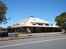
As the commercial and geographical centre of Woden, Phillip contains many of the district's key facilities. As well as the Woden Town Centre, which includes the Westfield Woden shopping centre, a bus interchange and the Lovett Tower (the tallest commercial office building in Canberra), it has its own commercial area located along Botany, Townshend and Parramatta Streets. The Southside campus of the Canberra Institute of Technology (CIT) is located in the suburb, as is Eddison Park and the Woden Cemetery. Phillip also contains a number of sporting facilities, including the Phillip Enclosed Oval, which has been known as Football Park since 1981 and was the headquarters of Australian rules football in Canberra during the 1980s and 1990s,[4] and the Phillip Swimming & Ice Skating Centre, home to the CBR Brave of the Australian Ice Hockey League. The Canberra College is situated in Phillip.
Swinger Hill

The Swinger Hill housing estate is located in Phillip but separated by Hindmarsh and Athllon Drives from the main part of Phillip. The name Swinger Hill follows the pattern of calling local trigonometrical points after the surveyor who surveyed them, in this case Louis Walter Henry Swinger (1901–1943) who surveyed this area.
The Swinger Hill development was built in the 1970s, some years after Phillip itself, as an estate of mixed townhouses. Some of the houses in Barnet Close in Swinger Hill are listed by the Royal Australian Institute of Architects as significant twentieth century architecture, and were given heritage listing in the ACT in late 2011.[5][6][7]
Geology
The rocks underneath Phillip are from the Silurian period and are from 417 to 414 million years old.
Deakin Volcanics green-grey and purple coloured rhyodacite is found in the west half and south east corner of Phillip and under the cemetery area, and Deakin Volcanics purple and green tuff is found around Hindmarsh Drive on the east side of Phillip. The volcano that produced these rocks may have been in Lyons. A small strip of shale from the older and lower Yarralumla Formation is just to the west of Easty Street.[8]
References
| Wikimedia Commons has media related to Phillip, Australian Capital Territory. |
- 1 2 Australian Bureau of Statistics (31 October 2012). "Phillip (State Suburb)". 2011 Census QuickStats. Retrieved 3 February 2014.
- ↑ "Where do migrants live? (4102.0 - Australian Social Trends, 2014)". Australian Bureau of Statistics. 17 March 2014. Retrieved 19 March 2014.
- ↑ "Suburb Name search results". ACT Planning & Land Authority. Retrieved 3 February 2014.
- ↑ "Zeltner back in Canberra". The Canberra Times. Canberra, ACT. 1 February 1981. p. 19.
- ↑ "Heritage (Decision about Provisional Registration for Swinger Hill Cluster Housing, Phillip) Notice 2011" (PDF). ACT Government. August 2011. Retrieved 3 February 2014.
- ↑ "Swinger Hill Stage 1 and 2, Phillip". Canberra House. Retrieved 3 February 2014.
- ↑ "1970s Swinger Hill townhouses added to ACT Heritage Register". Canberra Times. 9 December 2011. Retrieved 3 February 2014.
- ↑ Henderson, G. A. M.; Matveev, G. (1980). Geology of Canberra, Queanbeyan and Environs (Map). 1:50000.
Coordinates: 35°20′58″S 149°05′25″E / 35.34944°S 149.09028°E