Philippine Trench
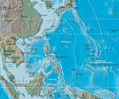
The Philippine Trench (also Philippine Deep, Mindanao Trench, and Mindanao Deep) is a submarine trench to the east of the Philippines.
It has a length of approximately 1,320 kilometres (820 miles) and a width of about 30 km (19 mi) from the centre of the Philippine island of Luzon trending southeast to the northern Maluku island of Halmahera in Indonesia. Its deepest point, the Galathea Depth, has a depth of 10,540 metres (5,760 fathoms; 34,580 feet), the third-deepest in the world.
Immediately to the north of the Philippine Trench is the East Luzon Trench. They are separated, with their continuity interrupted and displaced, by Benham Plateau on the Philippine Sea Plate.[1]
The Philippine Trench is the result of a collision of tectonic plates. The Philippine Sea Plate is subducting under the Philippine Mobile Belt at the rate of about 15 cm (5.9 in) per year.