Phang Nga
This article is about the town Phang Nga. For other uses, see Phang Nga (disambiguation).
| Phang Nga พังงา | |
|---|---|
| Town | |
|
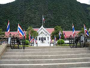
Khao Chang mount rising behind Phang Nga City Hall | |
 Phang Nga Location in Thailand | |
| Coordinates: 8°27′52″N 98°31′54″E / 8.46444°N 98.53167°E | |
| Country | Thailand |
| Province | Phang Nga Province |
| Districts of Thailand | Amphoe Mueang Phang Nga |
| Population (2005) | |
| • Total | 9,559 |
| Time zone | ICT (UTC+7) |
Phang Nga (Thai: พังงา, rtgs: Phangnga, pronounced [pʰāŋ.ŋāː]) is a town (thesaban mueang) in southern Thailand, capital of Phang Nga Province. The town covers the whole tambon Thai Chang of Mueang Phang Nga district. As of 2005 it had a population of 9,559 and covered an area of 6.75 km². Phang Nga is 764 km from Bangkok by road.
The municipal administration was created on 11 February 1937.[1] The town is subdivided into nine wards (chumchon).
- Talat Yai (ตลาดใหญ่)
- Borirak Bamrung (บริรักษ์บำรุง)
- Samakkhi (สามัคคี)
- Thung Chedi (ทุ่งเจดีย์)
- Ruamchai Phatthana (ร่วมใจพัฒนา)
- Na Krok Khok Ya (นากรอกคอกหญ้า)
- Thanon Mai (ถนนใหม่)
- Khao Chang (เขาช้าง)
- Wang Mokaeng (วังหม้อแกง)
References
- ↑ "About us". Phang Nga city administration. Note that B.E. 2479 ended on March 31.
External links
 Phang Nga travel guide from Wikivoyage
- http://www.phangngacity.go.th (Thai)
Coordinates: 8°27′52″N 98°31′54″E / 8.46444°N 98.53167°E
| ||
This article is issued from Wikipedia - version of the 7/9/2016. The text is available under the Creative Commons Attribution/Share Alike but additional terms may apply for the media files.