Phagi
| Phagi | |
|---|---|
| tehsil | |
|
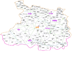
Political map of Phagi Tehsil in Hindi texts | |
 Phagi  Phagi Location in Rajasthan, India | |
| Coordinates: 26°36′N 75°57′E / 26.6°N 75.95°ECoordinates: 26°36′N 75°57′E / 26.6°N 75.95°E | |
| Country |
|
| State | Rajasthan |
| District | Jaipur |
| Talukas | Phagi |
| Government | |
| • Additional District Magistrate-II | Tikam Chand Bohra[1] |
| • Tehsildar | Ravi Vijay[2] |
| • Sub Divisional Officer | Baldev Chaudhary[3] |
| Area[4] | |
| • Total | 1,114.308 km2 (430.237 sq mi) |
| Elevation | 383 m (1,257 ft) |
| Population | |
| • Total | 161,610 |
| • Density | 145/km2 (380/sq mi) |
| Languages | |
| • Official | Hindi |
| Time zone | IST (UTC+5:30) |
| PIN | 303005 |
| Telephone code | 911430 |
| Lok Sabha constituency | Ajmer & Dausa[5] |
| Vidhan Sabha constituency | Dudu & Chaksu[6] |
| Distance from Jaipur | 51 kilometres (32 mi) South (land) |
| Distance from Malpura | 41 kilometres (25 mi) North (land) |
| Distance from Dudu | 40 kilometres (25 mi) East (land) |
| Distance from Chaksu | 43 kilometres (27 mi) West (land) |
Phagi (Hindi: फागी) is a tehsil and a panchayat samiti in Jaipur district in the state of Rajasthan, India. It has an average elevation of 383 m (1,257 ft).[7]
Phagi is also one of the Town in Phagi Tehsil in Jaipur District. Phagi is located on the intersection of SH2 and SH12 of Rajasthan.
Phagi tehsil is divided into seven Inspector Land Revenue Circles (or ILRCs) - Chittora, Chauru, Nimera, Phagi, Mandor, Madhorajpura and Renwal.[8]
ILRCs Phagi, Chauru, Mandor and Nimera are parts of Dudu assembly constituency and Ajmer (Lok Sabha constituency). ILRCs Chittora, Madhorajpura and Renwal are parts of Chaksu assembly constituency and Dausa (Lok Sabha constituency).
ILRC Phagi is subdivided into seven patwar circles - Chakwara, Phagi North, Phagi South, Phagi West, Bhojpura, Mandi and Shankarpura.
Holy places near by Phagi are Hanumanji's Temple at village Khera Hanumanji in Madhorajpura, Ranchordass ji ka Mandir at Sameliya, Kalyan ji ka Mandir at Diggi in Tonk district and Dadabari at Malpura, Auliya Baba Dargah at Rampura near small lake.
Phagi is 51 km far from its District Main City Jaipur . It is 36.0 km far from Sanganer near Jaipur .
Demographic of Phagi tehsil
According to 2011 Census,[9] there are 169 villages with 22,713 households having total population of 161,610 (with 52.12% males and 47.88% females) in Phagi Tehsil. Literacy rate in the tehsil is 63.2% (with 77.62% among males and 47.49% among females).[10] There are 185 primary schools, 6 primary health centres, 25 post offices in the tehsil. There are 7 commercial banks and 2 Co-operative banks in Tehsil.
Demographic of Phagi village
In Phagi village, there are 1,717 households with total population of 11,299 (with 52.33% males and 47.67% females), based on 2011 census.[11] Total area of village is 62.7 km2. There are 5 primary schools and one post office in the village. It has 2 commercial banks and 1 Co-operative bank. There is one cinema hall in Phagi village.
Villages in Phagi
| Patwar circle | Village |
|---|---|
| Chakwara | Chakwara |
| Phagi North | Phagi North |
| Phagi South | Phagi South |
| Phagi West | Phagi West |
| Bhojpura | Datooli |
| Bhojpura | |
| didawata | didawata |
| Ramdev gi ki dhani | |
| Bhanpura | |
| Mukandpura nohar | |
| hanutiya | |
| Mandi | Mandi |
| Mohanpura Ranwa | |
| Rampura Railway | |
| Shankarpura | Chainpura @ Bharatpura |
| Shankarpura | |
References
- ↑ Administration Jaipur, District Profile Jaipur, District Megistrate Jaipur
- ↑ Administration Jaipur, District Profile Jaipur, District Megistrate Jaipur
- ↑ Administration Jaipur, District Profile Jaipur, District Megistrate Jaipur
- ↑ Census India
- ↑ http://eci.nic.in/eci_main/CurrentElections/CONSOLIDATED_ORDER%20_ECI%20.pdf
- ↑ http://eci.nic.in/eci_main/CurrentElections/CONSOLIDATED_ORDER%20_ECI%20.pdf
- ↑ "Phagi Mandal". onefivenine.com. Retrieved 28 March 2011.
- ↑ District Revenue Hierarchy
- ↑ Census of India: Sub-Discrict Details
- ↑ Statistical Information - District Administration Website Jaipur
- ↑ Census India
 |
Sanganer tehsil | | ||
| Dudu tehsil | |
Chaksu tehsil | ||
| ||||
| | ||||
| Malpura tehsil, Tonk | Peeplu tehsil, Tonk | Newai tehsil, Tonk |