Pflugerville, Texas
| Pflugerville, Texas | |
|---|---|
| City | |
|
Pflugerville City Hall | |
 Location of Pflugerville, Texas | |
 | |
| Coordinates: 30°26′46″N 97°37′26″W / 30.44611°N 97.62389°WCoordinates: 30°26′46″N 97°37′26″W / 30.44611°N 97.62389°W | |
| Country |
|
| State |
|
| Counties | Travis, Williamson |
| Government | |
| • Type | Council-Manager |
| • City Council |
Mayor Jeff Coleman Wayne Cooper Brad Marshall Omar Pena Starlet Sattler Mike Heath |
| • City Manager | Brandon Wade |
| Area | |
| • Land | 22.3 sq mi (58 km2) |
| Elevation | 719 ft (219 m) |
| Population (2010) | |
| • Total | 46,936 |
| • Density | 2,102.8/sq mi (812.0/km2) |
| Time zone | Central (CST) (UTC-6) |
| • Summer (DST) | CDT (UTC-5) |
| ZIP codes | 78660, 78691 |
| Area code(s) | 512 & 737 |
| FIPS code | 48-57176[1] |
| GNIS feature ID | 1365131[2] |
| Website | PflugervilleTX.gov |

Pflugerville /ˈfluːɡərvɪl/ is a city in Travis County, Texas with a small portion in Williamson County. The population was 46,936 at the 2010 census. Pflugerville is a suburb of Austin and part of the Austin–Round Rock–San Marcos Metropolitan Statistical Area.
Geography
Pflugerville is located at 30°26′46″N 97°37′26″W / 30.446122°N 97.623989°W (30.446122, -97.623989),[3] 14 miles (23 km) northeast of downtown Austin along FM 1825 (Pecan Street) in northern Travis County.[4] Pflugerville is situated 15 miles (24 km) northeast of the Colorado River.
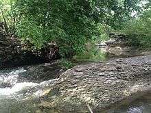
According to the 2010 United States Census Bureau, the city has a total land area of 22.32 square miles.[5] And Pflugerville has 40.39 square miles in the extraterritorial jurisdiction.[6] The city has one body of water - Lake Pflugerville - created in 2005 to serve as a water reservoir and recreation area, and two creeks, Gilleland Creek and Wilbarger Creek. A local school group Wilbarger Water Watchers in association with the LCRA monitor the waters of Wilbarger Creek to ensure it meets the United States Environmental Protection Agency's national standard.
Education
Public education in the city of Pflugerville is provided by the Pflugerville Independent School District (PISD). The district encompasses all or part of six municipalities including Pflugerville, Austin, Coupland, Hutto, Manor and Round Rock.[7]
As of the 2013-2014 school year, PISD had a total enrollment of 23,543 students[8] and operated 3 high schools (Pflugerville, Connally, and Hendrickson), 6 middle schools, 19 elementary schools, and 2 alternative campuses.
Economy and transportation
In response to a recent influx of higher sales tax revenue, the City Council lowered the property tax rate annually beginning in 2003 through 2014. However notice of an increase in the property tax rate was announced in late 2015, for the first time in more than a decade, to accommodate for $53 million in transportation and park bond projects approved by voters in a 2014 bond election.[9]
While a mile stretch of Interstate 35 is often referred by local media and residents as "in Pflugerville", the city of Austin actually controls this land, either as part of the city or through its extraterritorial jurisdiction. In November 2006, the first parts of a central Texas tollway system opened, including State Highway 130 and State Highway 45 increasing accessibility to Pflugerville. Approximately three miles of 130 run through Pflugerville, including the intersection of 45 and 130. The city is using this land to attract major commercial development, thereby improving its tax base and providing an opportunity to lower property tax rates. One such development, Stone Hill Town Center opened and includes The Home Depot, Best Buy, SuperTarget, At Home, Bealls, Dick's Sporting Goods, PETCO, Ross Dress for Less, Office Depot, 24 Hour Fitness, Cinemark Theatres and a St. David's HealthCare 24-hour emergency care facility.[10][11][12][13][14][15][16][17] With its close proximity to the Austin Executive Airport and SH 130, the connectivity of the area is attracting businesses and bringing jobs to Pflugerville.
Before the Stone Hill development and the nearby Pfluger Crossing (a development that includes a Wal-Mart Supercenter) opened their first stores in 2007, the city's two largest retailers were an Albertsons grocery store (which operated from 1996 to 2006) near Pflugerville High School and an H-E-B grocery store (operating since 2000) east of downtown.
Pflugerville Community Development Corporation
The Pflugerville Community Development Corporation (PCDC) has overseen economic development for the city since late 2009 as a Texas 4B Economic Development Corporation that collects a one-half cent sales tax off taxable goods purchased in the City of Pflugerville for the purpose of promoting economic development in Pflugerville. The PCDC is a separate entity that reports to City Council and is the economic arm for Pflugerville.
In 2010, RRE Austin Solar broke ground on what will be one of the nation's largest solar farms, the 60 MW Pflugerville Solar Farm,[18] but as of July 2013 no significant construction has begun.
PCDC has helped to develop the 130 Commerce Center, at the corner of State Highway 130 and Pecan (FM 1825), which is an office park with FedEx, TrackingPoint, Community Impact Newspaper, and D-bats, as well as two hotels and a conference center anticipated in 2016.[19] EOS and Medway Plastics are planned tenants.[20]
On August 6, 2013, the city agreed on a development deal with Harvest Family Entertainment to build the sixth and largest Hawaiian Falls water park just south of the intersection of State Highway 130 and State Highway 45 across from Stone Hill Town Center. The proposed $21-million water park would consist of a 15-acre water park along with a 5-acre adventure park that would become Hawaiian Falls Pflugerville the largest water park in the company.[21][22] Hawaiian Falls Pflugerville opened June 2014. The owner and operator of Hawaiian Falls water and adventure parks defaulted on the October 2015 payment for Hawaiian Falls Pflugerville and requested a deferment.[23] Hawaiian Falls' owner and operator caught up with payments by December 18, 2015.[24][25]
History
Early years
The area was initially settled by German immigrant Henry Pfluger, Sr. (1803–67) and members of his family from late 1849 into early 1850. Pfluger had been a wealthy farmer in Germany, but lost all of his property during the Prussian War. He arrived in the country with $1,600 and purchased 160 acres (0.65 km2) of land two miles (3 km) east of Austin from John Liese, a brother-in-law who had immigrated before him. In 1853, Pfluger paid Liese $960 for a 960-acre (3.9 km2) tract of land in an area known as Brushy Knob.[26] There, the family lived in a five-room log cabin and raised corn, wheat, rye, beans, sweet potatoes, and sugar cane.[27] The Pfluger family also owned several slaves, some whom were conversant in German.[28]
Community development
The beginnings of a community wouldn't develop until after the Civil War. During the 1870s, a school and Lutheran church were established at the settlement. The first commercial business in the community was a general store built by Louis Bohls in 1890. Two local organizations: the German-American Mutual Assistance Foundation, to insure residents against natural disasters; and "Pflugerville Schuetzen and Kegel Verein," a shooting and bowling club. Pflugerville's post office opened in 1893 with Louis Bohls serving as its first postmaster.[29] The population reached approximately 250 during the mid-1890s and a small downtown developed even though most residents did their branching and shipping in Round Rock, eight miles (13 km) to the northwest.[4] Wooden buildings were erected on Main Street and Pecan Street, many by Conrad Pfluger – one of Henry Pfluger, Sr.'s eight sons. In 1904, the Missouri–Kansas–Texas Railroad (MKT) completed its track between Georgetown and Austin, passing just outside Pflugerville. Its close proximity to the line, however, caused the community to grow rapidly.[29] On February 19, 1904, the town site of Pflugerville was platted by George Pfluger and his son, Albert, dedicating streets and alleys for the town from the Alexander Walter and C. S. Parrish Surveys in Travis County. The plat consisted of sixteen blocks, rights-of-way, and the depot grounds to the MKT. The first addition to the town was the six-block Wuthrich Addition, platted on November 22, 1904. The first cotton gin was built by Otto Pfluger in 1904. It was destroyed by fire in 1931 and a new one was built at the same location. On June 8, 1906, the Farmers State Bank of Pflugerville opened with William Pfluger as its president and A.W. Pfluger as cashier. The first issues of the Pflugerville Press, a weekly newspaper, began publishing on August 7, 1907 and operated through October 29, 1942. In 1910, black workers who worked in the Pflugerville cotton industry were not allowed to move into the town. Farmer La Rue Norton, who owned 1,200 acres (4.9 km2) of land west of Pflugerville, set aside an acre and sold lots to the workers at $50 each. County records listed the settlement as Pflugerville's Colored Addition in April 1910.[30] The first German Day celebration in Pflugerville took place on May 29, 1910. In 1913, H.S. Pfluger built the Sky Dome Theater, which showed motion pictures to the accompaniment of a player piano on Friday and Saturday nights. It closed in 1928. In the early 1920s, Pflugerville was home to an estimated 500 residents. During that period, several area school districts consolidated with Pflugerville High School.[29] Around 580 people lived in the community in 1930.
Decline
The arrival of the Great Depression halted what had been a lengthy period of growth in Pflugerville.[31] The population fell slightly to 500 in 1940. In the years immediately after World War II, the community lost around a quarter of its population as citizens moved to Austin and other larger cities with greater employment opportunities.[4] Despite the challenges of population loss and limited economic development, Pflugerville managed to survive. The community gained national attention when the Pflugerville Panthers won 55 consecutive football games from 1958 to 1962.
Resurgence
Efforts to incorporate Pflugerville culminated in the holding of an election on July 24, 1965. A total of 102 votes were cast with 60 (58.8%) supporting the proposition and 42 (41.2%) opposed. The town incorporated under a commission form of government. On April 4, 1970, an election was held that changed the form of government from commissioner to aldermanic, providing for an elected mayor and five aldermen. Pflugerville's population began to rebound after its incorporation and by the 1970 census, it stood at 549. That figure had risen to 745 by 1980. A weekly newspaper, the Pflugerville Pflag, began publication in 1980. During most of the 1980s, new development made Pflugerville one of the fastest growing cities in Texas. Estimates from the late 1980s were as high as 3,900.[27][29] Although the boom was slowed by a statewide recession, Pflugerville's population grew to 4,444 in 1990.
Recent history
Throughout the 1990s, the city of Austin experienced a rapid rise in its population. This was also the case in suburban areas surrounding the city. Pflugerville and communities such as Cedar Park, Round Rock, and Georgetown came to or more than doubled in size by the next census in 2000. Since then, Pflugerville has grown by approximately 20,000, with the total number of residents approaching 40,000 as of 2008.[32] The 2010 Census placed Pflugerville's population at 46,936, however with annexations since the 2010 census, the city's own population estimate is estimated to be 53,752 as of July 2013.[33]
The 2006 NBC television drama Friday Night Lights was filmed in Pflugerville and Austin, Texas. They used Pflugerville High School's stadium, Kuempel Stadium, to film the football games. Since then American Crime has filmed at the Pflugerville Justice Center as recently as 2014.
Demographics
2010 Census
| Historical population | |||
|---|---|---|---|
| Census | Pop. | %± | |
| 1970 | 549 | — | |
| 1980 | 745 | 35.7% | |
| 1990 | 4,444 | 496.5% | |
| 2000 | 16,335 | 267.6% | |
| 2010 | 46,936 | 187.3% | |
| Est. 2015 | 57,122 | [34] | 21.7% |
As of the census of 2010,[1] there were 46,936 people, 15,789 households, and 12,260 families residing in the city. The population density was 2,102.8 people per square mile (812.0/km2). There were 16,418 housing units at an average density of 736.2 per square mile (284.0/km2). The racial makeup of the city was 64.1% White, 15.5% African American, 0.6% Native American, 7.4% Asian, 0.1% Pacific Islander, 8.6% from other races, and 3.6% from two or more races. Hispanic or Latino of any race were 27.7% of the population.
There were 15,789 households out of which 45.0% had children under the age of 18 living with them, 59.4% were married couples living together, 13.4% had a female householder with no husband present, and 22.4% were non-families. 17.0% of all households were made up of individuals and 4.2% had someone living alone who was 65 years of age or older. The average household size was 2.96 and the average family size was 3.35.
In the city the population was spread out with 30.6% under the age of 18, 6.9% from 18 to 24, 32.4% from 25 to 44, 24.0% from 45 to 64, and 6.0% who were 65 years of age or older. The median age was 33.8 years. For every 100 females there were 93.9 males. For every 100 females age 18 and over, there were 89.2 males.
According to the U.S. Census Bureau's 2008-2012 American Community Survey 5-Year Estimates, the median income for a household in the city was $75,119, and the median income for a family was $84,449. Males had a median income of $53,670 versus $46,451 for females. The per capita income for the city was $29,995. About 6.6% of families and 9.0% of the population were below the poverty line, including 12.5% of those under age 18 and 3.5% of those age 65 or over.
2000 Census
By comparison, the census[1] of 2000 reported 16,335 people, 5,146 households, and 4,425 families residing in the city. The population density was 1,440.6 people per square mile (556.2/km2). There were 5,239 housing units at an average density of 462.0 per square mile (178.4/km2). The racial makeup of the city was 77.18% White, 9.46% African American, 0.24% Native American, 4.31% Asian, 0.09% Pacific Islander, 5.99% from other races, and 2.74% from two or more races. Hispanic or Latino of any race were 16.69% of the population.
There were 5,146 households out of which 56.4% had children under the age of 18 living with them, 72.4% were married couples living together, 10.4% had a female householder with no husband present, and 14.0% were non-families. 10.1% of all households were made up of individuals and 1.7% had someone living alone who was 65 years of age or older. The average household size was 3.15 and the average family size was 3.39.
In the city the population was spread out with 34.6% under the age of 18, 6.0% from 18 to 24, 38.8% from 25 to 44, 16.9% from 45 to 64, and 3.7% who were 65 years of age or older. The median age was 32 years. For every 100 females there were 97.3 males. For every 100 females age 18 and over, there were 93.6 males.
The median income for a household in the city was $71,985, and the median income for a family was $73,629. Males had a median income of $49,989 versus $32,188 for females. The per capita income for the city was $26,226. About 1.7% of families and 1.7% of the population were below the poverty line, including 2.1% of those under age 18 and 1.3% of those age 65 or over.
Parks and recreation
The City of Pflugerville has more than 15 parks, 30.5 miles of trail, 16 playscapes, 500 acres of parks and 528 acres of open space all within Pflugerville's city limits. Many of the parks offer a full range of amenities from pavilions, gazebos and playgrounds to pools and picnic areas.
Pfluger Park is along Gilleland Creek and is the site of the city's annual German festival, the Deutschen Pfest, held the third weekend in May. The park includes the Fallen Warrior Memorial, trails, a grove, playground, volleyball courts, basketball court, picnic areas and large shade trees. Pfluger Park is also used for music in the park events and festivals.
Lake Pflugerville is a 180-acre reservoir built to provide the citizens of Pflugerville with drinking water. The lake is open for fishing, swimming, jogging, canoes, kayaks and wind surfing. Lake Pflugerville Park includes a 3-mile walking/jogging trail, playground, boat launch, pavilion and beach area.
The Northeast Metro Skate/BMX Park opened Tuesday, September 18, 2012. The 349-acre Northeast Metropolitan Park is a multiple-use recreational area with soccer fields, multi-use fields, baseball fields, a cricket field, basketball court, tennis court, and a skate park. Amenities include restrooms, playgrounds, group shelters, picnic tables with grills, concession building for rent, and a water play area. While not located in the city limits but at the north end of Austin, the park does provide additional amenities to the community.
Hawaiian Falls opened a water park and adventure park in Pflugerville on Memorial Day Weekend 2014.[36]
In 2015, the city purchased a 237-acre tract of land for a community park with a new sports complex and nature areas for $4.276 million. It will be home to the future sports complex as approved by the voters in the 2014 General Bond Election.[37]
Notes
- 1 2 3 "American FactFinder". United States Census Bureau. Retrieved 2008-01-31.
- ↑ "US Board on Geographic Names". United States Geological Survey. 2007-10-25. Retrieved 2008-01-31.
- ↑ "US Gazetteer files: 2010, 2000, and 1990". United States Census Bureau. 2011-02-12. Retrieved 2011-04-23.
- 1 2 3 "Pflugerville, Texas". Texas Escapes Online Magazine. Retrieved 2009-08-16.
- ↑ "Pflugerville QuickFacts". United States Census Bureau. Retrieved 22 August 2014.
- ↑ "Extra-Terratorial Jurisdiction (ETJ)". City of Pflugerville. Retrieved 22 August 2014.
- ↑ "About the District". Pflugerville Independent School District. Retrieved 22 August 2014.
- ↑ "Totals by District for District: Pflugerville ISD". 2013-2014 Student Enrollment Reports. Texas Education Agency, Information Analysis Division. 2014-08-22. Retrieved 2014-08-22.
- ↑ "Pflugerville raises tax rate". Community Impact Newspaper. 1 October 2015. Retrieved 12 December 2015.
- ↑ 2009 Annual Regional Report, accessed January 25, 2009
- ↑ NewQuest Properties Property Lines, Fall 2009, accessed November 2, 2009
- ↑ 9-screen Cinemark theater joins Pflugerville's growing Stone Hill Town Center, April 28, 2011, accessed June 9, 2011
- ↑ St. David's HealthCare To Open Freestanding Emergency Department in Pflugerville, September 8, 2010, accessed June 9, 2011
- ↑ St. David’s announces freestanding emergency department in Pflugerville, September 8, 2010, accessed June 9, 2011
- ↑ St. David’s plans two freestanding ERs, September 20, 2010, accessed June 9, 2011
- ↑ Pflugerville's first emergency care facility could open in December, says CEO, June 3, 2011, accessed June 9, 2011
- ↑ Work starts on local emergency center, June 9, 2011, accessed June 9, 2011
- ↑ "Press Center". RRE Power. Retrieved 12 December 2015.
- ↑ "Construction to begin at 130 Commerce Center". Pflugerville Community Development Corporation. 23 October 2012. Retrieved 13 December 2015.
- ↑ "Industrial 3D-Printing Technology Leader to Establish North American Headquarters In Pflugerville". Pflugerville Community Development Corporation. 27 October 2015. Retrieved 12 December 2015.
- ↑ JP Eichmiller (August 6, 2013). "Pflugerville inks deal to build water park by May 2014". Community Impact. Retrieved August 6, 2013.
- ↑ Gary Dinges (August 6, 2013). "Waterpark, adventure park planned for Pflugerville". Statesmen.com. Retrieved August 6, 2013.
- ↑ "Hawaiian Falls parent company misses lease payment". Community Impact Newspaper. 11 November 2015. Retrieved 12 December 2015.
- ↑ "Hawaiian Falls clears 2015 debt to city". Austin American-Statesman. 11 January 2016. Retrieved 12 January 2016.
- ↑ "Hawaiian Falls no longer in default". Community Impact Newspaper. 5 January 2016. Retrieved 5 January 2016.
- ↑ "Pflugerville Cemetery" (PDF). Nathan O'Brien. Retrieved 2009-08-16.
- 1 2 "Pflugerville Community Library: Strategic Plan 2005". Pflugerville Community Library. Retrieved 2009-08-16.
- ↑ "Voices from slavery: The Travis County narratives". Austin American-Statesman. Retrieved 2013-02-09.
- 1 2 3 4 "Pflugerville, Texas". The Handbook of Texas online. Retrieved 2009-08-16.
- ↑ "History of Pflugerville, Texas". City of Pflugerville, Texas. Retrieved 2009-08-16.
- ↑ "Pflugerville". Just Outside Austin: Rural Travis County Communities. Austin History Center. Retrieved 2009-08-16.
- ↑ "Table 4: Annual Estimates of the Resident Population for Incorporated Places in Texas, Listed Alphabetically: April 1, 2000 to July 1, 2008" (CSV). United States Census Bureau, Population Division. 2009-07-01. Retrieved 2009-08-16.
- ↑ "Demographic Profile". City of Pflugerville. Retrieved 22 August 2014.
- ↑ "Annual Estimates of the Resident Population for Incorporated Places: April 1, 2010 to July 1, 2015". Retrieved July 2, 2016.
- ↑ "Census of Population and Housing". Census.gov. Retrieved June 4, 2015.
- ↑ "Waterpark, adventure park planned for Pflugerville". Hawaiian Falls Waterparks. August 7, 2013. Retrieved 22 August 2014.
- ↑ "City Council approves $4.276 million land purchase for a Community Park with a new sports complex and nature areas". City of Pflugerville. August 25, 2015. Retrieved 2 January 2016.
External links
- City of Pflugerville Home Page
- Pflugerville Council of Neighborhood Associations (PfCONA)
- Pflugerville Community Development Corporation (PCDC)
- Greater Pflugerville Chamber of Commerce (GPCC)
- Pflugerville Independent School District (PISD)
- Pflugerville Fire Department (ESD#2)
- Pflugerville from the Handbook of Texas Online
- Pflugerville Colored Addition from the Handbook of Texas Online
- Pflugerville High School Football
- Pflugerville Little League
Municipalities and communities of Travis County, Texas, United States | ||
|---|---|---|
| Cities | 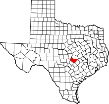 | |
| Villages | ||
| CDPs | ||
| Other unincorporated communities | ||
| Footnotes | ‡This populated place also has portions in an adjacent county or counties | |
Municipalities and communities of Williamson County, Texas, United States | ||
|---|---|---|
| Cities | 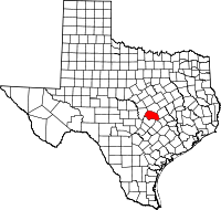 | |
| CDPs | ||
| Unincorporated communities | ||
| Ghost town | ||
| Footnotes | ‡This populated place also has portions in an adjacent county or counties | |
| Central city | 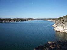 | ||||||
|---|---|---|---|---|---|---|---|
| Satellite cities | |||||||
| Other communities | |||||||
| Counties |
| ||||||
| Parks and preserves |
| ||||||
| Geography | |||||||
| Bodies of water | |||||||
| Transportation | |||||||
