Peribonka River
| Peribonka River | |
| Rivière Péribonka | |
 | |
| Country | Canada |
|---|---|
| Province | Quebec |
| Region | Saguenay–Lac-Saint-Jean |
| Source | Unnamed wilderness |
| - location | Just west of the Otish Mountains |
| - elevation | 800 m (2,625 ft) |
| - coordinates | 52°16′17″N 70°48′38″W / 52.27139°N 70.81056°W |
| Mouth | Lac Saint-Jean |
| - location | Town of Péribonka |
| - elevation | 99 m (325 ft) |
| - coordinates | 48°44′49″N 72°06′13″W / 48.74694°N 72.10361°WCoordinates: 48°44′49″N 72°06′13″W / 48.74694°N 72.10361°W |
| Length | 451 km (280 mi) [1] |
| Basin | 28,200 km2 (10,900 sq mi) [1] |
| Discharge | |
| - average | 635 m3/s (22,420 cu ft/s) [2] |
| Discharge elsewhere (average) | |
| - Peribonka Power Station | 438 m3/s (15,470 cu ft/s) |
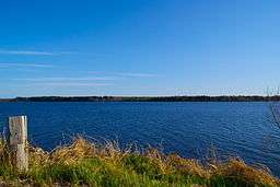
The Peribonka River (French: Rivière Péribonka) is a river in the Saguenay-Lac-Saint-Jean area in Quebec, Canada. It is 451 kilometres (280 mi) long and drains an area of 28,200 square kilometres (10,900 sq mi).[1] It drains into Lac Saint-Jean at Pointe-Taillon National Park and is the largest tributary of this lake. The town of Péribonka is located on the north shore of Lac St-Jean at the river's mouth.
The name is derived from the Montagnais word pelipaukau, meaning "river digging through the sand" or "where there is moving sand".
Geography
The Peribonka River springs a short distance west of the Otish Mountains in a swampy area on the granite and muskeg of the Canadian Shield. From there it flows south until Lamarche, forming the boundary between the Maria-Chapdelaine and Le Fjord-du-Saguenay Regional Counties. From Lamarche, it flows west to Lac Saint-Jean. Its basin of 28,200 square kilometres (10,900 sq mi) comprises about one-third of the entire Saguenay River basin.
Tributaries
The major tributaries of the Peribonka are (in upstream order):
- Little Peribonka River
- Alex River
- Brûlée River
- Serpent River
- Étienniche River
- Brodeuse River
- Lake Peribonka
- Carp River (à la Carpe)
- Saint-Onge River
- Cocoumenen River
- Bonnard River
- Modeste River
- Grande Loutre River
- Michel River
- Courtois River
- Épervanche River
- East Peribonka River
History
Historically the Innu indigenous people lived in this area and traveled the river by canoe. By the second half of the 17th century, the river was used by Europeans as an access route to James Bay. The first official reference to the river is from April 16, 1679, in the Register of missions, stating "juxtà fluvium Perib8ka ad lacum Peok8agami" (near the river Peribouka at Lake Peokouagami (old name of Lac Saint-Jean)) priest François de Crespieul baptized two children. In October of that year, after investigating the state of English positions on Hudson Bay, Louis Jolliet returned to Quebec City via this route and called it Périboca in his manuscript. The spelling changed to Periboaka on Laura's map of 1731 and Periboac on Nicolas Bellin's map of 1755. In 1825, Pascal Taché identified it as Péribonka and subsequently this name, together with Peribonca, came in general use.[3]
While trappers and traders made relatively little use of the Peribonka in the 17th and 18th centuries, the river gained importance in the 19th century. Logging camps were established within its watershed and the river was used to drive logs downstream, and starting in 1887, the first colonizers settled near its mouth.[3]
In 1928, the Peribonka River overflowed its banks and flooded several villages. Major development came in the 1940s when Alcan, a leading aluminum producer, needed adequate hydro-electric power supply. From 1941 to 1943, the Chute-des-Passes Dam was built at the south end of Lake Péribonka that became a vast reservoir. This was followed by two other dams were built downstream: the Chute-du-Diable from 1950 to 1952, and Chute-à-la-Savane from 1951 to 1953.[3]
The classic novel Maria Chapdelaine by French writer Louis Hémon is set on the shores of the Peribonka River.
Hydroelectric development
There are 4 hydroelectric power stations on the Peribonka River, 3 of which privately belong to Alcan aluminum smelter:
- Chute-du-Diable - built in 1952, 240 MW
- Chute-à-la-Savane - built in 1953, 231 MW
- Chute-des-Passes - built in 1959, 854 MW
The fourth, the Peribonka Power Station, built and operated by Hydro-Québec, is directly upstream from the confluence with the Manouane River. It was completed on March 9, 2008, and has a capacity of 385 MW. The dam is 80 metres (260 ft) high and 700 metres (2,300 ft) long, creating a reservoir with an area of 32 square kilometres (12 sq mi).[4]
References
- 1 2 3 Natural Resources Canada, Atlas of Canada - Rivers
- ↑ Comportement et performance en contexte de changements climatiques d’un système hydrique en milieu nordique exploité pour la production hydroélectrique
- 1 2 3 "Rivière Péribonka" (in French). Commission de toponymie du Québec. Retrieved 2010-11-26.
- ↑ Hydro-Québec - Aménagement hydroélectrique de la Péribonka. Retrieved 2010-11-26