Peperga
| Peperga | |
|---|---|
| Village | |
 | |
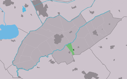 Location within the municipality of Weststellingwerf | |
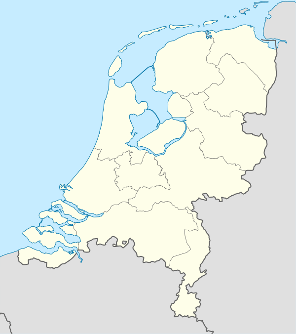 Peperga Location in Netherlands | |
| Coordinates: 52°51′0″N 6°3′23″E / 52.85000°N 6.05639°ECoordinates: 52°51′0″N 6°3′23″E / 52.85000°N 6.05639°E | |
| Country | Netherlands |
| Province | Friesland |
| Municipality | Weststellingwerf |
| Population (2016) | |
| • Total | 82 |
| Time zone | CET (UTC+1) |
| • Summer (DST) | CEST (UTC+2) |
Peperga (West Frisian: Pepergea) is a small village in Weststellingwerf in the province Friesland of the Netherlands. As of 2012, it has a population of 87 people. Peperga is located on the A32 between Wolvega and Steenwijk, and is characterized by detached houses, several businesses and a church. There are approximately 35 houses. Public transportation offers a service to the nearby villages of Steggerda and De Blesse. The church, formerly dedicated to Saint Nicholas, is now named after the famous native Peter Stuyvesant (c. 1612 – August 1672), and was completed in 1810.
History
The village originates in the Middle Ages and is listed as a parish in 1328;[1] mention of it occurs in the seventeenth-century copy of a 1399 document as Pepergae (Pepergo is also found, in 1408 and 1510)—peper is a Frisian term for the boggy type of wetland on which the village was built.[2] Peperga and nearby Blesdijke were burned by troops of Frederick of Blankenheim[3] during war in 1413 at the time of the short-lived independence of the Stellingwerf area (comprising Weststellingwerf and Ooststellingwerf).[4] The land was so wet that before 1660 the entire village, including the church, was moved one kilometer to a dryer area.[2] It is found in the 1716 atlas by Bernardus Schotanus à Sterringa as a linear village with buildings exclusively on the north side of the road, except for a church on the south side, in the middle of the area.[5] An 1850 atlas by Wopke Eekhoff shows that the village's meadows were dug up completely for peat. A provincial road in 1828 between Leeuwarden and Zwolle was the impetus for the formation of a new village west of Peperga, De Blesse.[5] De Blesse, like nearby Blesdijke, derives its name from the little river Blesse, which separates Blesdijke from Peperga.[6]
In 1865, the construction of a railway between Zwolle and Leeuwarden split the town in two: it separated Peperga from its west side, an area subsequently added to De Blesse. This division was boosted in the late eighties with the construction of a highway on the east side of the track. Peperga had its own railway station which opened in 1870 (with an adjoining cafe)[5] as an expansion of an earlier home for railroad watchmen[7] and closed on January 5, 1941. In the early seventies, the station was demolished. The nearby bridge over the river Linde is on the list of national state monuments as a Rijksmonument. There are several businesses in the village, including the Café De Landerije along the main road.
Notable landmarks

A medieval church had its "elegant" late-medieval tower expanded in 1537.[5] Peter Stuyvesant's father Balthasar Stuyvesant[8] was pastor of that (by then Dutch Reformed) church at the time of his son's birth in 1611 or 1612. Peter Stuyvesant was probably baptised there, though this cannot be proved since the parish register is missing. In 1810 a fire gutted the building and it was rebuilt.[5][9] It was dedicated to Saint Nicholas[5] until the church was closed for worship in autumn 2001 and sold. The church came into the hands of Folkert Munsterman, who wanted to convert it into a restaurant. This did not happen, and the church was sold again in 2007. The dysfunctional Van der Molen organ from 1912 was removed and replaced in 2007 by the 1903 from the Reformed Church of Woldendorp. The current owner has had the church renamed Peter Stuyvesant Kirke. The building is available for different purposes. The village also has a Dutch Reformed chapel, and a Roman Catholic church was built in 1837.[10]
A monument in the village honors Stuyvesant. It consists of a model of a sailing ship on top of a glacial erratic.
Demographics
- 1954 – 378
- 1959 – 370
- 1964 – 328
- 1969 – 286
- 1974 – 150
- 2004 – 60
- 2008 – 90
- 2012 – 87
- 2016 – 82
References
- ↑ Driemaandelijkse bladen. Rijksuniversiteit Groningen. 1966. Retrieved 15 June 2012.
- 1 2 Gildemacher, K.F. (2008). Friese plaatsnamen: alle steden, dorpen en gehuchten. Friese Pers Boekerij. p. 194. ISBN 9789033006432. Retrieved 15 June 2012.
- ↑ Friesche volks-almanak voor het jaar 1846. Van Druten & Bleeker. 1845. p. 92.
- ↑ Verslag der handelingen van de ... vergadering der Vereeniging tot Beoefening van Overijsselsch Regt en Geschiedenis. Vereeniging tot Beoefening van Overijsselsch Regt en Geschiedenis, Zwolle. 1874. Retrieved 15 June 2012.
- 1 2 3 4 5 6 Karstkarel, P. (2005). 419 x Friesland. Kok. p. 882. ISBN 9789033011917. Retrieved 15 June 2012.
- ↑ Bachiene, Willem Albert (1791). Vaderlandsche geographie, of Nieuwe tegenwoordige staat en hedendaagsche historie der Nederlanden. H. Gartman, W. Vermandel en J.W. Smit. p. 5. Retrieved 15 June 2012.
- ↑ Verslag der Maatschappij tot Exploitatie van Staatsspoorwegen over het jaar 1869. Giunta d'Albani. 1870. p. 47. Retrieved 14 June 2012.
- ↑ Bergsma, Wiebe (1999). Tussen Gideonsbende en publieke kerk. Verloren. p. 530. ISBN 9789065500441. Retrieved 15 June 2012.
- ↑ The American Philatelist. American Philatelic Association. 2003. p. 802. Retrieved 14 June 2012.
- ↑ Eekhoff, Wopke (1840). Friesland: Handboekje voor reizenden door de steden en voornaamste oorden van de provincie Friesland. G.T.N. Suringar. p. 109. Retrieved 15 June 2012.
External links
![]() Media related to Peperga at Wikimedia Commons
Media related to Peperga at Wikimedia Commons