Pennsylvania Route 340
| ||||
|---|---|---|---|---|
 | ||||
| Route information | ||||
| Maintained by PennDOT | ||||
| Length: | 30.064 mi[1] (48.383 km) | |||
| Major junctions | ||||
| West end: |
| |||
|
| ||||
| East end: |
| |||
| Location | ||||
| Counties: | Lancaster, Chester | |||
| Highway system | ||||
| ||||

Pennsylvania Route 340 (PA 340) is a 30-mile-long (48 km) state highway located in Lancaster and Chester counties in Pennsylvania. The western terminus is at PA 462 in Lancaster. The eastern terminus is at U.S. Route 30 Business (US 30 Bus.) in Thorndale. The route is a two-lane road passing through rural areas, serving the communities of Bird-in-Hand, Intercourse, White Horse, Compass, and Wagontown. PA 340 intersects US 30 near Lancaster, PA 772 in Intercourse, PA 897 in White Horse, PA 10 in Compass, PA 82 near Coatesville, and US 30 again near Thorndale.
The route follows the alignment of the King's Highway that linked Lancaster and Philadelphia in colonial times. PA 340 was first designated in 1928 between US 222/PA 240 east of Lancaster and US 30/PA 1 in Gap, following its current alignment to White Horse before turning south to Gap. By 1940, the route was extended west to US 22 in Harrisburg, heading west to Marietta, north to Hershey, northwest to Union Deposit, and west to Harrisburg. Also, the route was extended east to US 30 in Coatesville by heading east on its current alignment to Wagontown and turning south to Coatesville, with PA 897 replacing the former alignment between White Horse and Gap. PA 340 was rerouted to end at US 30 in Thorndale during the 1940s. In the 1950s, the west end was cut back to US 422 in Hershey. The western terminus was scaled back to PA 441 in Marietta by 1962 and its current location by 1970, with the former alignment now PA 743 between Hershey and Marietta and PA 23 between Marietta and Lancaster.
Route description
Lancaster County
PA 340 begins at an intersection with PA 462 in East Lampeter Township, Lancaster County, heading east on two-lane undivided Old Philadelphia Pike. The road passes through areas of homes and businesses, briefly forming the border between Lancaster to the north and East Lampeter Township to the south. Farther east, the route runs between industrial parks to the north and neighborhoods to the south before coming to an interchange with the US 30 freeway that does not have a ramp from westbound US 30 to PA 340. Past this interchange, PA 340 heads through less dense areas of residential and commercial development with some farm fields. The road heads into the community of Smoketown and intersects the northern terminus of PA 896 to the south of Smoketown Airport. The route continues east to Bird-in-Hand, where it passes under Amtrak's Philadelphia to Harrisburg Main Line.[2][3]
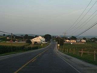
PA 340 enters Leacock Township and runs through open agricultural areas with occasional homes. The road heads into Intercourse and passes homes and businesses. PA 340 intersects PA 772 and forms a concurrency with that route on Main Street, with the road gaining a center left-turn lane. PA 772 splits to the southeast and PA 340 passes more residential development on Old Philadelphia Pike. The road leaves Intercourse and loses the turn lane, continuing through more farmland. The route heads into Salisbury Township and runs through more rural areas, passing through Spring Garden. PA 340 comes to an intersection with PA 897 and runs concurrent with that route before PA 897 turns south in the community of White Horse. Following this, the road runs east through more areas of farm fields.[2][3]
Chester County
PA 340 enters West Caln Township in Chester County and becomes West Kings Highway, passing southeast through woods and fields and reaching an intersection with PA 10 in Compass. At this point, PA 10 turns southeast for a brief concurrency with PA 340 before PA 340 splits to the east. The road runs through wooded areas with some homes and fields, passing through Wagontown. The route curves southeast before running east again and becoming the border between West Caln Township to the north and Coatesville to the south. PA 340 crosses the West Branch Brandywine Creek and runs along the border between West Brandywine Township to the north and Coatesville to the south as it comes to the junction with PA 82 in the community of Siousca.[2][4]
Following this intersection, the road becomes East Kings Highway and runs along the border between West Brandywine Township to the north and Valley Township to the south as it runs through forested areas with some homes. The route enters Caln Township and heads southeast, passing over the US 30 freeway. PA 340 intersects Reeceville Road, which heads north to an interchange with US 30. The road curves northeast and comes to another bridge over US 30. The route passes through more wooded areas with some homes and fields, as well as Caln Meeting House, turning east onto Bondsville Road. PA 340 runs through forested areas and makes a turn to the south, coming to an interchange with US 30. The route runs through wooded areas of residential development and comes to its eastern terminus at an intersection with US 30 Bus. (Lincoln Highway) in the community of Thorndale.[2][4]
History

The route follows the alignment of the King's Highway, a colonial road built in 1733 that linked Lancaster and Philadelphia. The road was laid out by the provincial government of Pennsylvania.[5] When Pennsylvania first legislated routes in 1911, what would become PA 340 was legislated as Legislative Route 142, which ran from Lancaster to White Horse before turning south to Gap.[6] By 1926, Legislative Route 142 was paved.[7] PA 340 was assigned in 1928 to the alignment extending from US 222/PA 240 (Horseshoe Road) east of Lancaster to US 30/PA 1 in Gap via White Horse. US 222/PA 240 was designated along the current alignment west to US 30/PA 1 (now PA 462) while the current route east of White Horse existed as an unpaved road with small paved sections west of PA 82 and north of Thorndale. [8] By 1940, PA 340 was extended in both directions. The western terminus was extended to US 22 (Herr Street) east of Harrisburg, following its current alignment (which replaced US 222) to US 30, which it ran concurrent with through Lancaster. From here, PA 340 headed west to Marietta, where it formed a concurrency with PA 441 before making a turn to the north and continuing through Elizabethtown to Hershey. At Hershey, PA 340 turned to the northwest and continued to Union Deposit, where it headed west towards Harrisburg. The eastern terminus was rerouted at White Horse to head east to US 30 (now US 30 Bus.) in Coatesville, following its current alignment east to Wagontown before following Wagontown Road to Coatesville, with an extended PA 897 replacing the former PA 340 designation between White Horse and Gap. At this time, the entire length of PA 340 was paved.[9] In the 1940s, the eastern terminus of PA 340 was rerouted to its current location at US 30 (now US 30 Bus.) in Thorndale.[10]
The western terminus of PA 340 was cut back to US 422 in Hershey in the 1950s, with the former route between Harrisburg and Hershey becoming unnumbered Union Deposit Road, Hockersville Road, and Fishburn Road.[11] By 1962, the western terminus of PA 340 was cut back PA 441 in Marietta, with an extended PA 743 replacing the route between Hershey and Marietta.[12] The western terminus was truncated to its current location at PA 462 by 1970, with PA 23 extended west to replace the former designation between Marietta and Lancaster.[13]
Major intersections
| County | Location | mi[1] | km | Destinations | Notes |
|---|---|---|---|---|---|
| Lancaster | East Lampeter Township | 0.000 | 0.000 | ||
| 1.351 | 2.174 | Interchange, no access from westbound US 30 to PA 340 | |||
| 3.820 | 6.148 | Northern terminus of PA 896 | |||
| Leacock Township | 8.521 | 13.713 | Western terminus of concurrency | ||
| 8.704 | 14.008 | Eastern terminus of concurrency | |||
| Salisbury Township | 13.896 | 22.363 | Western terminus of concurrency | ||
| 14.422 | 23.210 | Eastern terminus of concurrency | |||
| Chester | West Caln Township | 17.680 | 28.453 | Western terminus of concurrency | |
| 17.828 | 28.691 | Eastern terminus of concurrency | |||
| Coatesville | 24.604 | 39.596 | |||
| Caln Township | 29.248 | 47.070 | Interchange | ||
| 30.064 | 48.383 | ||||
1.000 mi = 1.609 km; 1.000 km = 0.621 mi
| |||||
See also
 U.S. Roads portal
 Pennsylvania portal
References
| Wikimedia Commons has media related to Pennsylvania Route 340. |
- 1 2 Bureau of Maintenance and Operations (January 2015). Roadway Management System Straight Line Diagrams (Report) (2015 ed.). Pennsylvania Department of Transportation. Retrieved June 30, 2015.
- Lancaster County (PDF)
- Chester County (PDF)
- 1 2 3 4 Google (May 25, 2013). "Pennsylvania Route 340" (Map). Google Maps. Google. Retrieved May 25, 2013.
- 1 2 Lancaster County, Pennsylvania Highway Map (PDF) (Map). PennDOT. 2012. Retrieved May 25, 2013.
- 1 2 Chester County, Pennsylvania Highway Map (PDF) (Map). PennDOT. 2012. Retrieved May 25, 2013.
- ↑ Historical Papers and Addresses of the Lancaster County Historical Society. 25-26. Lancaster, Pennsylvania: Lancaster County Historical Society. 1921. p. 45. Retrieved December 20, 2014.
- ↑ Map of Pennsylvania Showing State Highways (PDF) (Map). Pennsylvania Department of Highways. 1911. Retrieved January 1, 2014.
- ↑ Pennsylvania Highway Map (eastern side) (Map). Gulf Oil. 1926. Retrieved December 26, 2007.
- ↑ Pennsylvania Highway Map (Philadelphia Metro) (Map). Gulf Oil. 1928. Retrieved November 8, 2007.
- ↑ Official Road Map of Pennsylvania (PDF) (Map). Pennsylvania Department of Highways. 1940. Retrieved August 19, 2010.
- ↑ Official Road Map of Pennsylvania (PDF) (Map). Pennsylvania Department of Highways. 1950. Retrieved January 1, 2014.
- ↑ Official Map of Pennsylvania (PDF) (Map). Pennsylvania Department of Highways. 1960. Retrieved December 17, 2014.
- ↑ General Highway Map Lancaster County, Pennsylvania (PDF) (Map) (Sheet 1 ed.). Pennsylvania Department of Highways. 1962. Retrieved December 20, 2014.
- ↑ Official Map of Pennsylvania (PDF) (Map). Pennsylvania Department of Highways. 1970. Retrieved December 17, 2014.