Pennsylvania Route 222
| ||||
|---|---|---|---|---|
 | ||||
| Route information | ||||
| Maintained by PennDOT and City of Allentown | ||||
| Length: | 4.482 mi[1] (7.213 km) | |||
| Existed: | 1991[2] – present | |||
| Major junctions | ||||
| South end: |
| |||
| North end: |
| |||
| Location | ||||
| Counties: | Lehigh | |||
| Highway system | ||||
| ||||

Pennsylvania Route 222 (PA 222) is a 4.482 mi (7.213 km)-long state highway contained entirely in Allentown, Lehigh County, Pennsylvania and its immediate suburbs mostly along Hamilton Boulevard. The route, in center city Allentown, is aligned along West Hamilton, West Linden, and West Walnut Streets. The southern terminus of the route is at Interstate 78 (I-78) and PA 309 in Dorneyville, where the roadway changes designation from PA 222 to U.S. Route 222 (US 222). The northern terminus is PA 145 in Allentown.
Hamilton Street has served as the main street in Allentown since the community was founded in the 18th century. Hamilton Street and Hamilton Boulevard became part of the William Penn Highway in 1916, PA 3 in 1924, and US 22 in 1926. In 1931, US 22 was routed to a new alignment to the north, and Hamilton Boulevard and Hamilton Street west of 15th Street became a part of US 222. In the 1950s, US 222 was rerouted to bypass Allentown, leaving Hamilton Boulevard and Hamilton Street through the city unnumbered. In 1984, the Pennsylvania Department of Transportation proposed extending US 222 from I-78/PA 309 to downtown Allentown, where it would end at PA 145. The American Association of State Highway and Transportation Officials (AASHTO) rejected extending US 222 into Allentown, and PA 222 was instead designated to run between I-78/PA 309 and US 222 and PA 145 in 1991.
Route description
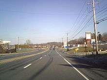
PA 222 begins at an interchange with I-78/PA 309 in the community of Dorneyville in South Whitehall Township in Lehigh County, where the road continues southwest as US 222 towards Reading. From this interchange, PA 222 heads northeast on four-lane divided Hamilton Boulevard, passing between Dorney Park & Wildwater Kingdom to the north and businesses to the south. Direct access to Dorney Park is limited to PA 222 southbound, as northbound traffic must make a left turn onto Lincoln Avenue to access the park. After passing the amusement park, the route splits into two carriageways, with PA 222 north remaining on Hamilton Boulevard and PA 222 south following the newer Hamilton Boulevard Bypass to the north. A short distance to the east, the road intersects Cedar Crest Boulevard, a major north–south arterial in the Allentown metropolitan area.[3][4]
Northeast of Cedar Crest Boulevard, the two carriageways merge onto Hamilton Boulevard as it passes to the south of Cedar Crest College. At this point, PA 222 leaves South Whitehall Township for the city of Allentown. The route becomes a four-lane undivided road and passes through residential areas. At the intersection with Ott Street, PA 222 curves east onto Hamilton Street and runs along the southern edge of Cedar Creek Park, where it intersects 24th Street. The road continues east through residential and commercial areas, narrowing to three lanes with two northbound lanes and one southbound lane at the 20th Street intersection. The route passes to the north of St. Luke's Hospital between 18th and 17th streets and comes to an intersection with 15th Street.[3][4]
PA 222 heads into downtown Allentown, where it splits into a one-way pair at 12th Street. Northbound PA 222 turns south onto 12th Street and east onto Walnut Street while southbound PA 222 runs west along Linden Street to 12th Street, following 12th Street south to Hamilton Street. Walnut Street is two lanes and two-way until 10th Street, where it becomes one-way with two northbound lanes heading east, while Linden Street is one way southbound with two lanes heading west. The one-way paring continues east past homes and businesses in the downtown area. Southbound PA 222 passes to the north of the PPL Center sports arena between 8th and 7th streets. PA 222 intersects 7th Street, which carries southbound PA 145, before it reaches its northern terminus at 6th Street, which carries northbound PA 145.[3][4]
History
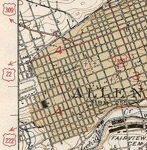
.svg.png)
From the establishment of Allentown in the 18th century to the modern age, Hamilton Street has been the main arterial of the municipality. Similar to many other Allentown-area streets at the time; Hamilton, Linden, and Walnut Streets were used for trolley car and horse transportation. Following an economic depression the city suffered in the late 19th century, it rebounded in the 20th century with the establishment of many shopping stores on Hamilton Street; the commercial center of the city, that hosted the annual Workhorse Parade, a popular attraction in the 1910s.[5]
When the Sproul Road Bill was signed on May 31, 1911,[6] the state began maintenance over state highways. One of those highways was Legislative Route 157, the modern Hamilton Boulevard section of PA 222, west of Allentown. Another state highway was Legislative Route 159, aligned east of Allentown to downtown Bethlehem along Hanover Avenue and Broad Street. No routes had a designation within the city of Allentown.[7][8]
In 1916, the William Penn Highway was organized as an alternative to the Lincoln Highway. The roadway traversed downtown Allentown via Hamilton Street and Hamilton Boulevard. The Pennsylvania Department of Highways gave the road the PA 3 numbering in 1924 and when the United States Highway System was formed, US 22 became part of it.[9] The William Penn Highway served New York City; the road became problematic for motorists in Lebanon along the current US 422; Reading via current US 422 and US 222; and Allentown on Hamilton Street.[10] PA 43 was aligned as a bypass, north of the Pennsylvania Dutch Country, between Allentown and Harrisburg.[11] On June 8, 1931, the American Association of State Highway Officials came to a resolution to the traffic problem, by replacing the PA 43 corridor with US 22 and the William Penn Highway name to match.[9][10] The state truncated PA 43 to Susquehanna Street from Allentown to Bethlehem.[12] US 222 replaced the former US 22 alignment from Reading to Allentown. Hamilton Street was numbered as US 222, west of downtown Allentown, where it turned north onto 15th Street. This portion of US 222 was seven-blocks long which ended at Tilghman Street (then US 22).[13] Signs were changed to reflect the new designations on May 31, 1932, with the new route designations officially in place on June 1, 1932.[14]
In the late 1950s, US 222 was realigned to a newly constructed bypass carrying US 309 and PA 29, west of Allentown. From the south, US 222 left Hamilton Boulevard and turned north onto the freeway. US 222 terminated at an interchange with US 22, US 309, and PA 29 in South Whitehall Township.[15][16] By 1970, what was the US 309/PA 29/US 222 freeway had the PA 29 designation removed, US 309 downgraded to PA 309 and US 222 was truncated to end at its current northern terminus.[17] By the 1980s, I-78 became part of the freeway that occupied PA 309.[18]
In 1984, the Pennsylvania Department of Transportation was planning to extend PA 145 and US 222. Traffic engineer Samuel D. Darrohh said that Allentown is one of few Pennsylvania cities without a traffic route going through it. After the plan was introduced, he said that motorists might be aided if US 222 is extended along Hamilton Boulevard to connect with the proposed PA 145 corridor.[19] PennDOT originally planned the road as US 222 but AASHTO denied the extension, stating that the route "is not the shortest or best available route between major control points on the system, and therefore, does not adhere to the policies established under AASHTO's 'Purpose and Policy Statement for U.S. Numbered Highways'". In addition, the route did not meet the criteria for a business route.[20] In 1991, it was commissioned as PA 222. PA 145 was extended south of the US 22 freeway to the I-78/PA 309 overlap near Lanark.[2]
Major intersections
The entire route is in Lehigh County.
| Location | mi[1] | km | Destinations | Notes | |
|---|---|---|---|---|---|
| South Whitehall Township | 0.000 | 0.000 | Exit 54 (I-78/PA 309). Northern terminus of US 222. Former corridors of US 222, US 309, and PA 29. | ||
| Allentown | 4.342 | 6.988 | |||
| 4.482 | 7.213 | ||||
| 1.000 mi = 1.609 km; 1.000 km = 0.621 mi | |||||
See also
 U.S. Roads portal
 Pennsylvania portal
References
- 1 2 Bureau of Maintenance and Operations (January 2015). Roadway Management System Straight Line Diagrams (Report) (2015 ed.). Pennsylvania Department of Transportation. Retrieved June 30, 2015.
- Lehigh County (PDF)
- 1 2 "Routes 222, 145 Hookup Appoved PennDOT Signs Along Hamilton Will Lead To 7th St. CROSSING". The Morning Call. 1991-07-10. Retrieved 2007-06-25.
- 1 2 3 Google (December 13, 2014). "overview of Pennsylvania Route 222" (Map). Google Maps. Google. Retrieved December 13, 2014.
- 1 2 3 Lehigh County, Pennsylvania Highway Map (PDF) (Map). PennDOT. 2014. Retrieved December 13, 2014.
- ↑ Bartholomew, Ann E.; Carol M. Front (2002). Allentown. Arcadia Publishing. ISBN 0-7385-0996-5.
- ↑ "Department of Highways". Pennsylvania Historical and Museum Commission. Retrieved 2007-06-25.
- ↑ 1915 Lehigh County Map (PDF) (Map). Pennsylvania Department of Highways. Retrieved 2007-06-25.
- ↑ 1911 state Map, showing the early state highways (PDF) (Map). Pennsylvania Department of Highways. Retrieved 2007-06-25.
- 1 2 "William Penn Highway: US 22 in Pennsylvania". Federal Highway Administration. Retrieved 2007-06-26.
- 1 2 Butko, Brian A.; Kevin Joseph Patrick (1999). Diners of Pennsylvania. Stackpole Books. ISBN 0-8117-2878-1.
- ↑ 1930 state map, front side (PDF) (Map). Pennsylvania Department of Highways. Retrieved 2007-06-26.
- ↑ 1941 Lehigh County Map (PDF) (Map). Pennsylvania Department of Highways. Retrieved 2007-06-25.
- ↑ 1940 state map, back side (PDF) (Map). Pennsylvania Department of Highways. Retrieved 2007-06-26.
- ↑ "U.S. Route 22 Through Reading Changed to 222". Reading Times. June 1, 1932. p. 14. Retrieved August 7, 2015 – via Newspapers.com.

- ↑ 1960 Lehigh County Map (PDF) (Map). Pennsylvania Department of Highways. Retrieved 2007-06-26.
- ↑ National Bridge Inventory, a database compiled by the United States Department of Transportation Federal Highway Administration, available at nationalbridges.com. Accessed 2007-06-26.
- ↑ 1970 state map, back side (PDF) (Map). Pennsylvania Department of Highways. Retrieved 2007-06-26.
- ↑ 1980 state map, back side (PDF) (Map). PennDOT. Retrieved 2007-06-28.
- ↑ Mellin, Ted (1984-07-31). "Route 145 Extension Through The City Receives Backing". The Morning Call. pp. B03. Retrieved 2007-06-26.
- ↑ Menhini, Leno (June 4, 1990). "Report of the Special Committee on U.S. Route Numbering to the Executive Committee" (PDF) (Report). Wilmington, DE: American Association of State Highway and Transportation Officials. Retrieved December 14, 2014.
External links
| Wikimedia Commons has media related to Pennsylvania Route 222. |