Pennsylvania Route 143
| ||||
|---|---|---|---|---|
 | ||||
| Route information | ||||
| Maintained by PennDOT | ||||
| Length: | 20.039 mi[1] (32.250 km) | |||
| Existed: | 1928[2] – present | |||
| Major junctions | ||||
| South end: |
| |||
|
| ||||
| North end: |
| |||
| Location | ||||
| Counties: | Berks, Lehigh | |||
| Highway system | ||||
| ||||

Pennsylvania Route 143 (PA 143) is a 20-mile-long (32 km) state highway in Pennsylvania. It runs from PA 662 in Richmond Township, Berks County northeast to PA 309 near New Tripoli in Lehigh County. The route passes through rural areas, intersecting Interstate 78 (I-78)/U.S. Route 22 (US 22) in Lenhartsville, PA 737 near Kempton, and PA 863 in Lynnport. What is now PA 143 north of Lenhartsville was originally designated Legislative Route 285 in 1911. PA 143 was designated to in 1928 to run from PA 43 in Lenhartsville to PA 29 near New Tripoli. The route was extended slightly east through New Tripoli by 1940 following a realignment of PA 29. PA 143 was extended south to PA 662 by 1966.
Route description
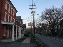
PA 143 begins at an intersection with PA 662 in Richmond Township, Berks County, heading to the north on two-lane undivided Hard Hill Road. It turns northwest through a mix of hilly farms and woods with some homes, reaching the community of Virginville and becoming Main Street. In Virginville, the road crosses the Maiden Creek into Perry Township, where it runs a short distance to the west of the creek with woods to the east and farm fields to the west as an unnamed road. PA 143 continues through rural surroundings as it passes through Windsor Township and into Greenwich Township. The road enters more wooded surroundings and makes a few sharp turns prior to heading west into Lenhartsville. Here, the road becomes Chestnut Street and passes homes and businesses, making a right turn to the north onto Willow Street as it intersects the former alignment of US 22.[3][4]
Upon leaving Lenhartsville for Greenwich Township again, PA 143 becomes unnamed and reaches an interchange with I-78/US 22. From this point, the road winds north through more forested areas, still running to the west of Maiden Creek. The route enters Albany Township and enters a mix of woods and farms as it comes to an intersection with the northern terminus of PA 737 near the community of Kempton. Following this intersection, the road passes through more rural areas as it runs to the west of Ontelaunee Creek and the Wanamaker, Kempton and Southern Railroad.[3][4]
PA 143 crosses into Lynn Township, Lehigh County, continuing northeast to the community of Wanamakers as Kings Highway. At this point, the road turns more to the east and passes the terminus of the Wanamaker, Kempton and Southern Railroad and heads into more agricultural areas with some homes. Upon reaching the community of Lynnport, PA 143 comes to the northern terminus of PA 863. From this intersection, the route continues farther east, passing through New Tripoli as Decatur Street before reaching its northern terminus at PA 309.[3][5]
PA 143 has a total length of 20.039 miles (32.250 km).[1] In 2010, PA 143 had an annual average daily traffic count ranging from a high of 5,400 vehicles between PA 662 and I-78/US 22 to a low of 1,800 vehicles between PA 737 and PA 863.[6] None of PA 143 is part of the National Highway System.[7]
History
What is now PA 143 north of Lenhartsville was designated as part of Legislative Route 285, a legislative route that ran from Hamburg to New Tripoli, in 1911.[8] PA 143 was designated in 1928 to follow its current alignment from PA 43 (now Old Route 22) in Lenhartsville northeast to PA 29 west of New Tripoli.[2] The route was originally unpaved between Lenhartsville and Kempton while the section between Kempton and New Tripoli was paved.[9] By 1940, PA 143 was paved between Lenhartsville and Kempton. Also by this time, PA 143 was extended through New Tripoli to end at PA 29 (now PA 309) to the east of the community following a realignment of PA 29.[10] PA 143 was extended south from Lenhartsville to its current southern terminus at PA 662 by 1966, adding 6.4 miles (10.3 km) to the length of the road.[3][11]
Major intersections
| County | Location | mi[1] | km | Destinations | Notes |
|---|---|---|---|---|---|
| Berks | Richmond Township | 0.000 | 0.000 | Southern terminus | |
| Greenwich Township | 6.643 | 10.691 | Exit 35 (I-78 / US 22) | ||
| Albany Township | 10.971 | 17.656 | |||
| Lehigh | Lynn Township | 16.293 | 26.221 | ||
| 20.039 | 32.250 | Northern terminus | |||
| 1.000 mi = 1.609 km; 1.000 km = 0.621 mi | |||||
See also
 U.S. Roads portal
 Pennsylvania portal
References
- 1 2 3 Bureau of Maintenance and Operations (January 2015). Roadway Management System Straight Line Diagrams (Report) (2015 ed.). Pennsylvania Department of Transportation. Retrieved June 30, 2015.
- Berks County (PDF)
- Lehigh County (PDF)
- 1 2 Pennsylvania Highway Map (Philadelphia Metro) (Map). Gulf Oil. 1928. Retrieved November 8, 2007.
- 1 2 3 4 Google (November 25, 2010). "overview of Pennsylvania Route 143" (Map). Google Maps. Google. Retrieved November 25, 2010.
- 1 2 Berks County, Pennsylvania Highway Map (PDF) (Map). PennDOT. 2010. Retrieved November 25, 2010.
- ↑ Lehigh County, Pennsylvania Highway Map (PDF) (Map). PennDOT. 2010. Retrieved November 25, 2010.
- ↑ Pennsylvania Traffic Volume Map (PDF) (Map). Pennsylvania Department of Transportation. 2010. Retrieved October 10, 2012.
- ↑ National Highway System: Pennsylvania (PDF) (Map). Federal Highway Administration. 2010. Retrieved February 10, 2012.
- ↑ Map of Pennsylvania Showing State Highways (PDF) (Map). Pennsylvania Department of Highways. 1911. Retrieved January 27, 2011.
- ↑ Tourist Map of Pennsylvania (PDF) (Map). Pennsylvania Department of Highways. 1930. Retrieved June 24, 2010.
- ↑ Official Road Map of Pennsylvania (PDF) (Map). Pennsylvania Department of Highways. 1940. Retrieved June 24, 2010.
- ↑ General Highway Map Berks County, Pennsylvania Sheet 1 (PDF) (Map). Pennsylvania Department of Highways. 1966. Retrieved December 14, 2012.