Pegu Range
| Pegu Range | |
|---|---|
| ပဲခူးရိုးမ | |
 Mount Popa | |
| Highest point | |
| Peak | Mount Popa |
| Elevation | 1,518 m (4,980 ft) |
| Coordinates | 20°55′27″N 95°15′02″E / 20.92417°N 95.25056°E |
| Dimensions | |
| Length | 475 km (295 mi) N/S |
| Width | 60 km (37 mi) E/W |
| Geography | |
 | |
| Country | Burma |
| Range coordinates | 20°55′N 95°15′E / 20.92°N 95.25°ECoordinates: 20°55′N 95°15′E / 20.92°N 95.25°E |
The Pegu Range (Burmese: ပဲခူးရိုးမ, Pegu Yoma or Bago Yoma) is a range of low mountains or hills[1] and uplands[2] between the Irrawaddy and the Sittaung River in central Burma (Myanmar). The range runs from Mount Popa in the north to Singguttara Hill (Theingottara Hill) in the south. Both the Pegu River and the Sittaung River originate in the Pegu Range.
High points
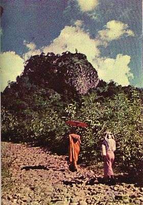
Among the notable peaks or hilltops are 1,518 metres (4,980 ft) high Mount Popa, a stratovolcano,[3] Binhontaung 2,003 feet (611 m),[4] Kodittaung 1,885 feet (575 m),[4] Phoe-Oo Taung [3] and Singguttara Hill (Theingottara Hill).[3]
Geology
The Pegu Range consists of folded and faulted Paleogene marine sediments combined with more recent volcanics.
History
The Shwedagon Pagoda was built sometime before 1000 A.D. on Singguttara Hill.
The Pegu Range was the original site of the 1930-1931 Saya San uprising against the British. Saya San raised the flag of independence on Alantaung Hill near Tharrawaddy.[5]
Later the Pegu Range became a center for the Communist Party of Burma.[6]
Ecology
The northern end of the Pegu merges into the Burmese Dry Belt, while in the south there is over 80 inches of rainfall a year.[7] The hills of the Pegu Range were originally heavily forested with teak and other commercially exploitable hardwoods.[1][7] The southern forests were "ironwood forests", while the central and northern forests were teak.[8] Extensive logging has caused the present deforestation and increased erosion in the area.
Notes
- 1 2 Seekins, Donald M. (2006) Historical dictionary of Burma (Myanmar) Scarecrow Press, Lanham, Maryland, page 357, ISBN 0-8108-5476-7
- ↑ Seekins, Donald M. (2006) Historical dictionary of Burma (Myanmar) Scarecrow Press, Lanham, Maryland, page 191, ISBN 0-8108-5476-7
- 1 2 3 Moore, Elizabeth H. (2007) Early landscapes of Myanmar River Books, Bangkok, page 44, ISBN 974-9863-31-3
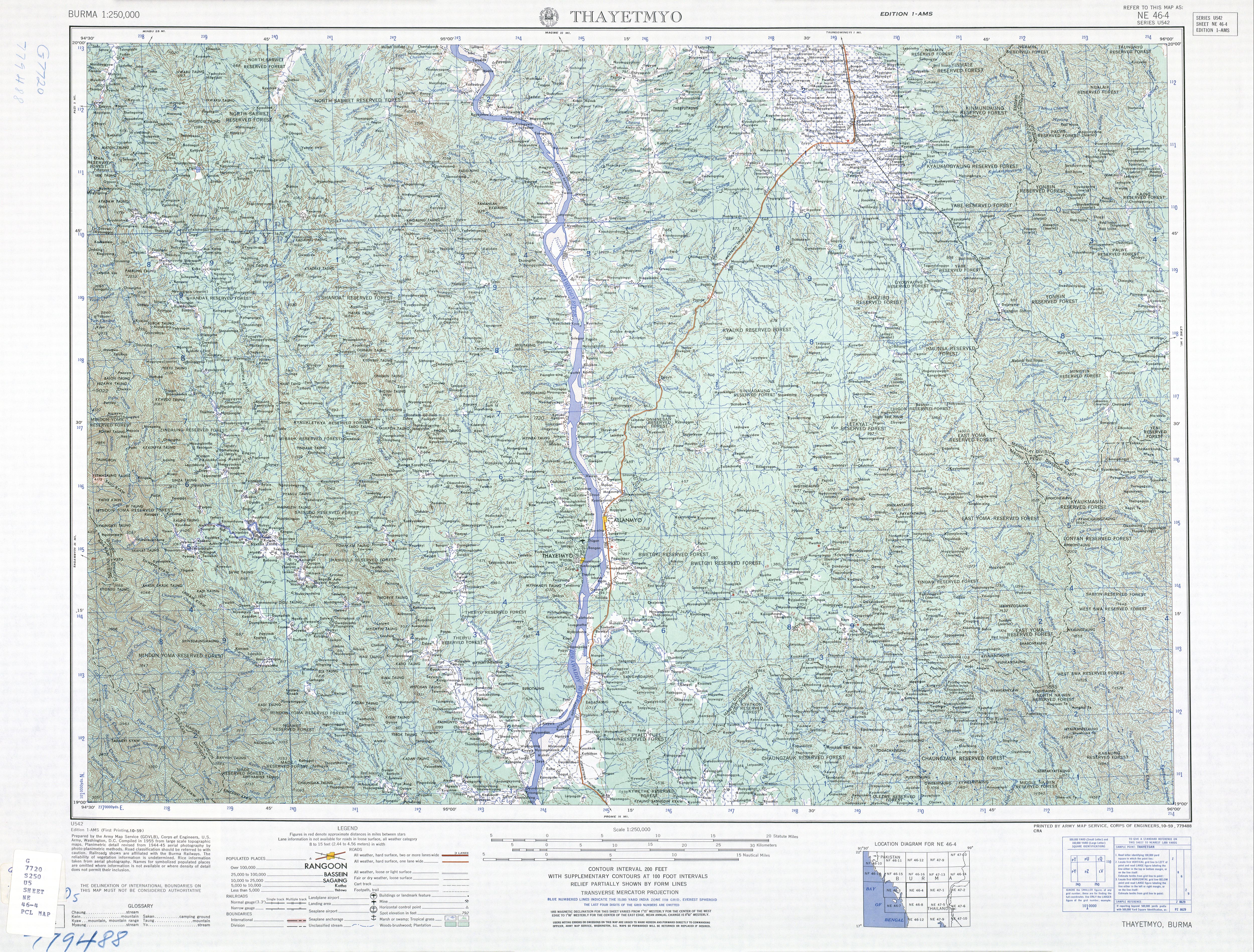
- 1 2 topographic map, 1:250,000 Thayetmyo, Burma, NE 46-4, Series U542, United States Army Map Service, October 1959
- ↑ Ghosh, Parimal (2000) Brave men of the hills: resistance and rebellion in Burma, 1825-1932 University of Hawai'i Press, Honolulu, Hawaii, page 174, ISBN 0-8248-2207-2
- ↑ Seekins, Donald M. (2006) Historical dictionary of Burma (Myanmar) Scarecrow Press, Lanham, Maryland, page 151, ISBN 0-8108-5476-7
- 1 2 Stamp, L. Dudley (1930) "Burma: An Undeveloped Monsoon Country" Geographical Review 20(1): pp.86-109, page 105
- ↑ de Terra, Hellmut (1944) "Component Geographic Factors of the Natural Regions of Burma" Annals of the Association of American Geographers 34(2): pp. 67-96, page 82