Pefki
| Pefki Πεύκη | |
|---|---|
 | |
 Pefki | |
|
Location within Athens  | |
| Coordinates: 38°4′N 23°48′E / 38.067°N 23.800°ECoordinates: 38°4′N 23°48′E / 38.067°N 23.800°E | |
| Country | Greece |
| Administrative region | Attica |
| Regional unit | North Athens |
| Municipality | Lykovrysi-Pefki |
| • Municipal unit | 2.176 km2 (0.840 sq mi) |
| Elevation | 260 m (850 ft) |
| Population (2011)[1] | |
| • Municipal unit | 21,352 |
| • Municipal unit density | 9,800/km2 (25,000/sq mi) |
| Time zone | EET (UTC+2) |
| • Summer (DST) | EEST (UTC+3) |
| Postal code | 151 xx |
| Area code(s) | 210 |
| Vehicle registration | Z |
| Website | www.dimospefkis.gr |
Pefki (Greek: Πεύκη meaning "pine", before 1959: Μαγκουφάνα - Magkoufana[2]) is a suburb in the northeastern part of the Athens agglomeration, Greece. Since the 2011 local government reform it is part of the municipality Lykovrysi-Pefki, of which it is the seat and a municipal unit.[3]
Geography
Pefki is situated 10 kilometres (6 miles) northeast of Athens city centre. The municipal unit has an area of 2.176 km2.[4] The built-up area of Pefki is continuous with those of the neighbouring suburbs Irakleio, Lykovrysi, Kifisia and Marousi. Pefki consists of two areas: Ano Pefki and Kato Pefki. Pefki is served by Athens Metro Line 1 and by several bus routes. The nearest motorway is Motorway 6, south of Pefki.
Historical population
| Year | Population |
|---|---|
| 1981 | 10,863 |
| 1991 | 17,987 |
| 2001 | 19,887 |
| 2011 | 21,352 |
Education
The Japanese Community School of Athens was previously located in Ano Pefki.[5]
Twin towns
Pefki is twinned with:
Gallery
 Municipal Stadium of Pefki
 Village of the Sun at Ano Pefki
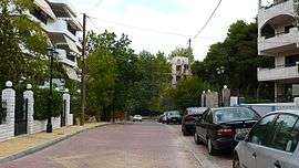
 Pefki Architecture
See also
References
- ↑ "Απογραφή Πληθυσμού - Κατοικιών 2011. ΜΟΝΙΜΟΣ Πληθυσμός" (in Greek). Hellenic Statistical Authority.
- ↑ Name changes of settlements in Greece
- ↑ Kallikratis law Greece Ministry of Interior (Greek)
- ↑ "Population & housing census 2001 (incl. area and average elevation)" (PDF) (in Greek). National Statistical Service of Greece.
- ↑ "学校紹介" (Archive). Japanese Community School of Athens. Retrieved on January 16, 2015. "33 PINDOU ST, ANO-PEFKI 151-21,ATHENS GREECE"
External links
| Wikimedia Commons has media related to Pefki. |
- City of Pefki official website (Greek)
 |
Lykovrysi | Kifisia | | |
| |
Marousi | |||
| ||||
| | ||||
| Irakleio | Marousi |