Peetz, Colorado
| Town of Peetz, Colorado | |
|---|---|
| Town | |
 Location in Logan County and the state of Colorado | |
| Coordinates: 40°57′42″N 103°6′43″W / 40.96167°N 103.11194°WCoordinates: 40°57′42″N 103°6′43″W / 40.96167°N 103.11194°W[1] | |
| Country |
|
| State |
|
| County[2] | Logan County |
| Incorporated (town) | May 17, 1917[3] |
| Government | |
| • Type | Statutory Town[2] |
| Area | |
| • Total | 0.2 sq mi (0.5 km2) |
| • Land | 0.2 sq mi (0.5 km2) |
| • Water | 0 sq mi (0 km2) |
| Elevation[4] | 4,436 ft (1,352 m) |
| Population (2000) | |
| • Total | 227 |
| • Density | 1,135/sq mi (454/km2) |
| Time zone | MST (UTC-7) |
| • Summer (DST) | MDT (UTC-6) |
| ZIP code[5] | 80747 |
| Area code(s) | 970 |
| FIPS code | 08-58235 |
| GNIS feature ID | 0204648 |
| Website | Town of Peetz Website |
Peetz is a Statutory Town in Logan County, Colorado, United States. The population was 227 at the 2000 census. Peetz is home to the RE-5 School District and Peetz K-12 School. Peetz is also home to the Peetz Wind Farm.
Geography
According to the United States Census Bureau, the town has a total area of 0.2 square miles (0.52 km2), all of it land.
Peetz is located on the Peetz Plateau.
Commerce
Peetz's commerce mainly is focused on farming. In the town of Peetz, there is one restaurant/bar, the Hot Spot, a grain elevator and service station, Peetz Co-op, a telephone and internet provider, Peetz Telephone Company, and a laundromat.
Demographics
| Historical population | |||
|---|---|---|---|
| Census | Pop. | %± | |
| 1920 | 322 | — | |
| 1930 | 244 | −24.2% | |
| 1940 | 207 | −15.2% | |
| 1950 | 232 | 12.1% | |
| 1960 | 218 | −6.0% | |
| 1970 | 186 | −14.7% | |
| 1980 | 220 | 18.3% | |
| 1990 | 179 | −18.6% | |
| 2000 | 227 | 26.8% | |
| 2010 | 238 | 4.8% | |
| Est. 2015 | 237 | [6] | −0.4% |
As of the census[8] of 2000, there were 227 people, 90 households, and 63 families residing in the town. The population density was 4 people per square mile (461.3/km²). There were 99 housing units at an average density of 529.6 per square mile (201.2/km²). The racial makeup of the town was 95.59% White, 1.76% from other races, and 2.64% from two or more races. Hispanic or Latino of any race were 10.57% of the population.
There were 90 households out of which 31.1% had children under the age of 18 living with them, 54.4% were married couples living together, 8.9% had a female householder with no husband present, and 30.0% were non-families. 25.6% of all households were made up of individuals and 10.0% had someone living alone who was 65 years of age or older. The average household size was 2.52 and the average family size was 3.06.
In the town the population was spread out with 30.4% under the age of 18, 4.8% from 18 to 24, 26.4% from 25 to 44, 18.5% from 45 to 64, and 19.8% who were 65 years of age or older. The median age was 37 years. For every 100 females there were 108.3 males. For every 100 females age 18 and over, there were 102.6 males.
The median income for a household in the town was $42,083, and the median income for a family was $47,614. Males had a median income of $31,875 versus $21,667 for females. The per capita income for the town was $19,172. About 4.5% of families and 7.3% of the population were below the poverty line, including 15.2% of those under the age of eighteen and none of those sixty five or over.
Name
The community was named after Peter Peetz, an early settler.[9]
Transportation
There are no forms of public transportation in Peetz. There is a BNSF Railway line that runs past Peetz, however, there are no passenger trains. The Peetz lies next to Highway 113.
See also
References
- ↑ "US Gazetteer files: 2010, 2000, and 1990". United States Census Bureau. 2011-02-12. Retrieved 2011-04-23.
- 1 2 "Active Colorado Municipalities". State of Colorado, Department of Local Affairs. Retrieved 2007-09-01.
- ↑ "Colorado Municipal Incorporations". State of Colorado, Department of Personnel & Administration, Colorado State Archives. 2004-12-01. Retrieved 2007-09-02.
- ↑ "US Board on Geographic Names". United States Geological Survey. 2007-10-25. Retrieved 2008-01-31.
- ↑ "ZIP Code Lookup" (JavaScript/HTML). United States Postal Service. Retrieved December 2, 2007.
- ↑ "Annual Estimates of the Resident Population for Incorporated Places: April 1, 2010 to July 1, 2015". Retrieved July 2, 2016.
- ↑ "Census of Population and Housing". Census.gov. Retrieved June 4, 2015.
- ↑ "American FactFinder". United States Census Bureau. Retrieved 2008-01-31.
- ↑ Dawson, John Frank. Place names in Colorado: why 700 communities were so named, 150 of Spanish or Indian origin. Denver, CO: The J. Frank Dawson Publishing Co. p. 40.
External links
Municipalities and communities of Logan County, Colorado, United States | ||
|---|---|---|
| City | 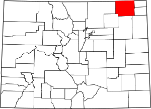 | |
| Towns | ||
| CDPs | ||
| Unincorporated communities | ||
