Pavlodar Region
| Pavlodar Region Павлодар облысы Павлодарская область | ||
|---|---|---|
| Region | ||
|
View of the Irtysh River | ||
| ||
 Map of Kazakhstan, location of Pavlodar Province highlighted | ||
| Coordinates: 52°18′N 76°57′E / 52.300°N 76.950°ECoordinates: 52°18′N 76°57′E / 52.300°N 76.950°E | ||
| Country |
| |
| Capital | Pavlodar | |
| Government | ||
| • Akim | Bakauov, Bulat Zhumabekovich | |
| Area[1] | ||
| • Total | 124,800 km2 (48,200 sq mi) | |
| Population (2013-02-01)[2] | ||
| • Total | 749,516 | |
| • Density | 6.0/km2 (16/sq mi) | |
| Time zone | East (UTC+6) | |
| • Summer (DST) | not observed (UTC+6) | |
| Postal codes | 140100 - 141200 | |
| Area codes | +7 (718) | |
| ISO 3166 code | KZ-PAV | |
| Vehicle registration | 14, S | |
| Districts | 10 | |
| Cities | 3 | |
| Villages | 504 [3] | |
| Website | http://www.pavlodar.gov.kz | |

Pavlodar Region (Kazakh: Павлодар облысы, Pavlodar oblısı, پاۆلودار وبلىسى) is a region of Kazakhstan. Its capital is the city of Pavlodar, which has a population of 322,851. The population of the region: 742,475 (2009 Census results);[4] 806,983 (1999 Census results).[4] Pavlodar borders Russia to the north, and also borders the following Kazakh regions: Akmola (to the west), East Kazakhstan (to the south-east), North Kazakhstan (to the north-west), and Karaganda (to the south). Many people, especially Ukrainians, migrated to Pavlodar in Nikita Khrushchev's Virgin Lands Campaign.
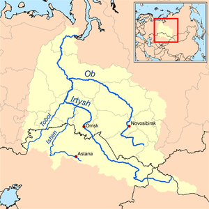
The Irtysh River flows from the Altay Mountains in China to Russia through the region; the Irtysh–Karaganda Canal crosses the western part of the region, taking some of the river's water to Ekibastuz and Karaganda.
Bayanaul National Park is located in the region within 100 km of Ekibastuz.
Administrative divisions
The region is administratively divided into ten districts and the cities of Pavlodar, Aksu, and Ekibastuz.[5]
- Aktogay District, with the administrative center in the selo of Aktogay;
- Bayanaul District, the selo of Bayanaul;
- Ertis District, the selo of Ertis;
- Kashyr District, the selo of Kashyr;
- Lebyazhye District, the selo of Akku;
- May District, the selo of Koktobe;
- Pavlodar District, the city of Pavlodar;
- Sharbakty District, the selo of Sharbakty;
- Uspen District, the selo of Uspenka;
- Zhelezin District, the selo of Zhelezinka.
* Three localities in Pavlodar Region have town status. These are Pavlodar, Aksu, and Ekibastuz.[6]
Demographics (2007 Jan)
Pavlodar Region hosts a diverse range of ethnic groups:[1]
- Kazakhs – 46.15%
- Russians – 38.26%
- Ukrainians – 6.39%
- Germans – 3.21%
- Tatars – 2.07%
- Belarusians – 0.86%
- Moldovans – 0.39%
- Ingushes – 0.25%
- Chechens – 0.25%
- Azeris – 0.25%
- Bashkirs – 0.20%
- Others – 1.75%.
- According to preliminary data population censuses of 2009 the area population has made 729 512 foreheads (99% from planned number), the share of Kazakhs has made 47,7% of all population.
External links
References
- 1 2 Pavlodar Region Statistics
- ↑ Agency of statistics of the Republic of Kazakhstan: Численность населения Республики Казахстан по областям с началa 2013 года до 1 февраля 2013 года (russisch; Excel-Datei; 55 kB).
- ↑ All-Biz Ltd. Павлодарская область
- 1 2 "Население Республики Казахстан" (in Russian). Департамент социальной и демографической статистики. Retrieved 8 December 2013.
- ↑ "Cities and areas akimats". The official portal of akimat of Pavlodar region. Retrieved 25 November 2012.
- ↑ Население Республики Казахстан (PDF) (in Russian). Департамент социальной и демографической статистики. Retrieved 25 November 2012.
![]() Media related to Pavlodar Province at Wikimedia Commons
Media related to Pavlodar Province at Wikimedia Commons
 |
North Kazakhstan Region |
|
|
|
| Akmola Region | |
|||
| ||||
| | ||||
| Karagandy Region | East Kazakhstan Region |
Capital: Pavlodar | ||
| Districts |  | |
| Major cities | ||
| Regions |  | |
|---|---|---|
| Metropolitan cities | ||