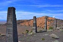
Pahvant Butte
| Pahvant Butte | |
|---|---|
 | |
| Geography | |
| Country | United States |
| State | Utah |
| Region | Black Rock Desert volcanic field |
| District | Millard County |
| Range coordinates | 39°07′54″N 112°33′08″W / 39.1317°N 112.5522°WCoordinates: 39°07′54″N 112°33′08″W / 39.1317°N 112.5522°W |
| Topo map | USGS Pahvant Butte North, Utah and Pahvant Butte South, Utah |
Pahvant Butte or Pavant Butte is a butte formed by a dormant volcano in the west-central portion of Utah. It is located in the Sevier Desert in the Pahvant Valley 15.7 miles (25.3 km) south of Delta and five miles east of Clear Lake and the Clear Lake Wildlife Management Area.[1]
The butte has two peaks. The north peak has an elevation of 5,751 ft (1,753 m) and the south peak reaches 5,486 ft (1,672 m). The peaks are about 1000 feet above the surrounding valley floor. The butte is about 1.5 mi (2.4 km) in diameter at the base.[2]
It formed in an active area of volcanism on top of pahoehoe and aa lavas. Originally a subaqueous volcano, it erupted out of the floor of glacial Lake Bonneville approximately 15,500 years ago.
Geography and geology
Part of the Black Rock Desert volcanic field of the Pleistocene-Holocene age, Pahvant Butte formed above older pahoehoe and aa lavas of the Pahvant field.[3] The volcano was originally a subaqueous volcano formed under Lake Bonneville by a large eruption about 15,500 years ago. The water depth at the time of eruption is estimated to have been 85 m (279 ft).[4] This eruptive activity probably ejected steam, ash, and other materials out of the lake, enveloping the surrounding area with ash and spawning large waves in the lake. The eruption released particles of basaltic lava into the air, which fell back to form tuff.[5]
A raised beach, or lacustrine terrace, formed by waves surrounds most of the volcano's lower rock. A vertical cliff, known as the Lace Curtain, is present on the north flank of the volcano, formed as a result of storm wave action. This name originated from the distinct white, lace-like pattern seen on the cliff face, caused by partial cementation of the tuff by minerals deposited by groundwater.[5]
Pahvant Butte was overlapped by the lava flows of the Ice Springs eruption between 1140 and 1440 AD.[6]
Morphology
The Pahvant Butte volcano consists of an asymmetrical tuff cone with a breach on its southwestern side — and a platform area that extends to the southeast of the cone, formed of beds of tephra dipping steeply away from the cone, and partly concealing a mound of near horizontally-bedded sideromelane tephra beneath.[4]
History of development
The mound of sub-horizontally bedded tephra represents the first stage of the eruption. The ash grains are variably vesiculated, a texture typical of material erupted during phreatomagmatic activity, which involves direct interaction between magma and water. The layers of ash and lapilli, incorporating some clasts of deformed lake sediments, were deposited by sediment gravity flows. Some large ejected blocks have bedding sags beneath them, indicating a ballistic emplacement. The uppermost part of the mound consists of moderately vesicular ash with lapilli, passing up into ripple-marked beds at the base of the overlying cone deposits. These beds are interpreted to represent the result of wave reworking.[4]
The cone consists of steeply dipping layers of mainly palagonite, formed by the alteration of the original basaltic glass. The cone is typical of tuff cones, which form during eruptions in the presence of standing water or abundant groundwater. This part of the volcano was constructed sub-aerially.
The platform consists of deposits formed by the erosion of the cone. These built out into the lake as a prograding delta or beach, forming large cross bedding foresets.[4]
References
- ↑ Delta, Utah, 30x60 Minute Topographic Quadrangle, USGS, 1989
- ↑ Pahvant Butte North, Utah and Pahvant Butte South, Utah, 7.5 Minute Topographic Quadrangles, USGS, 1971
- ↑ "America's Volcanic Past: Utah". United States Geological Survey. June 11, 2003. Retrieved May 7, 2010.
- 1 2 3 4 White, J.D.L (2001). "Eruption and reshaping of Pahvant Butte volcano in Pleistocene Lake Bonneville". In White J.D.L. & Riggs N.R. Volcaniclastic sedimentation in lacustrine settings. Special Publication of the International Association of Sedimentologists. 30. pp. 61–80. ISBN 978-0-632-05847-1. Retrieved 10 May 2010.
- 1 2 Case, William F. (2010). "Pahvant Butte in the Black Rock Desert, Millard County, Utah". Utah Geological Survey. Retrieved May 7, 2010.
- ↑ "Black Rock Desert: Summary". Global Volcanism Program. Smithsonian Institution. Retrieved July 12, 2010.