Patterson, Georgia
| Patterson, Georgia | |
|---|---|
| City | |
|
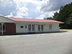
Patterson City Hall | |
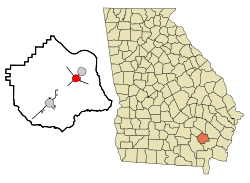 Location in Pierce County and the state of Georgia | |
| Coordinates: 31°23′14″N 82°8′18″W / 31.38722°N 82.13833°WCoordinates: 31°23′14″N 82°8′18″W / 31.38722°N 82.13833°W | |
| Country | United States |
| State | Georgia |
| County | Pierce |
| Area | |
| • Total | 2.7 sq mi (7.1 km2) |
| • Land | 2.7 sq mi (7.1 km2) |
| • Water | 0 sq mi (0 km2) |
| Elevation | 105 ft (32 m) |
| Population (2000) | |
| • Total | 627 |
| • Density | 232.2/sq mi (88.3/km2) |
| Time zone | Eastern (EST) (UTC-5) |
| • Summer (DST) | EDT (UTC-4) |
| ZIP code | 31557 |
| Area code(s) | 912 |
| FIPS code | 13-59500[1] |
| GNIS feature ID | 0332619[2] |
Patterson is a city in Pierce County, Georgia, United States. The population was 627 at the 2000 census.
History
Patterson is named after William Patterson, who came to South Georgia from New York. He established a sawmill, and the small community grew from agriculture (tobacco) and the railroad.
In November 2007, Patterson was named the 50th best place in the United States to raise children by BusinessWeek Magazine.
Geography
Patterson is located at 31°23′14″N 82°08′18″W / 31.387356°N 82.138281°W.[3] According to the United States Census Bureau, the city has a total area of 2.7 square miles (7.0 km2), all of it land.
Demographics
| Historical population | |||
|---|---|---|---|
| Census | Pop. | %± | |
| 1900 | 314 | — | |
| 1910 | 264 | −15.9% | |
| 1920 | 357 | 35.2% | |
| 1930 | 528 | 47.9% | |
| 1940 | 541 | 2.5% | |
| 1950 | 656 | 21.3% | |
| 1960 | 719 | 9.6% | |
| 1970 | 788 | 9.6% | |
| 1980 | 763 | −3.2% | |
| 1990 | 626 | −18.0% | |
| 2000 | 627 | 0.2% | |
| 2010 | 730 | 16.4% | |
| Est. 2015 | 751 | [4] | 2.9% |
Patterson is part of the Waycross Micropolitan Statistical Area.
As of the census[1] of 2000, there were 627 people, 264 households, and 180 families residing in the city. The population density was 230.3 people per square mile (89.0/km²). There were 318 housing units at an average density of 116.8 per square mile (45.1/km²). The racial makeup of the city was 70.49% White, 28.23% African American, 0.32% Native American, 0.64% Asian, and 0.32% from two or more races. Hispanic or Latino of any race were 0.64% of the population.
There were 264 households out of which 26.1% had children under the age of 18 living with them, 52.7% were married couples living together, 12.1% had a female householder with no husband present, and 31.8% were non-families. 31.1% of all households were made up of individuals and 18.6% had someone living alone who was 65 years of age or older. The average household size was 2.38 and the average family size was 2.98.
In the city the population was spread out with 24.1% under the age of 18, 7.7% from 18 to 24, 23.3% from 25 to 44, 25.4% from 45 to 64, and 19.6% who were 65 years of age or older. The median age was 42 years. For every 100 females there were 77.6 males. For every 100 females age 18 and over, there were 78.9 males.
The median income for a household in the city was $26,591, and the median income for a family was $33,750. Males had a median income of $33,125 versus $20,938 for females. The per capita income for the city was $14,968. About 14.2% of families and 17.6% of the population were below the poverty line, including 21.4% of those under age 18 and 28.7% of those age 65 or over.
Climate
The climate in this area is characterized by relatively high temperatures and evenly distributed precipitation throughout the year. According to the Köppen Climate Classification system, Patterson has a humid subtropical climate, abbreviated "Cfa" on climate maps.[6]
| Climate data for Patterson, Georgia | |||||||||||||
|---|---|---|---|---|---|---|---|---|---|---|---|---|---|
| Month | Jan | Feb | Mar | Apr | May | Jun | Jul | Aug | Sep | Oct | Nov | Dec | Year |
| Average high °C (°F) | 17 (63) |
19 (66) |
21 (70) |
26 (78) |
29 (85) |
32 (90) |
33 (92) |
33 (92) |
31 (87) |
26 (79) |
21 (69) |
17 (62) |
26 (78) |
| Average low °C (°F) | 4 (39) |
3 (38) |
7 (44) |
11 (51) |
16 (60) |
20 (68) |
21 (70) |
22 (71) |
19 (67) |
13 (56) |
7 (44) |
3 (38) |
12 (54) |
| Average precipitation mm (inches) | 107 (4.2) |
97 (3.8) |
109 (4.3) |
86 (3.4) |
94 (3.7) |
140 (5.5) |
155 (6.1) |
145 (5.7) |
99 (3.9) |
79 (3.1) |
58 (2.3) |
71 (2.8) |
221 (8.7) |
| Source: Weatherbase [7] | |||||||||||||
Notable people
- KaDee Strickland, actress (b. 1975) Born in Blackshear but she grew up in Patterson and went to school in Pierce County. Her successful acting career includes a starring role in the television series Private Practice.
- Lindsay Thomas, Congressman born in Patterson.[8]
References
- 1 2 "American FactFinder". United States Census Bureau. Retrieved 2008-01-31.
- ↑ "US Board on Geographic Names". United States Geological Survey. 2007-10-25. Retrieved 2008-01-31.
- ↑ "US Gazetteer files: 2010, 2000, and 1990". United States Census Bureau. 2011-02-12. Retrieved 2011-04-23.
- ↑ "Annual Estimates of the Resident Population for Incorporated Places: April 1, 2010 to July 1, 2015". Retrieved July 2, 2016.
- ↑ "Census of Population and Housing". Census.gov. Retrieved June 4, 2015.
- ↑ Climate Summary for Patterson, Georgia
- ↑ "Weatherbase.com". Weatherbase. 2013. Retrieved on September 28, 2013.
- ↑ Robert Lindsay Thomas at Biographical Directory of the United States Congress