Patnos
| Patnos | |
|---|---|
 Patnos | |
| Coordinates: TR 39°14′09″N 42°52′07″E / 39.23583°N 42.86861°ECoordinates: TR 39°14′09″N 42°52′07″E / 39.23583°N 42.86861°E | |
| Country | Turkey |
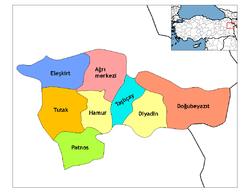
| Province | Ağrı |
| Government | |
| • Mayor | Cem Afşin Akbay (AKP) |
| • Kaymakam | Tuncay Dursun |
| Area[1] | |
| • District | 1,455.74 km2 (562.06 sq mi) |
| Population (2012)[2] | |
| • Urban | 62,425 |
| • District | 125,995 |
| • District density | 87/km2 (220/sq mi) |
| Post code | 04500 |
| Website |
www |
Patnos (Armenian: Բադնոց, Latin transliteration: Badnoc‘ or Patnoc‘, Kurdish: Panos ) was a historically important Armenian city, is now a district of Ağrı Province of Turkey on a plain surrounded by high mountains including Süphan, watered by tributaries of the Murat River. 82 km south of the city of Ağrı on the road to Van. The mayor is Cem Afşin Akbay (AKP).
The plain has been settled since at least 1300BC and this was a centre of the Urartu civilisation. The city has many historical ruins from Urartian period.[3] There are a number of places of historical interest around Patnos, including the castle of Aznavur Tepe, an impressive Urartu building.
Today Patnos is a small town in an impoverished rural area.
References
- ↑ "Area of regions (including lakes), km²". Regional Statistics Database. Turkish Statistical Institute. 2002. Retrieved 2013-03-05.
- ↑ "Population of province/district centers and towns/villages by districts - 2012". Address Based Population Registration System (ABPRS) Database. Turkish Statistical Institute. Retrieved 2013-02-27.
- ↑ http://www.igeme.org.tr/english/dogu_anadolu.pdf
This article is issued from Wikipedia - version of the 9/23/2015. The text is available under the Creative Commons Attribution/Share Alike but additional terms may apply for the media files.