Parelioi
| Parelioi Παρέλιοι | |
|---|---|
 Parelioi | |
|
Location within the regional unit 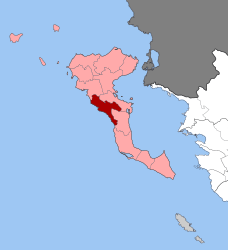 | |
| Coordinates: 39°36′N 19°49′E / 39.600°N 19.817°ECoordinates: 39°36′N 19°49′E / 39.600°N 19.817°E | |
| Country | Greece |
| Administrative region | Ionian Islands |
| Regional unit | Corfu |
| Municipality | Corfu |
| • Municipal unit | 49.0 km2 (18.9 sq mi) |
| Population (2011)[1] | |
| • Municipal unit | 6,403 |
| • Municipal unit density | 130/km2 (340/sq mi) |
| Time zone | EET (UTC+2) |
| • Summer (DST) | EEST (UTC+3) |
| Vehicle registration | ΚΥ |
Parelioi (Greek: Παρέλιοι) is a former municipality on the island of Corfu, Ionian Islands, Greece. Since the 2011 local government reform it is part of the municipality Corfu, of which it is a municipal unit.[2] It is located on the central west coast of the island of Corfu. It has a land area of 48.990 square kilometres (18.92 sq mi)[3] and a population of 6,403 (2011 census). The seat of the municipality was the town of Kokkini (pop. 580). Its largest towns are Sinarádes (pop. 854), Áfra (839), Giannádes (565), Kokkíni, Kompítsi (733), and Pélekas (405).
Subdivisions
The municipal unit Parelioi is subdivided into the following communities (constituent villages in brackets):
- Kokkini
- Agios Ioannis (Agios Ioannis, Agia Triada, Kouramaditika, Vasilika)
- Afra (Afra, Agios Vlasios, Kourkoulaiika)
- Vatos
- Giannades (Giannades, Ermones)
- Kanakades
- Kompitsi
- Marmaro
- Pelekas (Pelekas, Avramis, Agios Onoufrios, Glyfada, Kokkinogeia, Plakoto)
- Sinarades (Sinarades, Aspai, Kontogialos)
Population
| Year | Population |
|---|---|
| 1991 | 6,180 |
| 2001 | 7,196 |
| 2011 | 6,403 |
Tourism
The economy of Parelioi is mainly based on tourism. There are beaches in Agios Gordis, Glyfada, Kondogialos and Ermones. The Historic and Folklore Museum of Central Corfu is located in Sinarades. Aqualand, the third largest water park in Europe, is situated in Agios Ioannis.
External links
References
- ↑ "Απογραφή Πληθυσμού - Κατοικιών 2011. ΜΟΝΙΜΟΣ Πληθυσμός" (in Greek). Hellenic Statistical Authority.
- ↑ Kallikratis law Greece Ministry of Interior (Greek)
- ↑ "Population & housing census 2001 (incl. area and average elevation)" (PDF) (in Greek). National Statistical Service of Greece.
 |
Palaiokastritsa | Corfu (city) | | |
| Ionian Sea | |
Corfu (city) | ||
| ||||
| | ||||
| Ionian Sea | Achilleio |