Parbhani
| Parbhani परभणी/प्रभावतीनगरी پربھنی | |
|---|---|
| City & Municipality | |
|
Marathwada Liberation Day monument in Parbhani | |
| Nickname(s): City Of Stains | |
 Parbhani | |
| Coordinates: 19°16′N 76°47′E / 19.27°N 76.78°ECoordinates: 19°16′N 76°47′E / 19.27°N 76.78°E | |
| Country |
|
| State | Maharashtra |
| Region | Marathwada |
| District | Parbhani |
| Established | 1610 A.D |
| Named for | Prabhavati Goddess |
| Government | |
| • Type | Municipal corporation/Municipality |
| • Body | Parbhani Municipal Corporation |
| • Mayor | Smt. Dipali kupse,[1] (Nationalist Congress Party) |
| • Municipal Commissioner | Shri Rahul Ashok Rekhawar[2] (I.A.S.) |
| • Member of Legislative Assembly | Dr. Shri Rahul Vedprakash Patil,[3] (Shiv Sena) |
| • Member of Parliament | Shri Sanjay Haribhau Jadhav Alias Bandu,[4] (Shiv Sena) |
| Area | |
| • City & Municipality | 37.77 km2 (14.58 sq mi) |
| Elevation | 347 m (1,138 ft) |
| Population (2011) | |
| • City & Municipality | 307,191 |
| • Rank |
India : 149th Maharashtra : 24th |
| • Density | 244.44/km2 (633.1/sq mi) |
| • Metro | 307,191 |
| Demonym(s) | Parbhanikar/Parbhaniwala |
| Languages | |
| • Official | Marathi |
| Time zone | IST (UTC+5:30) |
| PIN | 431401 & 431402 |
| Telephone code | +91-02452 |
| ISO 3166 code | IN-MH |
| Vehicle registration |
MH22 : Parbhani |
| Sex ratio | 958/1000 ♂/♀ |
| Literacy Rate | 77.75% |
| Distance from Hyderabad | 337 kilometres (209 mi) NW (land) |
| Distance from Aurangabad, Maharashtra | 187 kilometres (116 mi) SE (land) |
| Distance from Mumbai | 491 kilometres (305 mi) NW (land) |
| Precipitation | 1,700 millimetres (67 in) |
| Avg. annual temperature | 21.2 °C (70.2 °F) |
| Avg. summer temperature | 49 °C (120 °F) |
| Avg. winter temperature | 06.4 °C (43.5 °F) |
| HDI | Medium[5] |
| Website |
www |

Parbhani (parbhani, IPA ![]() [pərbhNi] ) is a city in Maharashtra state of India. It is the administrative headquarters of Parbhani District. Parbhani is the 4th largest city in Marathwada region o Maharashtra after Aurangabad, Nanded and Latur. Parbhani is around 200 kilometres (120 mi) away from regional headquarter Aurangabad while it is 491 km (305 mi) away from state capital Mumbai.
[pərbhNi] ) is a city in Maharashtra state of India. It is the administrative headquarters of Parbhani District. Parbhani is the 4th largest city in Marathwada region o Maharashtra after Aurangabad, Nanded and Latur. Parbhani is around 200 kilometres (120 mi) away from regional headquarter Aurangabad while it is 491 km (305 mi) away from state capital Mumbai.
Along with entire Marathwada region, Parbhani was a part of the erstwhile Nizam State; later a part of Hyderabad State; after reorganization of states in 1956 it became a part of the then Bombay state; and from 1960 onwards it is part of the present Maharashtra state.[6]
Parbhani is known for its Vasantrao Naik Marathwada Agricultural University, which is one of only 4 agriculture universities of Maharashtra. Moreover, Parbhani is also famous for its annual urs festival at Hazrat Turabul Haq Dargah, which attracts lakhs of tourists each year.[7][8]
Origin of Name
In ancient times, Parbhani was known as "Prabhavati nagari" on account of the existence of a massive temple of Goddess Prabhavati. Indian name "Prabhavati" means goddess Lakshmi and Parvati.[9] Present name Parbhani is a corrupt form of Prabhavati.[10]
History
In the treaty between Sadashivrao Bhau and Nizam of Hyderabad at the conclusion of battle of Udgir by which Peshwa received revenue from the town. After this, Peshwa went to fight third battle of Panipat in 1761. Parbhani languished for over 650 years under Muslim rule, under the Sultans, the Mughals and later the Nizam. The town remained a part of the Hyderabad State under the rulership of the Nizam until Operation Polo of the Indian Army in 1948. Thereafter it became a part of the independent Republic of India. Until 1956 the town remained a part of Hyderabad State within India. Under the administrative reforms that year and the break-up of the State of Hyderabad, Parbhani and the adjacent towns were transferred to the multilingual Bombay State. Since 1960 it has been a part of Maharashtra state, and one memorable thing is that the Marathwada Mukti Sangram Andolan (Protest) was started from Kranti Chawk of Parbhani, and Parbhani had played a lead role in Andolan.
City's History
History of Parbhani, Maharashtra:"There are many evidences suggesting the existence of civilization at Parbhani on the banks of River Godavari since the times of Mahabharata. It is said that Sage Agasthyaset up his ashram on the banks of this river, after crossing the Vindhya Mountain, after which many other sages followed suit. Many settlements in the district corroborate this viewpoint and can be traced to these times: Mudgal village where Sage Mudgal performed penance, Valur (today known as Selu) where Sage Valmiki lived and the town of Pathri (earlier Parthapur) established by Arjun alias Partha, one of the five Pandavas. Parbhani district was a part of Nizams regime. The region of Hingoli along with Parbhani was actually known as the Nizams military base as it was bordered with Vidharbha. In that era military troops, hospitals, veterinary hospital were in operation from Hingoli. Residents had experienced two big wars between Tipu Sultan and Marathas in 1803 and in 1857 between Nagpurkars and Bhonsles. Being a military base, the city was one of the important and famous places of the Hyderabad State.In the 1956, post independence when the state were reconstructed Marathwada wasattached to Mumbai State and in 1960 Hingoli became part of the Maharashtra State as part of Parbhani district. Later on 1 May 1999, Hingoli district came into existence by division of Parbhani. Being under the Nizam rule, the district did not celebrate its freedom when the rest of India became independent in 1947. On September 13, 1948, thirteen months after independence, the Indian Police force took action against the Nizam of Hyderabad. Hyderabad State was merged with independent India, and Parbhani became a part of free India. Parbhani was divided on 1 May 1999 to form the new district of Hingoli. Mauryan Empire, Satavahana, Chalukyas, the Rashtrakutas, Vakatakas, Sultan of Delhi, Bahmani Sultanate, Nizam Shahi sultanate, Mughals, Nagpurkars, Bhonsles, Nizams, Marathas and British. Parbhani is famous for its Hindu and Jain temples.
Culture
Parbhani is very rich in cultural heritage. It is home to many communities and so is having the monuments around the district. The Nemgiri (sequence of caves related to Jainism) is a place that must be visited to observe the cultural excellence of the district.[11]
Notable Churches In Parbhani Include Christ Gospel Church(Narayan Chawl),Church Of The Nazarene(Pedgaoun Road),Good News Church(Shastri Nagar),New Apostolic Church(Tathagat Nagar)
Notable temples in Parbhani include Shree Motha Maruti (at Deshmukh Galli) (a temple of Lord Hanuman) which is famous in the city, Shree Supari Hanuman Mandir, Jabreshwar (at Wadgalli). Ashtbhuja Mandir is at Gandhi Park, Pardeshwar Temple and Beleshwar Mahadev Temple are known for the worship of Lord Mahadev (also known as Bhagwan Shankar). The Naag Temple is also present in Parbhani, near the Temple of Lord Shani. Shri Siddhivinayak Ganpati Temple at vidyanagar is one of the important and famous temple in the City.
The Jain Mandir in Bhajan galli is very attractive in its structure while the Neminath Digambar Jain Mandir, Anand Nagar invites the devotees with its marvelous architecture.A very famous Jain saint Acharya Aryanandi have spent their end time in Navagadh which is near by Parbhani.
Recently, a temple of Goddess Maata Hingulambika's temple is constructed by Bhavsar community behind Shri Datta Dham on Vasmath Road. Original temple of Maa Hingulambika is at Hinglaj, Baluchisthan in Pakistan, and the pilgrims knows her as Nani-Maa there.
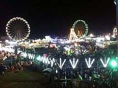
Hazarat Shah Turabul Haq Dargah ( Turatpir ) is located in Parbhani Town. The Dargah consists of the tomb of Hazrat Turabul Haq Shah, a Muslim saint who lived here during the last days of his life. The Dargah is famous for annual Urs i.e. fair of Shah Turabul Haq. Urs is an important festival where people of all religions come together and celebrate for a week (usually start from 2nd Feb to 15th Feb). dargah of Hazrat Qurban Ali shah, dargah of Hazrat Akhund Shah and dargah of many other saints are also situated in the city.
In Pathri tehasil of Parbhani district there are three important places: Sai Baba of Shirdi temple in Pathri, Datta temple in Gunj (khurd) and Renuka Devi temple at Pedgaon.
During Namantar Andolan Parbhani district and its villages faced cultural animosities which brought civil rights revolution in Marathwada region.[12][13][14]
Geography
Parbhani is located at 19°16′N 76°47′E / 19.27°N 76.78°E.[15] It has an average elevation of 347 metres . In the northeast of district on the boundary of Hingoli district and Parbhani district there is extension of Ajanta ranges called Nirmal Hills. The main river in the district is Godavari river, other rivers are Purna and Dudhana which are tributaries of Godavari. Major dams around Parbhani city in Parbhani district are Yeldari dam which is on Purna river, Lower Dudhana dam is on Dudhana river, Mudgal barrage on Godavari river, Masoli Dam MEDIUM PROJECT on Masoli river, Karpara Dam on Karpara river.
Climate
| Climate data for Parbhani (1961–1990) | |||||||||||||
|---|---|---|---|---|---|---|---|---|---|---|---|---|---|
| Month | Jan | Feb | Mar | Apr | May | Jun | Jul | Aug | Sep | Oct | Nov | Dec | Year |
| Record high °C (°F) | 38.0 (100.4) |
39.8 (103.6) |
42.2 (108) |
45.0 (113) |
46.6 (115.9) |
45.9 (114.6) |
39.1 (102.4) |
36.7 (98.1) |
37.9 (100.2) |
37.7 (99.9) |
36.5 (97.7) |
36.0 (96.8) |
46.6 (115.9) |
| Average high °C (°F) | 30.0 (86) |
33.2 (91.8) |
37.1 (98.8) |
40.4 (104.7) |
41.6 (106.9) |
36.3 (97.3) |
31.9 (89.4) |
30.6 (87.1) |
31.7 (89.1) |
32.6 (90.7) |
30.7 (87.3) |
29.1 (84.4) |
33.8 (92.8) |
| Average low °C (°F) | 14.4 (57.9) |
16.7 (62.1) |
20.5 (68.9) |
24.3 (75.7) |
26.3 (79.3) |
24.4 (75.9) |
23.2 (73.8) |
22.5 (72.5) |
22.3 (72.1) |
20.2 (68.4) |
16.5 (61.7) |
14.0 (57.2) |
20.1 (68.2) |
| Record low °C (°F) | 4.4 (39.9) |
6.1 (43) |
11.6 (52.9) |
16.6 (61.9) |
18.8 (65.8) |
18.7 (65.7) |
19.0 (66.2) |
19.4 (66.9) |
15.2 (59.4) |
10.0 (50) |
8.3 (46.9) |
4.8 (40.6) |
4.4 (39.9) |
| Average precipitation mm (inches) | 5.7 (0.224) |
4.6 (0.181) |
12.5 (0.492) |
7.0 (0.276) |
19.2 (0.756) |
157.8 (6.213) |
238.4 (9.386) |
265.4 (10.449) |
184.9 (7.28) |
74.6 (2.937) |
13.8 (0.543) |
12.5 (0.492) |
996.4 (39.228) |
| Average rainy days | 0.4 | 0.4 | 0.8 | 0.8 | 1.8 | 8.8 | 10.8 | 11.2 | 8.9 | 3.2 | 0.8 | 0.7 | 48.6 |
| Source: India Meteorological Department (record high and low up to 2010)[16][17] | |||||||||||||

Salient Physical Features
The hills on the north east form part of the Ajanta Hill ranges which passes through Jintur Tahsil. The hills on the southern side are the Balaghat Hill ranges. The district is at an average height of 357 m from mean sea level.
Demographics
According to the 2011 census, the population of Parbhani city is 3,07,191 and it was officially accorded city status by establishing a municipal corporation. Male and female populations are 157,628 and 149,563 respectively, a ratio of 949 females per 1000 males. The average literacy rate of Parbhani city is 84.34 percent (225,298 people), with male literacy at 90.71 percent and female at 77.70 percent. Children (aged 0–6 years) in Parbhani city total 40,075 according to the Census India report published in 2011. There were 21,187 boys and 18,888 are girls, a ratio of 981 girls per 1000 boys.[18][19]
According to 2011 census religious population of Parbhani city is as follows, Hindus 138,562, Muslims 126,702, Buddhist 36,203, Jain 2,870, Not Stated 1,447, Christian 697, Sikh 632, Others 57. Hinduism is majority religion in Parbhani city with 45.11% followers. Islam is second most popular religion in city of Parbhani with approximately 41.25% following it and Buddhism by 09.21%, Christianity is followed by 0.23%, Jainism by 0.93%, Sikhism by 0.21%. Around 0.02% stated 'Other Religion', approximately 0.47% stated 'No Particular Religion'.[20]
Healthcare
The condition of healthcare in Parbhani is very good. Though high-end facilities are not available, essential basic needs of healthcare can be easily fulfilled. A number of intensive care units & 2 Multi-Super Specialty Hospitals are currently being opened up in Parbhani. City has district civil hospital with 412 beds and separate Govt. eye hospital as well as Govt. orthopaedic hospital are available and a separate Govt. women's hospital has also been sanctioned for the city due to efforts taken by Ex-health minister Mrs. Fouzia Khan.[21]

_India.jpg)
Transport
Rail
The transport system of the city is largely dependent on rails. Parbhani railway station is a railway junction situated on Secunderabad-Manmad section of South Central Railway Zone. The town has connectivity to major cities of Maharashtra, such as Aurangabad, Mumbai, Nagpur, Pune and Ajmer. It is also connected to other Indian cities like New Delhi, Ajmer, Hyderabad, Nizamabad, Vishakapatnam and Chennai.[22] Railway Parbhani Junction has many facilities, such as baggage check, metal detectors, VIP Lounge, parking 4/3/2 wheeler's, ATMs, ATVM (Automatic Ticket Vending Machines), canteen (Rail Aahar), fruit stalls, book stalls, Indian Post (Bhartiya Daak), foot over-bridges, water for passenger's, milk dairy, television, wifi network (54Mbit/s), etc.
Bus
Central Bus Station, Parbhani: It connects Parbhani to other states of India, such as Andhra Pradesh, Telangana, Karnataka, Gujarat and Madhya Pradesh. There are daily services of MSRTC Parbhani Division between Parbhani to other metropolitan cities, such as Aurangabad, Pune, Mumbai, Kalyan, Nirmal, Hyderabad and Nashik. Typically Ashok Leyland's Buses And Tata Buses Used To transportation.
Roads
National Highway 61 old numbering NH222, which connects the states Telangana and Maharashtra, passes through the town, which makes it have connectivity to Mumbai, Nanded. The NH61 paves its way into National Highway 3 at Kalyan and National Highway 7 at Nirmal. These highways open further connectivity options for Parbhani, making it to connect with north-eastern cities of Indore, Jhansi, Agra and North-Southern cities like Varanasi, Nagpur, Adilabad, Nizamabad, Hyderabad, Bangalore and Kanyakumari.
Air
Parbhani Airport is under construction at National Highway 222 (Pathri Road) Parbhani.
Maharashtra Industrial Development Corporation(MIDC)Project
Ownership: State Govt. - Statutory Bodies
Project Location:Parbhani, Maharashtra, India
Project Status: Shelved Project
Type/Scale: New Unit
Industry: Air Transport
Investment/Estimated Cost: Rs. 4.47 Crores / USD 1.12 Million
Thursday, December 31, 1998 State government approval received
Friday, January 1, 1999 Date of announcement
Thursday, November 1, 2001 Stalled
Local Transport
Auto rickshaw, taxi (Kaali Peelis). Municipal transport buses were used to serve the cityl, but now these buses serve rural areas, like Jintur, Manwath, Gangakhed, Basmath. Typical Tata Starbuses are used for transportation.
Economy
Parbhani has Maharashtra Industrial Development Corporation area for development of industries in the region, but because of lack of political will, Parbhani does not have any big industry.[23]
Demand for Mumbai-Visakhapatnam Economic Corridor
Parbhani city is situated on the route of two National big cities Mumbai and Visakhapatnam, so there has been constant demand for creation of new industrial zone named Mumbai-Ahemadnagar-Parbhani-Nirmal-Mancherial-Jagdalpur-Visakhapatnam route as an Economic Corridor which will connect to [[Delhi Mumbai Industrial Corridor Project][Kolkata-Visakhapatnam-Chennai Industrial Corridor and Proposed Mumbai-Bangalore Economic Corridor]].[24] This project will not only help Parbhani to develop, but it will promote industrial growth in entire Marathwada.
Development programmes
For development of Parbhani city, a Global Forum for Parbhani City Development Web portal has been launched for Parbhani citizens.[25]
Sports
Many sports complexes are available in Parbhani, such as swimming pool complexes, tennis, badminton courts, cricket club, basketball club, baseball clubs. These clubs are operated by PMC Sport Complexes, Nehru Road, Parbhani.
- Stadium
Smt. Priyadarshani Indira Gandhi Stadium, Nehru Road, Parbhani (Football,Basesball,Cricket Stadium) National Level
Utility services
The electrical supply to the city is managed by the Maharashtra State Electricity Distribution Company Limited, and water is supplied from the Jayakawadi Dam Reservoir, Paithan & Yeldari Dam Reservoir, Yeldari, Parbhani. Parbhani has 2 water pumping stations in MIDC Area Parbhani and 7 water filtration centres.
Media
- FM Radio
All India Radio Parbhani Frequency-102.00(Timings 0006:00AM-11:55PM)
- Aaakshwani Radio
Parbhani Have 2 Radio Station 1st is locted at Super Market Road,Kalyan Nagar,Parbhani and 2nd is located at Dharmapuri,Jintur Road,Parbhani
- TV Stations
Doordarshan Broadcasting Center Located at Super Market,Karegaoun Road,Parbhani
- Private Media
TV9 Marathi Channel Located at Shaahi Mosque,Parbhani and other
There Are Many News Papers are available
Government and Politics
Since 1989, Parbhani is stronghold of Shiv Sena both in Maharashtra Legislative Assembly elections and in Lok Sabha elections for Indian Parliament.[26][27] Politics of Parbhani is mainly religious politics, Ministry of Minority Affairs declared Parbhani as Minority Concentration District as Muslims makes 15.97% of the population, so religious polarization is common phenomenon of Parbhani politics.[28] Religious politics have restricted developmental growth of Parbhani.[29]

Non-Government Organizations
- Indian Institute of Personality Development, Iqbal Nagar, Parbhani
- Welfare Association for Resourgence of Minorities, Parbhani
- Azad Educational & Welfare Society, Iqbal Nagar, Parbhani
- Parbhani Education Society Parbhani
- Faizan Education & Welfare Society, Parbhani
- Socio Economic Development Trust, Dreamland, Kerwadi Ta. Palam Dist. Parbhani
- Fatema Education Society, Parbhani
Education
There are high quality education facilities in Parbhani. There are well-reputed schools,Has number of CBSE affiliated Schools good colleges and most importantly an agricultural university. Besides boys there were 41 girls under instructions for primary education in 1903.[30]
Vasantrao Naik Marathwada Agricultural University (VNMAU) Parbhani is the only agricultural university in India which conducts all agriculture related courses in single campus,VNMAU is one of four Agri-Universities in the State of Maharashtra. Prior to original Maharashtra Agricultural University, it was established on May 18, 1972 to fulfil the regional aspirations of agrarian growth. It is entrusted with the responsibilities to pro- vide education in agriculture and allied fields, undertake research and facilitate technology transfer in Marathwada region of Maharashtra. The first college of Agriculture was established in this region at Parbhani in 1956 by Hyderabad State Government just before State reorganization. During Nizam's rule, however, agricultural education was available only at Hyderabad but crop research centres viz., sorghum, cotton, fruits existed in the region. The foundation of research was laid by the erstwhile Nizam State with commencement of the Main Experimental Farm at Parbhani in 1918. The famous 'Gaorani' desi cotton is the result of the research on cotton and local sorghum cultivars were improved by selec- tion by the then Economic Botanist. Since then Parbhani remain the hub of educational, research and extension activ- ities in Marathwada.facilitate technology transfer, etc. It is the only agricultural university in India where all the branches of Agricultural Sciences are taught.[31] College of Veterinary and Animal Sciences, Parbhani is located here which is one of the constituent Veterinary Colleges coming under the authority of Maharashtra Animal and Fishery Sciences University, Nagpur from 2000. Earlier this college was established in 1972 as a part of MAU.
Colleges
- Beleshwar Institute of Nursing(Basic B.Sc/RGNM/RANM)Beleshwar Nagar,Parbhani
- College of Veterinary & Animal Sciences, MAFSU, Parbhani
- P.D. Jain Homoeopathic Medical College, Vakil Colony Parbhani
- Saraswati Dhanwantari Dental College
- Beleshwar college Of BCA & MCM,Beleshwar Nagar Parbhani
- Dnyanopasak College Of Arts, Commerce, Science, and Technology
- Dr. Zakir Hussain Women's Degree college Parbhani
- M.G.M. College of CS & IT
- Queens College of Education Parbhani
- Rajiv Gandhi College of Agriculture Parbhani
- Rajiv Gandhi College of Food Technology Parbhani
- Shree Shivaji College Of Arts, Commerce, and Science
- Shri Shivaji Law College, Vasmat Road, Parbhani
- Shree Shivaji College of Engineering and Management
- Sitaramji Mundada Marathwada Poly
- Yeshwant College of Information Technology, Bioinformatics and Biotechnology
Junior colleges
- Bal Vidya Mandir School and Jr. College, Parbhani.
- Dr. Zakir Hussain Jr. College of Arts, Sci
- Haji Mohammad Padela Jr. College Of Science Osmaniya Colony Parbhani
- Queens Jr. College of Science Parbhani
- Sant Tukaram Jr. College Parbhani
- Vishwashanti Dnyanpeeth Junior College [ISO 9001:2008 Certified]
- Late. Raosaheb Jamkar secondary & higher secondary school,Parbhani.
Schools
- Indian School of Learning and Integration, Dr. Iqbal Nagar, Parbhani - 431401 (02452-222613) Contact Person : Mohd. Quddus A. Rasheed
- National Urdu High School, Mumtaz Nagar, Parbhani - 431401 (02452-222443) Contact Person : I. A. S. Khan
- Faran Urdu High School, Dr. Iqbal Nagar, Parbhani - 431401 (02452-000000) Contact Person : Salman Mujahed Quadri
- Kamel urdu primary and secondary school,Yousuf colony, Parbhani.
- Maiudul muslimeen primary and secondary school,Usmaniya colony,Parbhani.
Gallery
-

Shrine of Parbhani dargah
-
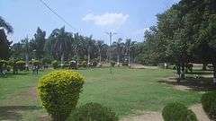
Rajgopalachari Park in Parbhani Basmath Road
See also
| Wikimedia Commons has media related to Parbhani district. |
- Parbhani (Vidhan Sabha constituency)
- Hazrat Turabul Haq Dargah
- Marathwada
- Namantar Andolan
- Mirkhel Railway Station
- Pingali Railway Station
References
- ↑ "Corporators Profile (List Of Elected Members)". Parbhani Municipal Corporation.
- ↑ "timesofindia.indiatimes.com".
- ↑ "Parbhani (Maharashtra) Assembly Constituency Elections". http://www.elections.in.
- ↑ "Parbhani Lok Sabha Elections and Results 2014". http://www.elections.in.
- ↑ https://www.maharashtra.gov.in/Site/upload/WhatsNew/Economic%20Survey%20of%20Maharashtra...pdf
- ↑ "Parbhani overview". Retrieved 22 July 2015.
- ↑ "Parbhani, India". Encyclopedia Britannica. Retrieved 19 July 2015.
- ↑ "सय्यद शाह तुराबुल हक साहेब (फोटो फिचर)" (in Marathi). Sakal. Retrieved 19 July 2015.
- ↑ "Meaning of Prabhavati". bachpan.com. Retrieved 23 July 2015.
- ↑ "Parbhani District Gazetteers chapter 1". cultural.maharashtra.gov.in. Retrieved 23 July 2015.
- ↑ "Nemgiri.org". nemgiri.org. Retrieved 2016-08-26.
- ↑ Namantar Andolan
- ↑ Mendelsohn, O., Vicziany, M., (1998). The Untouchables Subordination, Poverty and the State in Modern India, Cambridge University Press, pp 73-75
- ↑ The Untouchables: Subordination, Poverty and the State in Modern India - Oliver Mendelsohn, Marika Vicziany - Google Books. Books.google.co.in. 1998-04-30. ISBN 9780521556712. Retrieved 2015-05-29.
- ↑ Falling Rain Genomics, Inc – Parbhani
- ↑ "Parbhani Climatological Table Period: 1961–1990". India Meteorological Department. Retrieved April 10, 2015.
- ↑ "Ever recorded Maximum and minimum temperatures up to 2010". India Meteorological Department. Archived from the original on 21 May 2013. Retrieved April 10, 2015.
- ↑ "City Population Census 2011 |". Census2011.co.in. Retrieved 2015-05-29.
- ↑ "Census of India 2001: Data from the 2001 Census, including cities, villages and towns (Provisional)". Census Commission of India. Archived from the original on 2004-06-16. Retrieved 2008-11-01.
- ↑
- ↑
- ↑ http://www.hotelnirajint.com/niraj%20img/g5.jpg
- ↑ http://dcmsme.gov.in/dips/DIPS%20Parbhani.pdf
- ↑ "DMICDC". DMICDC. Retrieved 2015-05-29.
- ↑ Web Portal Link: http://www.gfpcd.org/index.html
- ↑ "Parbhani (Maharashtra) Election Results 2014, Current and Previous MLA". Elections.in. Retrieved 2015-05-29.
- ↑ "Parbhani(Maharashtra) Lok Sabha Election Results 2014 with Sitting MP and Party Name". Elections.in. Retrieved 2015-05-29.
- ↑ "Parbhani |". Minorityaffairs.gov.in. Retrieved 2015-05-29.
- ↑ http://www.icssr.org/parbhani.pdf
- ↑ Imperial Gazetteer of India, Volume 19, 410–416.
- ↑ Archived 10 February 2012 at the Wayback Machine.
External links
- http://www.census2011.co.in/census/city/358-parbhani.html
- http://mkv2.mah.nic.in/doe/maufrgen.html
- shafeen.in
- Official website of Bal Viddya Mandir Highshool,Parbhani.
Largest city: Aurangabad Second largest: Nanded | |
| List of districts of Marathwada | |
| Cities with municipal corporations | |
| Topics | |
Portal: Maharashtra | |
| Topics | |||||||||||||||||||||||
|---|---|---|---|---|---|---|---|---|---|---|---|---|---|---|---|---|---|---|---|---|---|---|---|
| Regions | |||||||||||||||||||||||
| Divisions and Districts |
| ||||||||||||||||||||||
| Million-plus cities in Maharashtra | |||||||||||||||||||||||
| Other cities with municipal corporations | |||||||||||||||||||||||
Portal: Maharashtra | |||||||||||||||||||||||
Major Villages of Parbhani district | |
|---|---|
| Parbhani |
|
| Jintur | |
| Gangakhed |
|
| Sailu | |
| Pathri |
|
| Manwath |
|
| Purna |
|
| Sonpeth |
|
| Palam |
|
| |