Panihati
| Panihati পানিহাটি | |
|---|---|
| Neighbourhood in Kolkata (Calcutta) | |
|
Barrackpore Trunk Road at Panihati | |
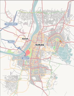 Panihati Location in Kolkata | |
| Coordinates: 22°41′N 88°22′E / 22.69°N 88.37°ECoordinates: 22°41′N 88°22′E / 22.69°N 88.37°E | |
| Country |
|
| State | West Bengal |
| City | Kolkata |
| Government | |
| • Municipality Chairman | Swapan Ghosh |
| Elevation | 13 m (43 ft) |
| Population (2001) | |
| • Total | 348,379 |
| Languages | |
| • Official | Bengali, English |
| Time zone | IST (UTC+5:30) |
| Lok Sabha constituency | Dum Dum |
| Vidhan Sabha constituency | Panihati, |

Panihati is a place in north Kolkata and a municipality under Khardaha / Ghola police stations under Barrackpur City Police of Barrackpore subdivision. in Kolkata in the Indian state of West Bengal. It is a part of the area covered by Kolkata Metropolitan Development Authority.[1]
Geography
Panihati has an average elevation of 13 metres (42 feet).
Panihati covers two important Railway stations from Sealdah north main section line - 1)Sodepur -a densely populated urban city connected to the northern side of Kolkata by Barrackpore Trunk Road and with Barasat via Sodepur Road through Madhyamgram. 2) Agarpara — which shares its borders with Kamarhati and North Dumdum Municipality. Panihati Municipality is located on BT Road, Kolkata - 700110 at the western side of Sodepur Rail station.
Demographics
As of 2001 India census,[2] Panihati had a population of 348,379. Males constitute 52% of the population and females 48%. Panihati has an average literacy rate of 82%, higher than the national average of 59.5%: male literacy is 85%, and female literacy is 79%. In Panihati, 8% of the population is under 6 years of age.
Healthcare
North 24 Parganas district (under Kolkata Metropolitan area)has been identified as one of the areas where ground water is affected by arsenic contamination.[3] The famous scientist Kishori Mohan Bandyopadhyay who had assisted Ronald Ross in his malaria research work and was awarded a Gold Medal in 1903 for his pioneering work by King Edward VII of Britain was a resident of Panihati.
References
- ↑ "Base Map of Kolkata Metropolitan area". Kolkata Metropolitan Development Authority. Retrieved 2007-09-03.
- ↑ "Census of India 2001: Data from the 2001 Census, including cities, villages and towns (Provisional)". Census Commission of India. Archived from the original on 2004-06-16. Retrieved 2008-11-01.
- ↑ "Groundwater Arsenic contamination in West Bengal-India (19 years study )". Groundwater arsenic contamination status of North 24-Parganas district, one of the nine arsenic affected districts of West Bengal-India. SOES. Retrieved 2007-08-24.
External links
 Media related to Panihati at Wikimedia Commons
 Kolkata/Northern fringes travel guide from Wikivoyage
Cities, towns and locations in North 24 Parganas district | |
|---|---|
| Cities, municipal and census towns | |
| Locations other than cities and towns | |
| Related topics |
|