Palmyra (Cooper) Airport
| Palmyra (Cooper) Airport | |||||||||||
|---|---|---|---|---|---|---|---|---|---|---|---|
 | |||||||||||
| IATA: none – ICAO: PLPA – FAA LID: P16 | |||||||||||
| Summary | |||||||||||
| Airport type | Private | ||||||||||
| Owner | The Nature Conservancy | ||||||||||
| Location | Palmyra Atoll | ||||||||||
| Built | 1939 | ||||||||||
| Time zone | Samoa Time Zone (+11) | ||||||||||
| Elevation AMSL | 5 ft / 2 m | ||||||||||
| Coordinates | 05°53′00″N 162°04′00″W / 5.88333°N 162.06667°WCoordinates: 05°53′00″N 162°04′00″W / 5.88333°N 162.06667°W | ||||||||||
| Maps | |||||||||||
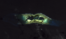 EO-1 image of Palmyra Atholl with runway at the top | |||||||||||
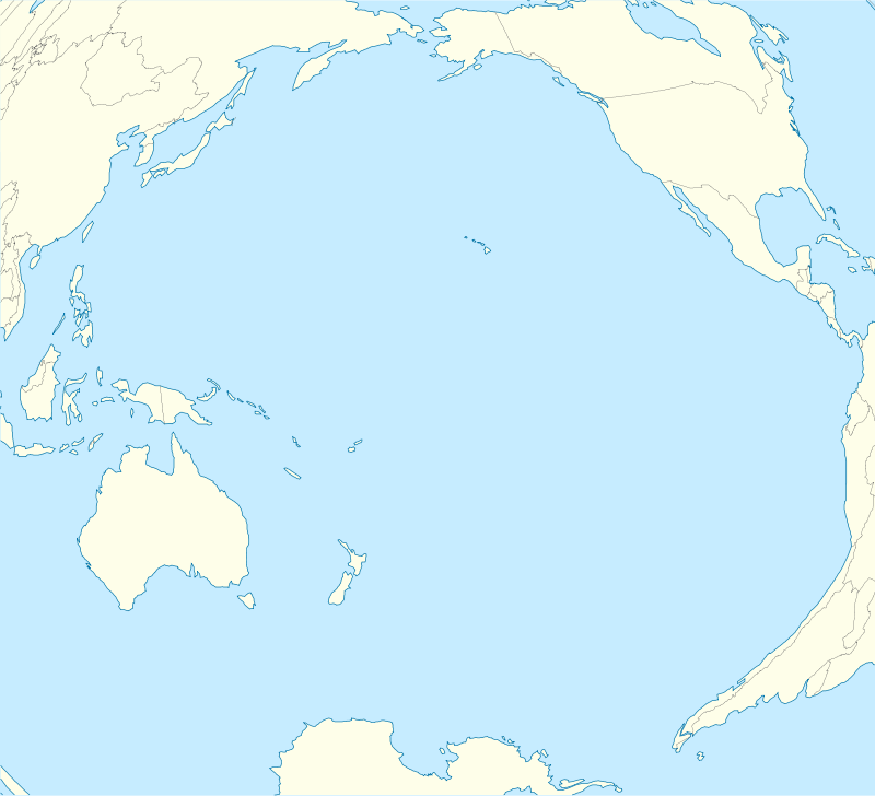 PLPA Location in the Pacific Ocean | |||||||||||
| Runways | |||||||||||
| |||||||||||
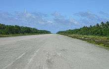
Palmyra (Cooper) Airport (ICAO: PLPA, FAA LID: P16) is an unattended airport on Palmyra Atoll in the Pacific Ocean. It is a private-use facility, originally built during World War II and now owned by The Nature Conservancy. It has one runway (6/24) measuring 5,000 ft × 150 ft (1,524 m × 46 m).[1]
The name for the airport and the island where it is located[2] comes from Henry Ernest Cooper, Sr. (1857–1929) who owned Palmyra from 1911 to 1922.[3]
History
When built the airport was called Palmyra Atoll Airfield, and later Palmyra Island Naval Air Station as it was a former Naval airfield on the Palmyra Atoll in the Line Islands of the Central Pacific Area.
Preliminary surveys were made by the U.S. Navy in 1938 for an airfield at this location. The first Navy group to begin construction sailed from Honolulu on November 14, 1939. The runway was made from crushed coral, and expanded during World War II. During the war, the U.S. Naval Construction Battalion dredged a channel during World War II so that ships could enter the protected lagoons and bulldozed coral rubble into a long, unpaved landing strip for refueling transpacific supply planes at the airbase. Jan.16, 1942 six Boeing B-17 Flying Fortress from Hawaii were stationed at airbase, Commanded by Lt Col Walter C Sweeney as part of Hawaiian Air Force's Task Group 8. Marine Corps VMF-2211 pilots also used the airfield. During World War II two other runways were built and used, one on Mengle island and one on Sand Island. Both of these runways are now overgrown with plants and returning to jungle. The U.S. Air Force maintained the main airfield until 1961.[4][5]
The airstrip still exists today but can only be used after prior permission has been obtained or in case of emergency.[6]
References
- 1 2 FAA Airport Master Record for P16 (Form 5010 PDF), effective 2007-08-30
- ↑ U.S. Geological Survey Geographic Names Information System: Cooper Island
- ↑ "Palmyra Atoll". Office of Insular Affairs web site. United States Department of Interior. Retrieved August 12, 2010.
- ↑ Maurer, Maurer, ed. (1982) [1969]. Combat Squadrons of the Air Force, World War II (PDF) (reprint ed.). Washington, DC: Office of Air Force History. ISBN 0-405-12194-6. LCCN 70605402. OCLC 72556.
- ↑ Airfields Freeman, Airfields of the Pacific
- ↑ Airnav.com - PLPA / Palmyra Atoll Airfield, page retrieved 21 November 2013.
External links
![]() This article incorporates public domain material from the Air Force Historical Research Agency website http://www.afhra.af.mil/.
This article incorporates public domain material from the Air Force Historical Research Agency website http://www.afhra.af.mil/.
Previously: Hawaiian Air Force (1940-1942) | |||||||||||||||||||||||||||||||||||
| Airfields |
| .svg.png) | |||||||||||||||||||||||||||||||||
| Units |
| ||||||||||||||||||||||||||||||||||