Palam
| Palam पालम | |
|---|---|
| Suburb | |
|
Palam Railway Station | |
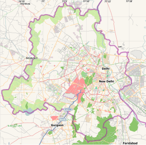 Palam Location in India | |
| Coordinates: 28°35′21″N 77°5′9″E / 28.58917°N 77.08583°ECoordinates: 28°35′21″N 77°5′9″E / 28.58917°N 77.08583°E | |
| Country |
|
| State | Delhi |
| District | South West Delhi |
| Government | |
| • Body | DDA |
| Population (2011) | |
| • Total | 200,000 - Including Village and Cooperative Housing societies |
| Languages | |
| Time zone | IST (UTC+5:30) |
| PIN | 110045 |
| Telephone code | 011 |
| Lok Sabha constituency | South Delhi |
| Vidhan Sabha constituency | Palam |
| Civic agency | DDA |

Palam is a major suburb and residential colony in South West Delhi. The Indira Gandhi International Airport, formerly known as Palam Airport, the main airport of National Capital Region is situated here.It is one of 70 Vidhan Sabha constituencies of the Delhi National Capital Territory in northern India.
History
Palam finds reference in the Persian Sarcastic verse, Sultanat-e-Shah-e-Alam, Az Dilli ta Palam,[1][2][3] meaning 'The dominion of Emperor Shah Alam, begins from Delhi and ends at Palam'. This indicates that Palam existed during the rule of Mughal Empire in India.
Geography
Palam is Situated 20 km Southwest to the New Delhi City Center.[4] It is Surrounded by Dwarka, Janakpuri and Delhi Cantt. Palam comes in the Dwarka Sub-division of South West Delhi District.[5]
Demographics
Palam is made up of an estimated five percent Jat, 15 percent Pandit, 5 percent Scheduled Caste, 40 percent Uttarakhandi, five percent Yadav, 30 percent Other Castes.
Government and politics
Palam lies in the South Delhi Lok Sabha constituency[6] from where Ramesh Bidhuri from BJP is the MP.[7] In Delhi Legislative Assembly Bhavna Gaur from AAP is the MLA from Palam. The complete Palam area consisting of wards Mahavir Enclave (147), Dabri (129), Mangla puri (130), Palam (145), Rajnagar (142) and Saad Nagar (146) comes in the Najafgarh zone of the South Delhi Municipal Corporation.[8]
Climate
Palam features an atypical version of the humid subtropical climate (Köppen Cwa). The warm season lasts from 9 April to 8 July, with an average daily high temperature above 36 °C (97 °F). The hottest day of the year is 22 May, with an average high of 38 °C (100 °F) and low of 25 °C (77 °F).[9] The cold season lasts from 11 December to 11 February with an average daily high temperature below 18 °C (64 °F). The coldest day of the year is 4 January, with an average low of 2 °C (36 °F) and high of 15 °C (59 °F).[9] In early March, the wind direction changes from north-westerly to south-westerly. From April to October the weather is hot. The monsoon arrives at the end of June, along with an increase in humidity.[10] The brief, mild winter starts in late November, peaks in January and heavy fog often occurs.[11]
Temperatures in Palam usually range from 5 to 40 °C (41.0 to 104.0 °F), with the lowest and highest temperatures ever recorded being −2.2 and 48.4 °C (28.0 and 119.1 °F) respectively.[12][13] The annual mean temperature is 25 °C (77 °F); monthly mean temperatures range from 13 to 32 °C (55 to 90 °F). The highest temperature recorded in July was 45 °C (113 °F) in 1931.[14][15] The average annual rainfall is approximately 714 mm (28.1 in), most of which falls during the monsoon in July and August.[16] The average date of the advent of monsoon winds in Palam is 29 June.[17]
| Climate data for Delhi (Safdarjung) 1971–1990 | |||||||||||||
|---|---|---|---|---|---|---|---|---|---|---|---|---|---|
| Month | Jan | Feb | Mar | Apr | May | Jun | Jul | Aug | Sep | Oct | Nov | Dec | Year |
| Record high °C (°F) | 30.0 (86) |
34.1 (93.4) |
40.6 (105.1) |
45.6 (114.1) |
47.2 (117) |
46.7 (116.1) |
45.0 (113) |
42.0 (107.6) |
40.6 (105.1) |
39.4 (102.9) |
36.1 (97) |
29.3 (84.7) |
47.2 (117) |
| Average high °C (°F) | 21.0 (69.8) |
23.5 (74.3) |
29.2 (84.6) |
36.0 (96.8) |
39.2 (102.6) |
38.8 (101.8) |
34.7 (94.5) |
33.6 (92.5) |
34.2 (93.6) |
33.0 (91.4) |
28.3 (82.9) |
22.9 (73.2) |
31.2 (88.2) |
| Daily mean °C (°F) | 14.3 (57.7) |
16.8 (62.2) |
22.3 (72.1) |
28.8 (83.8) |
32.5 (90.5) |
33.4 (92.1) |
30.8 (87.4) |
30.0 (86) |
29.5 (85.1) |
26.3 (79.3) |
20.8 (69.4) |
15.7 (60.3) |
25.1 (77.2) |
| Average low °C (°F) | 7.6 (45.7) |
10.1 (50.2) |
15.3 (59.5) |
21.6 (70.9) |
25.9 (78.6) |
27.8 (82) |
26.8 (80.2) |
26.3 (79.3) |
24.7 (76.5) |
19.6 (67.3) |
13.2 (55.8) |
8.5 (47.3) |
19.0 (66.2) |
| Record low °C (°F) | −0.6 (30.9) |
1.6 (34.9) |
4.4 (39.9) |
10.7 (51.3) |
15.2 (59.4) |
18.9 (66) |
20.3 (68.5) |
20.7 (69.3) |
17.3 (63.1) |
9.4 (48.9) |
3.9 (39) |
1.1 (34) |
−0.6 (30.9) |
| Average precipitation mm (inches) | 19 (0.75) |
20 (0.79) |
15 (0.59) |
21 (0.83) |
25 (0.98) |
70 (2.76) |
237 (9.33) |
235 (9.25) |
113 (4.45) |
17 (0.67) |
9 (0.35) |
9 (0.35) |
790 (31.1) |
| Average precipitation days (≥ 1.0 mm) | 1.7 | 2.5 | 2.5 | 2.0 | 2.8 | 5.5 | 13.0 | 12.1 | 5.7 | 1.7 | 0.6 | 1.6 | 51.7 |
| Average relative humidity (%) | 63 | 55 | 47 | 34 | 33 | 46 | 70 | 73 | 62 | 52 | 55 | 62 | 54 |
| Mean monthly sunshine hours | 214.6 | 216.1 | 239.1 | 261.0 | 263.1 | 196.5 | 165.9 | 177.0 | 219.0 | 269.3 | 247.2 | 215.8 | 2,684.6 |
| Source #1: NOAA[18] | |||||||||||||
| Source #2: Indian Meteorological Department (record high and low up to 2010)[19] | |||||||||||||
Economy
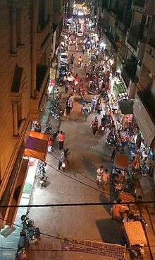
Ram Chowk is one of the primary markets in Palam, with over 1,000 shops. Many shops are on the main road, including Dada Chattri Wala Marg, Shere Punjab Dhaba, Ghar Jaisa, Footland and Swastik Creations.
Palam is divided into Rajnagar and Sadhnagar areas. Pandit Chowk, Jhanda wala Chowk and DDA park are major landmarks of Rajnagar-II. Birbal Chaat is a chaat shop in Ramphal Chowk. It is known for its Aloo Tikki, Bhalle Papri and Gol Gapee. Famous omelet shop in palam.
Culture
Palam's culture is diverse and includes many temples. The biggest and oldest is Dada Dev Mandir. It is some one thousand years old, and is situated on more than thirteen acres of land. It is the largest temple in West Delhi.
Transport

Palam has a well-established transportation infrastructure. It is well connected to other parts of Delhi by Roads. Palam is connected to other States by air, rail and road.
Road
Buses are primarily operated by the DTC and DIMTS; although private operators assist in connecting Delhi and the North Capital Region (NCR). A privately operated network of chartered buses connects Palam areas to corporate offices nearby and in the National Capital Territory.
The Ministry of Transport took over the local bus services of Delhi in May 1948 and renamed it Delhi Transport. Delhi Road Transport Authority was constituted under the Road Transport Corporation Act, 1950. This Authority became the undertaking of Municipal Corporation of Delhi in April, 1958.[20]
Delhi Metro
Palam Metro Station will be Served by Magenta Line of Delhi Metro that will directly connect it to Janakpuri and Botanical Garden.[21] Palam's underground Metro station near the Palam Police Station is in its third building phase.[22] It is expected to be completed in 2016.
Rail Network
Palam railway station has connections to Rewari, Delhi Cantonment and New Delhi.[23] Porbandar, Motihari & Delhi Sarai Rohilla Trains Pass through Palam Railway Station.
Airways
Indira Gandhi International Airport, formerly "Palam Airport", is Situated in Palam.
Education
Palam has a large number of Schools and Educational Centers. Most of the Private and Government schools are affiliated to CBSE.
Schools:
- Deep Parmarth Secondary School
- Delhi Jain Public School
- Sir chhotu ram public school
- Sarvodaya Bal Vidyalaya No 2
- Sarvodaya kanya Vidyalaya No 1
- Shiv Vani Model Senior Secondary
- Kennedy Public School
- Prakash public school
Coaching Centers:
- Pioneer Coaching Centre
- Arihant
- Kataria Coaching
- Om Sai Ram Institute
- Sunrise
- Patron Academy For Competitive Exams
- COC Institute
- Jupiter Coaching center
- Aryavarta institute
- Kaushik Tution Center
Health care
Palam's public health services network includes Bhagat Chandra, Divya Prastha, Singhal (Multispecialty) hospitals,[24] the Gagan Child Care Centre,[25] Maharaja Agrasen Hospital, Mangla Puri Central Government Health Scheme (CGHS) dispensary,[26][27] a Primary Health Centre (PHC),[28] pathology labs and the Sanjay Nursing Home.
References
- ↑ Sharp, Sir Henry. Delhi: its story and buildings. H. Milford. Retrieved 6 July 2016.
- ↑ Fanshawe, H. C. Delhi, Past and Present. Asian Educational Services. ISBN 9788120613188. Retrieved 6 July 2016.
- ↑ "The tale of Dhaula Kuan". Deccan Herald. Retrieved 6 July 2016.
- ↑ "Distance between Palam and Connaught Place". alldistancebetween.com. Retrieved 1 July 2016.
- ↑ "South West District". www.delhi.gov.in. Retrieved 1 July 2016.
- ↑ "List of Parliamentary & Assembly Constituencies, General Election to the Lok Sabha, 2004" (PDF). Retrieved 6 July 2016.
- ↑ "Ramesh Bidhuri wins: margin 1.07 lakh votes". The Hindu. 17 May 2014. Retrieved 1 July 2016.
- ↑ "South Delhi Municipal Corporation". mcdonline.gov.in. Retrieved 1 July 2016.
- 1 2 "Average weather for New Delhi, India". http://weatherspark.com. Retrieved 2 July 2013. External link in
|publisher=(help) - ↑ "Climate of Delhi". http://delhitrip.in. Retrieved 17 May 2012. External link in
|publisher=(help) - ↑ "Fog continues to disrupt flights, trains". The Hindu. Chennai, India. 7 January 2005.
- ↑ "Palam records highest temperature of season". Deccan Herald. Retrieved 21 September 2016.
- ↑ "Ever recorded Maximum and minimum temperatures up to 2010" (PDF). India Meteorological Department. Retrieved 11 June 2016.
- ↑ "Mercury touches new high for July, Met predicts rain relief". 3 July 2012.
- ↑ "Weatherbase entry for Delhi". Canty and Associates LLC. Retrieved 16 January 2007.
- ↑
- ↑ Kurian, Vinson (28 June 2005). "Monsoon reaches Delhi two days ahead of schedule". The Hindu Business Line. Retrieved 9 January 2007.
- ↑ "New Delhi (SFD) 1971-1990". National Oceanic and Atmospheric Administration. Retrieved June 6, 2015.
- ↑ "Ever recorded Maximum and minimum temperatures up to 2010" (PDF). Indian Meteorological Department. Retrieved June 6, 2015.
- ↑ "Delhi Transport Corporation". www.delhi.gov.in. Retrieved 1 July 2016.
- ↑ delhi metro rail Phase-III (PDF). Retrieved 1 July 2016.
- ↑ "Delhi Metro Commences Tunneling at Palam on the Janakpuri west- Botanical garden corridor of Phase 3". www.delhimetrorail.com. Retrieved 1 July 2016.
- ↑ "PM/Palam (3 PFs) Railway Station - Train Departure Timings - India Rail Info". India Rail Info. Retrieved 1 July 2016.
- ↑ "Singhal Hospital". www.justdial.com/. Justdial.com. Retrieved 29 November 2014.
- ↑ "Gagan Child Care Centre". plus.google.com/. Google+. Retrieved 30 November 2014.
- ↑ "CGHS Wellness Centres and Dispensaries in Delhi". www.gconnect.in/. GConnect.in - Central Government Employees News Portal. Retrieved 29 November 2014.
- ↑ "Parliament Constituency Wise Health Facilities" (PDF). delhi.gov.in. Government of the National Capital Territory (NCT) of Delhi. Retrieved 29 November 2014.
- ↑ "Parliament Constituency Wise Health Facilities" (PDF). delhi.gov.in. Government of the National Capital Territory (NCT) of Delhi. Retrieved 29 November 2014.