Pahala, Hawaii
| Pahala, Hawaii | |
|---|---|
| Census-designated place | |
|
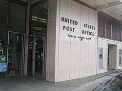
U.S. Post office in Pahala | |
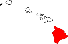
 Location in Hawaii County and the state of Hawaii | |
| Country | United States |
| State | Hawaii |
| Counties | Hawaii |
| Area | |
| • Total | 0.8 sq mi (2.2 km2) |
| • Land | 0.8 sq mi (2.2 km2) |
| • Water | 0 sq mi (0 km2) |
| Population (2010) | |
| • Total | 1,356 |
| • Density | 1,695.0/sq mi (616.3/km2) |
Pahala (Hawaiian: Pāhala[1]) is a census-designated place (CDP) in Hawaii County, Hawaii, United States. The population was 1,378 at the 2000 census.
Geography
Pahala is located at 19°12′15″N 155°28′44″W / 19.204109°N 155.479005°WCoordinates: 19°12′15″N 155°28′44″W / 19.204109°N 155.479005°W.[2]
According to the United States Census Bureau, the CDP has a total area of 0.8 square miles (2.1 km2), all of it land.
Climate
| Climate data for Pahala | |||||||||||||
|---|---|---|---|---|---|---|---|---|---|---|---|---|---|
| Month | Jan | Feb | Mar | Apr | May | Jun | Jul | Aug | Sep | Oct | Nov | Dec | Year |
| Record high °F (°C) | 93 (34) |
90 (32) |
93 (34) |
100 (38) |
93 (34) |
89 (32) |
92 (33) |
92 (33) |
90 (32) |
90 (32) |
90 (32) |
91 (33) |
100 (38) |
| Average high °F (°C) | 78 (26) |
78 (26) |
78 (26) |
78 (26) |
79 (26) |
80 (27) |
81 (27) |
82 (28) |
82 (28) |
81 (27) |
80 (27) |
78 (26) |
79.6 (26.7) |
| Average low °F (°C) | 63 (17) |
62 (17) |
63 (17) |
64 (18) |
65 (18) |
67 (19) |
67 (19) |
68 (20) |
68 (20) |
67 (19) |
66 (19) |
67 (19) |
65.6 (18.5) |
| Record low °F (°C) | 50 (10) |
52 (11) |
50 (10) |
50 (10) |
51 (11) |
54 (12) |
52 (11) |
59 (15) |
56 (13) |
58 (14) |
55 (13) |
48 (9) |
48 (9) |
| Average precipitation inches (mm) | 5.37 (136.4) |
4.22 (107.2) |
4.11 (104.4) |
3.19 (81) |
2.38 (60.5) |
1.87 (47.5) |
3.57 (90.7) |
3.28 (83.3) |
4.04 (102.6) |
4.67 (118.6) |
6.53 (165.9) |
5.64 (143.3) |
48.87 (1,241.4) |
| Average precipitation days | 12 | 11 | 13 | 12 | 10 | 7 | 7 | 8 | 9 | 11 | 11 | 11 | 122 |
History
Pahala was created by a sugarcane plantation. The area selected to house the sugar refinery had several key features:
- a flat plateau on a sloping mountainous region.
- direct access to a water well
- a strategic central location to sugarcane fields.
In Hawaiian, Pāhala refers to the ashes of leaves from the hala tree (Pandanus tectorius). Long ago, when cracks were found in the sugarcane fields, workers would stuff them with hala leaves and burn them.
For years, Pahala consisted of a managers house, several plantation homes, a general store and the sugar refinery. Many of the sugarcane workers were housed in small camps in and around Pahala and in camps situated throughout the outer lying sugarcane fields. Many of these camps were self-sufficient. They consisted of 8 to 12 plantation dwellings with a small store. Some camps had specialty shops such as a blacksmith or a simple barbershop. As time passed some installed gas stations.
In 1881, the first public school in the district of Kaʻu was established in Kapapala. The humble campus consisted of just two buildings. Some years later the school and its two buildings were relocated to Pahala and called Pahala High and Elementary School. In 1959, as Hawaii Territory became the State of Hawaii, the last class of the Pahala High School held commencement ceremonies. The school then became Kaʻu High and Pahala Elementary School. Kaʻu High and Pahala Elementary School is the second oldest public school in the state of Hawaii, behind Lahainaluna School in Lahaina. Still in use today at Kaʻu High is Kapono Building, the oldest public school building west of the Rocky Mountains. The only other public school in the district of Kaʻu is Naʻalehu Elementary. Naʻalehu once had a high school. Today, students attend grades Kindergarten through 6th grade in Naʻalehu.
As time progressed, Pahala became the focal town of the northeastern side of the district of Kaʻu; Naʻalehu became the other focal town to the south of the district. Businesses from outer camps migrated to Pahala to set up shop. With social and economic changes came the demands for convenience. Soon, more stores opened up. A bank and gas stations were built. For leisure, a town hall or "Club House" was built and used by the plantation and the community to hold meetings and parties. In the early 1940s Pahala Theatre was built.
By the early 1960s, C. Brewer & Co. had decided to phase out all of the camps and move homes and other structures to Pahala. At this time C Brewer explored other alternatives to diversify into, eventually settling on macadamia nuts. Considered a weed in their native Australia, macadamia trees flourished into a new niche market for Hawaii.
The early 1970s demonstrated how influential the world's economy can be to Pahala. The 1970s brought about fuel shortages and developing nations began to produce cheaper sugar. It was during the 1970s C Brewer was proposed the perfect opportunity to diversify. A gentleman by the name of Bob Shleser had proposed to Doc Buyers (then CEO of C Brewer) the idea and technology to convert the Pahala Sugar Mill to produce ethanol fuel from sugarcane. Bob also proposed the idea that the city and County of Hawaii pass a bill that would require 25% of all vehicles on the island would be retrofitted to use ethanol by the year 1985. This proposal would have been monumental had it been carried out. For whatever reason, Doc Buyers let his short sightedness get the best of him and at the last minute got cold feet and decided against it.
By the late 1970s with sugar's looming demise C Brewer instead decided to expand its macadamia nut operations. They began to phase out sugarcane fields that encircled Pahala, converting them to grow macadamia nuts.
By the mid 1980s it was apparent sugar had seen its heyday. Honuapo's mill had long closed in 1972 and its workers transferred to Pahala. But other sugarcane plantations around the island began to close as well. Still, the Pahala Sugar Mill continued to produce record tons per acre, but at a steep price. At the time it cost $1.50 to produce 1 lb (0.45 kg), which would then sell for $0.60. Congress had proposed bills that placed huge tariffs and taxes on imported sugar. But economically, even those measures could not stave off the inevitable.
In the 1990s, it was all too evident that sugarcane had lost its lustre. C Brewers' investors were getting older and demanded Doc Buyers cut their losses and liquidate. In 1994, Doc made a last-ditch effort to keep the mill running. But it required all workers to take drastic pay cuts; most would have to accept minimum wage. The workers refused. That sealed the faith of sugar legacy in Pahala. The last sugarcane was hauled and processed at the mill. Over the next 2 years the mill was dismantled and sold as parts to other manufacturing plants around the world. The sugarcane plantation and mill shut down in April, 1996.
Many who lived and worked in Pahala moved on to other jobs around the island. Some took jobs in the hotel industry. Some commute up to 5 hours a day to and from jobs at resorts along the Kohala coast. Some moved to Maui and Kauaʻi and worked at sugarcane plantations there. Others moved to the mainland to try a fresh start. Many old timers that have generations of family ties to Pahala had passed on. Many in the younger generation have chosen not to return.
Still, there are those that have remained. There are those that have found their roots and figured out a way to remain in Pahala. In fact, unlike many other places where the larger plantation homes were purchased by outsiders coming to live in Hawaiʻi, the manager homes in Pahala were mostly purchased by local people who have stepped up to the new economy and have such jobs as doctor, bakery manager, fisherman, policeman, painting contractor and other jobs important to the community. Some new people have also moved in, restored the historic homes and established their roots and now call Pahala home.
There has also been a movement to preserve the shoreline near Pahala, called the Kaʻu Coast, which is known to be the longest uninhabited coast in Hawaii. Its 80 miles (130 km) now includes 235 acres (0.95 km2) of ocean front park for which the community raised more than $4 million to purchase and set aside forever. Another 750 acres (3.0 km2) along the coast called Kawa is likely to be preserved. Inland, more than 115,000 acres (470 km2) have been added to Hawaii Volcanoes National Park, which now circles Pahala in the mountains above the village.
Economy
Pahala's main industries include one of the world's largest macadamia nut growing orchards, cattle and horse ranching, small independent Ka`u Coffee farms and Ka`u Coffee Mill & Visitor Center. Kaʻu Coffee has gained a reputation winning many international coffee tasting competitions.
A former sugar plantation town, Pahala is the district hub for education and health services, including a pharmacy, hospital, clinic, preschool and public school as well as a library.
Plantation houses, from small cottages to large homes and the former plantation manager's manor, have been restored around the village servicing local families and visitors to Hawai`i Volcanoes National Park and Punalu`u Black Sand Beach. The village has a post office, swimming pool, two food stores, fire station and gas station. Fisherman sell their catch and farmers sell their produce on the roadside in the village. There is a Catholic, Assembly of God, and Baptist church, as well as a Buddhist Hoangwanji and a Tibetan Buddhist temple up the mountain in Wood Valley.
The Ka'u District's regional newspaper – the Ka`u Calendar – with offices in Pahala, is online daily and printed monthly.
Pahala hosts the annual Ka`u Coffee Festival and Ka`u Coffee Trail Run, Science Camps of America for teenagers each summer and many family reunions and weddings, as well as NGO, company, music and dance retreats.
Demographics
As of the census[3] of 2000, there were 1,378 people, 443 households, and 334 families residing in the CDP. The population density was 1,635.9 people per square mile (633.4/km²). There were 487 housing units at an average density of 578.1 per square mile (223.8/km²). The racial makeup of the CDP was 8.78% White, 0.07% Native American, 47.68% Asian, 10.45% Pacific Islander, 0.51% from other races, and 32.51% from two or more races. Hispanic or Latino of any race were 6.31% of the population.
There were 443 households out of which 33.4% had children under the age of 18 living with them, 55.5% were married couples living together, 12.0% had a female householder with no husband present, and 24.6% were non-families. 21.2% of all households were made up of individuals and 12.2% had someone living alone who was 65 years of age or older. The average household size was 3.08 and the average family size was 3.51.
In the CDP the population was spread out with 27.3% under the age of 18, 9.5% from 18 to 24, 21.0% from 25 to 44, 23.3% from 45 to 64, and 18.9% who were 65 years of age or older. The median age was 40 years. For every 100 females there were 100.0 males. For every 100 females age 18 and over, there were 97.6 males.
The median income for a household in the CDP was $30,243, and the median income for a family was $31,548. Males had a median income of $25,375 versus $21,023 for females. The per capita income for the CDP was $11,450. About 17.9% of families and 24.2% of the population were below the poverty line, including 32.8% of those under age 18 and 12.8% of those age 65 or over.
See also
- ↑ Soehren, Lloyd. "Hawaiian Place Names – Pahala". Hawaiian Place Names. Ulukau. Retrieved 2009-05-04.
- ↑ "US Gazetteer files: 2010, 2000, and 1990". United States Census Bureau. 2011-02-12. Retrieved 2011-04-23.
- ↑ "American FactFinder". United States Census Bureau. Retrieved 2008-01-31.
http://pahalaplantationcottages.com/hawaii/Welcome.html https://kaucoffeemill.com/ http://royalhawaiianorchards.com/ http://kaucoffeefestival.com/