Pacitan Regency
| Pacitan Regency Kabupaten Pacitan | |
|---|---|
| Regency | |
| Motto: Tata Pramana Hargeng Praja | |
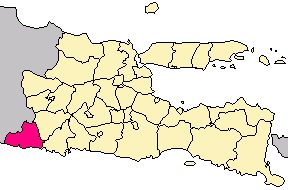 Location in East Java | |
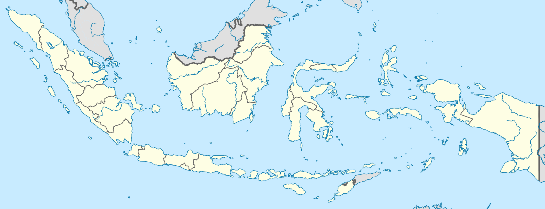 Pacitan Regency Location in Indonesia | |
| Coordinates: 8°12′S 111°7′E / 8.200°S 111.117°E | |
| Country |
|
| Province | East Java |
| Area | |
| • Total | 1,389.87 km2 (536.63 sq mi) |
| Population (2003) | |
| • Total | 538,000 |
| • Density | 390/km2 (1,000/sq mi) |
| Website | www.pacitankab.go.id |
Pacitan (Indonesian: Kabupaten Pacitan) is a regency located in the southwestern East Java Province, with Central Java Province on its west border. Located between 7.55° - 8.17°S and 110.55° - 111.25°E. The borders of Pacitan Regency are: Wonogiri Regency (Central Java) in the west, Ponorogo Regency and Wonogiri Regency in the north, Trenggalek Regency in the east, and Indian Ocean in the south. The capital of Pacitan Regency is Pacitan city. The majority of citizens in Pacitan speak Javanese as their first language, while speaking Indonesian as a second language.
Geography

The area of Pacitan Regency is about 1,342.42 km². Most of it is mountainous and rocky, also having a few rocky canyons. That sort of geography covers about 88% of the regency, and this is because Pacitan is located in the Thousand Mountains. The highest mountain in Pacitan is Mount Lima in Kebonagung, and Mount Gembes in Bandar as the spring of Grindulu River.
Comparison of land types:
- Flat (0 - 5% slope) = 53.7 km² (4%)
- Bumpy (6 - 10% slope) = 134.24 km² (10%)
- Wavy (11 - 30% slope) = 322.18 km² (24%)
- Hilly (31 - 50% slope) = 698.06 km² (52%)
- Mountainous (more than 51% slope) = 134.24 km² (10%)
Generally, the land in Pacitan can be divided into two categories, calcium rich in the south, and fertile land in the north. The land consists of lithosal association, red mediterranean lithosal, tuf and volcanic compound, reddish lithosal complex, and grey alluvial, clay sediments containing many potential minerals. The minerals are feldspar, ball clay, bentonite, pyrophyllite, calcite, gypsum, phosphate rock, quartz, coal, dolomite, gemstone, tin ore, and manganite.
Pacitan Regency consists 130.87 km² of rice fields and 1,211.55 km² of dry land. According irrigation type the rice fields can be grouped into: technical irrigation rice field (16.06 km²), half technical irrigation rice field (11.88 km²), simple irrigation rice field (40.63 km²), and rain-dependent rice field (62.3 km²).
Administrative divisions
Pacitan Regency is divided into twelve districts (kecamatan):
- Pacitan
- Kebonagung
- Arjosari
- Tulakan
- Ngadirojo
- Punung
- Pringkuku
- Donorojo
- Nawangan
- Tegalombo
- Sudimoro
- Bandar
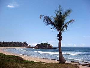
Surfer beaches
Pacitan Regency has 17 beaches, in the west of Pacitan City: Banyu Tibo, Buyutan, Karang Bolong, Srau, Klayar, and Watu Karung, near Pacitan City: Pantai Teleng Ria, Tamperan Gung, Kali Uluh, and Wawaran, in the east of Pacitan City: Pidakan, Soge, Tawang, Taman, and Kunir. All beaches are near 70 kilometers of South Coast Road from Wonogiri Regency to Trenggalek Regency. Soge Beach can be accessed in 30 minutes drive or by bus public transport from Pacitan City, but all beaches are relatively far from big cities as Surabaya (7 hours) and Surakarta (4 hours).[1]
Some of the beaches are recognized as great beaches for surfing. Although still relatively unknown among the international surfing world, a consistent stream of surfers from around the world enjoy its beaches. Among many beautiful beaches in Pacitan Regency, these four beaches are ideal for surfing:[2]
- Teleng Ria Beach, ideal for beginners, suitable months are November to February
- Pancer Beach, ideal for beginners, suitable months are May to October
- Srau Beach, rocky beach, suitable months are November to February
- Watu Karung Beach, rocky beach, suitable months are April to October
- Klesem Beach, a shallow right hander breaking over reef, suitable months are April to October
Notable people
Pacitan is also the birthplace of the former army general and the former and first directly elected President, Susilo Bambang Yudhoyono.
References
- ↑ I Made Asdhiana. "Pantai Soge, Keindahan Pesisir Pacitan". Retrieved November 29, 2014.
- ↑ "Kiat Berselancar di Pacitan". May 8, 2012.