Périgueux Bassillac Airport
| Périgueux - Bassillac Airport Aéroport de Bassillac - Périgueux | |||||||||||||||
|---|---|---|---|---|---|---|---|---|---|---|---|---|---|---|---|
 | |||||||||||||||
| IATA: PGX – ICAO: LFBX | |||||||||||||||
| Summary | |||||||||||||||
| Airport type | Public | ||||||||||||||
| Operator | Mairie de Périgueux | ||||||||||||||
| Serves | Périgueux, France | ||||||||||||||
| Location | Bassillac, France | ||||||||||||||
| Elevation AMSL | 328 ft / 100 m | ||||||||||||||
| Coordinates | 45°11′51″N 000°48′55″E / 45.19750°N 0.81528°E | ||||||||||||||
| Website | aeroport-perigueux.com | ||||||||||||||
| Maps | |||||||||||||||
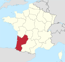 Location of Aquitaine region in France | |||||||||||||||
 LFBX Location of airport in Aquitaine region | |||||||||||||||
| Runways | |||||||||||||||
| |||||||||||||||
|
Source: French AIP[1] | |||||||||||||||
Périgueux - Bassillac Airport (French: Aéroport de Bassillac - Périgueux) (IATA: PGX, ICAO: LFBX) is an airport in the village of Bassillac in the Dordogne department, Aquitaine region, France. It is located 8 kilometres (4.3 NM) east-northeast of the town of Périgueux,[1] which manages the airport.
Facilities
The airport resides at an elevation of 328 feet (100 m) above mean sea level. It has one paved runway designated 11/29 which measures 1,750 by 30 metres (5,741 ft × 98 ft). It also has a parallel unpaved runway with a grass surface measuring 845 by 80 metres (2,772 ft × 262 ft).[1]
Airlines and destinations
| Airlines | Destinations |
|---|---|
| Twin Jet | Paris-Orly |
List of the users based at the airport
- ASSAP - Périgueux Aéroclub (Piloting Lesson)[2]
- GenAIRation Antonov Association (Antonov An-2 exploitation)[3]
- CVVP - parachuting center Périgord[4]
- Périgord Air Job
References
- 1 2 3 LFBX – Périgueux Bassillac. AIP from French Service d'information aéronautique, effective 8 December 2016.
- ↑ Official Website Périgueux Aéroclub
- ↑ Association GenAIRation Antonov Website
- ↑ Site du Centre de vol à voile du Périgord
External links
- Aéroport de Bassillac - Périgueux, official website
- Accident history for PGX at Aviation Safety Network
- Airport information for LFBX at Great Circle Mapper.
- Airport information for LFBX at World Aero Data. Data current as of October 2006.
This article is issued from Wikipedia - version of the 2/11/2016. The text is available under the Creative Commons Attribution/Share Alike but additional terms may apply for the media files.