Oxford, Michigan
| Oxford | |
|---|---|
| Village | |
 | |
| Motto: Our past guides our vision for the future. | |
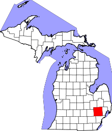
 Location of Oxford, Michigan | |
| Coordinates: 42°49′29″N 83°15′53″W / 42.82472°N 83.26472°WCoordinates: 42°49′29″N 83°15′53″W / 42.82472°N 83.26472°W | |
| Country | United States |
| State | Michigan |
| County | Oakland |
| Incorporated | January 13, 1876 (by County Board of Supervisors)[1] |
| Reincorporated | 1891 (by act of the Legislature)[1] |
| Government | |
| • Manager | Joseph Young |
| Area[2] | |
| • Total | 1.47 sq mi (3.81 km2) |
| • Land | 1.25 sq mi (3.24 km2) |
| • Water | 0.22 sq mi (0.57 km2) 14.97% |
| Elevation | 1,056 ft (322 m) |
| Population (2010)[3] | |
| • Total | 3,436 |
| • Estimate (2012[4]) | 3,466 |
| • Density | 2,748.8/sq mi (1,061.3/km2) |
| Time zone | EST (UTC-5) |
| • Summer (DST) | EDT (UTC-4) |
| ZIP code | 48371 |
| Area code(s) | 248, 810 |
| FIPS code | 26-62020[5] |
| GNIS feature ID | 0634267[6] |
| Website | www.villageofoxford.org |
Oxford is a village in Oakland County in the U.S. state of Michigan. It is located among metropolitan Detroit's affluent northern suburbs. The population was 3,436 at the 2010 census.[7] The village is entirely within Oxford Charter Township. The village occupies one square mile and is both politically and geographically a part of the township. The village calls itself sister city to Oxford, England. Oxford is located roughly 30 miles (48 km) from Flint and 40 miles (64 km) from Detroit.
Culture of Oxford


The village center consists of shops, restaurants, and taverns stretching for two blocks. Local happenings such as athletic events, downtown fairs, scarecrow competitions, school plays, the annual Steamback golf outing at Oxford Hills and concerts garner a large turnout throughout the year and are reported in the weekly newspaper of record since 1898, The Oxford Leader.
The area's public high school, Oxford High School, was newly expanded in 2003-2004 and now holds the title of the largest single-floor high school in the state of Michigan.
Notable people
- Brace Beemer, Radio Actor who played the Lone Ranger on radio from 1941-1953, retired and raised thoroughbred horses on his 300-acre ranch Paint Creek Acres, until his death in 1965.
- Nathan Gerbe, NHL player was born in Oxford and currently plays for the New York Rangers.
- Eric Ghiaciuc, NFL player for the New England Patriots, was born in Oxford on May 28, 1981.
- Mike Lantry, NFL player, (University of Michigan / Dallas Cowboys)
- Chris Gambol NFL player, (University of Iowa / Indianapolis Colts)
- Dave Rayner NFL player, (Michigan State University / Indianapolis Colts)
- Jim Bates (1964), NFL coach, form the University of Tennessee has been a long time NFL defensive coach (Packers, Broncos, Dolphins and Bucs) as well as being Miami's head coach for 8 games in 2004.
- Zach Line, NFL player, played college football for Southern Methodist University, and is currently on the Minnesota Vikings roster as a fullback.[8]
- William R. Reed, commissioner of the Big Ten Conference from 1961-71, was born in Oxford.
- Albert J. Campbell, United States Representative from Montana, lived in Oxford[9]
- Ralph Gilles, an automotive designer currently serving as the President and CEO of the SRT Brand and Senior Vice President of Design at Chrysler Group LLC.[10]
Geography
According to the United States Census Bureau, the village has a total area of 1.47 square miles (3.81 km2), of which 1.25 square miles (3.24 km2) is land and 0.22 square miles (0.57 km2) is water.[2]
Demographics
| Historical population | |||
|---|---|---|---|
| Census | Pop. | %± | |
| 1880 | 851 | — | |
| 1890 | 1,128 | 32.5% | |
| 1900 | 1,172 | 3.9% | |
| 1910 | 1,191 | 1.6% | |
| 1920 | 1,668 | 40.1% | |
| 1930 | 2,052 | 23.0% | |
| 1940 | 2,144 | 4.5% | |
| 1950 | 2,305 | 7.5% | |
| 1960 | 2,357 | 2.3% | |
| 1970 | 2,536 | 7.6% | |
| 1980 | 2,746 | 8.3% | |
| 1990 | 2,929 | 6.7% | |
| 2000 | 3,540 | 20.9% | |
| 2010 | 3,436 | −2.9% | |
| Est. 2015 | 3,534 | [11] | 2.9% |

2010 census
As of the census[3] of 2010, there were 3,436 people, 1,335 households, and 889 families residing in the village. The population density was 2,748.8 inhabitants per square mile (1,061.3/km2). There were 1,468 housing units at an average density of 1,174.4 per square mile (453.4/km2). The racial makeup of the village was 95.1% White, 1.9% African American, 0.2% Native American, 0.7% Asian, 0.7% from other races, and 1.3% from two or more races. Hispanic or Latino of any race were 4.4% of the population.
There were 1,335 households of which 33.0% had children under the age of 18 living with them, 51.5% were married couples living together, 10.6% had a female householder with no husband present, 4.6% had a male householder with no wife present, and 33.4% were non-families. 29.1% of all households were made up of individuals and 6.6% had someone living alone who was 65 years of age or older. The average household size was 2.49 and the average family size was 3.09.
The median age in the village was 38.5 years. 25% of residents were under the age of 18; 8.4% were between the ages of 18 and 24; 27.5% were from 25 to 44; 28.9% were from 45 to 64; and 10.2% were 65 years of age or older. The gender makeup of the village was 49.3% male and 50.7% female.
2000 census
As of the census[5] of 2000, there were 3,540 people, 1,402 households, and 918 families residing in the village. The population density was 2,873.5 per square mile (1,111.2/km²). There were 1,476 housing units at an average density of 1,198.1 per square mile (463.3/km²). The racial makeup of the village was 97.23% White, 0.59% African American, 0.28% Native American, 0.51% Asian, 0.31% from other races, and 1.05% from two or more races. Hispanic or Latino of any race were 2.66% of the population.
There were 1,402 households out of which 35.6% had children under the age of 18 living with them, 53.4% were married couples living together, 9.4% had a female householder with no husband present, and 34.5% were non-families. 29.6% of all households were made up of individuals and 7.2% had someone living alone who was 65 years of age or older. The average household size was 2.51 and the average family size was 3.15.
In the village the population was spread out with 28.2% under the age of 18, 8.1% from 18 to 24, 34.4% from 25 to 44, 21.2% from 45 to 64, and 8.2% who were 65 years of age or older. The median age was 34 years. For every 100 females there were 96.6 males. For every 100 females age 18 and over, there were 93.7 males.
The median income for a household in the village was $53,885, and the median income for a family was $72,875. Males had a median income of $50,179 versus $29,938 for females. The per capita income for the village was $24,811. About 3.0% of families and 5.3% of the population were below the poverty line, including 6.1% of those under age 18 and 10.5% of those age 65 or over.
History
During the early 19th century the northeast Oakland County area was largely avoided by the early settlers because it was believed to be nothing but impenetrable swamp land. The area was, at that time, nicknamed "The Barren Plains of Oxford." It was called this primarily because of a report made in 1812 by the U.S. Surveyor General that described the area as a poor, barren, sandy land, on which scarcely any vegetation could grow with the exception of some very small scrubby oaks. It was concluded in the surveyors' report that there was one acre out of one hundred that appeared to be eligible for cultivation. Any hope for crop production was thought to be preposterous. At this point, the area was deemed worthless, and discouragement of any hope for development by forthcoming settlers was inevitable.

Purchase of public land in what is now called Oxford was in 1823 by a man named Elbridge G. Deming. Soon after, the first person to settle in Oxford was a wolf trapper named Avery Brown. He made use of the land and gave some credibility to its value. It wasn't long after that the first area post office was officially established in what was then known as Demingsburgh on May 2, 1834. Five years later, the name was officially changed to Oxford on January 15, 1839. Elbridge D. Deming was the first postmaster for Oxford, as the post office was located in his log home near the intersection of M-24 and Metamora Road. At that time, the mail was brought from Rochester once a week by a man named Mr. Hubbard who walked the distance to ensure, what was at that time, considered as prompt delivery of the mail. A few years later the delivery time was drastically cut by another man named Mr. Rose. The route was given to him as he would use his horse and cart instead of walking like his predecessor, thus expediting the delivery time tenfold.
Schools

The village of Oxford is home to the school district of Oxford Community Schools. The district has nine schools which include:
- Two high schools (Oxford High School and Oxford Bridges High School )
- One middle school (Oxford Middle School)
- Five elementary schools (Clear Lake, Daniel Axford, Lakeville, Leonard, and Oxford Elementary). All five elementary schools earned an A on their EducationYes! Report cards for the 2010-2011 school year.
- One adjudicated youth school (Crossroads for Youth)
The primary mascot for Oxford Schools is the Wildcat. Both the high school and the middle school have sports teams which are referred to as Oxford Wildcats. The Oxford Wildcat logo is visible around the town, prominently on one of the three water towers.
In 2009 and in 2010, Oxford Community Schools was featured as one of the "Best Schools In Michigan". Two of the elementary schools Leonard Elementary and Lakeville Elementary both won Michigan Blue Ribbon Awards, making all Oxford elementary schools Michigan Blue Ribbon Schools. In the 2010-2011 year, Oxford High School moved from the Flint Metro League to the Oakland Activities Association.

References
- 1 2 Seeley, Thaddeus. History of Oakland County Michigan. The Lewis Publishing Company, 1912, p 421. Google Book Search. Retrieved on November 18, 2010.
- 1 2 "US Gazetteer files 2010". United States Census Bureau. Retrieved 2012-11-25.
- 1 2 "American FactFinder". United States Census Bureau. Retrieved 2012-11-25.
- ↑ "Population Estimates". United States Census Bureau. Retrieved 2013-06-03.
- 1 2 "American FactFinder". United States Census Bureau. Retrieved 2008-01-31.
- ↑ U.S. Geological Survey Geographic Names Information System: Oxford, Michigan
- ↑ "Race, Hispanic or Latino, Age, and Housing Occupancy: 2010 Census Redistricting Data (Public Law 94-171) Summary File (QT-PL), Oxford village, Michigan". U.S. Census Bureau, American FactFinder 2. Retrieved August 19, 2011.
- ↑ Minnesota Vikings http://www.vikings.com/team/roster/zach-line/6cdafdbd-6e1f-4dc0-8c48-39c26326dab2/. Retrieved 4 December 2014. Missing or empty
|title=(help) - ↑ "CAMPBELL, Albert James, (1857 - 1907)". Biographical Directory of the United States Congress. Retrieved October 14, 2012.
- ↑ http://www.automationalley.com/a2_nws_eventinfo?id=a086000000HU8PjAAL
- ↑ "Annual Estimates of the Resident Population for Incorporated Places: April 1, 2010 to July 1, 2015". Retrieved July 2, 2016.
- ↑ "Census of Population and Housing". Census.gov. Retrieved June 4, 2015.
External links
Municipalities and communities of Oakland County, Michigan, United States | ||
|---|---|---|
| Cities |
|  |
| Villages | ||
| Charter townships | ||
| General law townships | ||
| Unincorporated communities |
| |
| Footnotes | ‡This populated place also has portions in an adjacent county or counties | |
| Topics |  | |
|---|---|---|
| Detroit | ||
| Municipalities over 80,000 | ||
| Municipalities 40,000 to 80,000 | ||
| Cultural enclaves | ||
| Satellite cities | ||
| Counties in MSA | ||
| Counties in CSA | ||