Owen Ridge
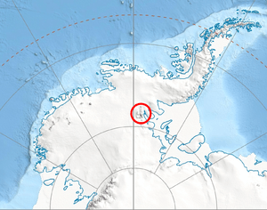

Owen Ridge (79°50′S 84°50′W / 79.833°S 84.833°WCoordinates: 79°50′S 84°50′W / 79.833°S 84.833°W) is a very high and rugged mountain ridge, 22 nautical miles (41 km) long, which forms the southwesternmost element of the Sentinel Range, Ellsworth Mountains. It extends south-southeast from Mount Strybing (3,200 m) and includes Mount Southwick and Lishness Peak. Mapped by United States Geological Survey (USGS) from surveys and U.S. Navy aerial photography, 1957-60. Named by Advisory Committee on Antarctic Names (US-ACAN) (1974) for Thomas B. Owen, Assistant Director of National and International Programs, National Science Foundation.
Maps
- Vinson Massif. Scale 1:250 000 topographic map. Reston, Virginia: US Geological Survey, 1988.
![]() This article incorporates public domain material from the United States Geological Survey document "Owen Ridge" (content from the Geographic Names Information System).
This article incorporates public domain material from the United States Geological Survey document "Owen Ridge" (content from the Geographic Names Information System).