Owariasahi, Aichi
| Owariasahi 尾張旭市 | |||
|---|---|---|---|
| City | |||
| |||
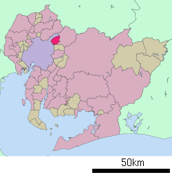 Location of Owariasahi in Aichi Prefecture | |||
 Owariasahi
| |||
| Coordinates: 35°12′59.5″N 137°02′7.3″E / 35.216528°N 137.035361°ECoordinates: 35°12′59.5″N 137°02′7.3″E / 35.216528°N 137.035361°E | |||
| Country | Japan | ||
| Region | Chūbu (Tōkai) | ||
| Prefecture | Aichi Prefecture | ||
| Government | |||
| • - Mayor | Kōji Taniguchi | ||
| Area | |||
| • Total | 21.03 km2 (8.12 sq mi) | ||
| Population (May 2015) | |||
| • Total | 81,924 | ||
| • Density | 3,900/km2 (10,000/sq mi) | ||
| Time zone | Japan Standard Time (UTC+9) | ||
| - Tree | Camphor Laurel | ||
| - Flower | Sunflower | ||
| Phone number | 0561-53-2111 | ||
| Address | 2600-1 Hadara, Higashi-Ōmichi-chō, Owariasahi-shi, Aichi-ken 488-8666 | ||
| Website | Official website | ||


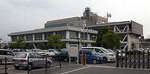
City hall
Owariasahi (尾張旭市 Owariasahi-shi) is a city located in Aichi Prefecture, Japan.
As of May 2015, the city had an estimated population of 81,294 and a population density of 3900 persons per km². The total area was 21.03 square kilometres (8.12 sq mi).
Geography
Owariasahi is located in west-central Aichi Prefecture, north of the Nagoya metropolis. The Aichi Prefectural Forest Park covers approximately 15% of its area.
Surrounding municipalities
- Aichi Prefecture
History
During the Meiji period, the area was organized into villages under Higashikasugai District, Aichi. Asahi was proclaimed a town on August 5, 1948. Asahi was raised to city status on December 1, 1970. In order to prevent confusion with the city of Asahi, Chiba, the new city was named Owariasahi.
Transportation
Railways
Highways
Education
- Nagoya Management Junior College
- Nagoya Sangyo University
- Owariasahi has nine elementary schools, three middle schools and one high school
Notable people from Owariasahi
- Hiromitsu Kanehara, mixed martial artist
External links
| Wikimedia Commons has media related to Owariasahi, Aichi. |
- Official website (Japanese)
- Owariasahi City official website (English)
| Wards of Nagoya | ||
|---|---|---|
| Core cities | ||
| Special cities | ||
| Cities | ||
| Aichi District | ||
| Ama District | ||
| Chita District | ||
| Kitashitara District | ||
| Nishikasugai District | ||
| Niwa District | ||
| Nukata District | ||
This article is issued from Wikipedia - version of the 12/29/2015. The text is available under the Creative Commons Attribution/Share Alike but additional terms may apply for the media files.