Otisville, New York
| Otisville, New York | |
|---|---|
| Village | |
 Location in Orange County and the state of New York. | |
 Otisville, New York Location within the state of New York | |
| Coordinates: 41°28′15″N 74°32′22″W / 41.47083°N 74.53944°WCoordinates: 41°28′15″N 74°32′22″W / 41.47083°N 74.53944°W | |
| Country | United States |
| State | New York |
| County | Orange |
| Area | |
| • Total | 0.7 sq mi (1.8 km2) |
| • Land | 0.7 sq mi (1.8 km2) |
| • Water | 0.0 sq mi (0.0 km2) |
| Elevation | 853 ft (260 m) |
| Population (2010) | |
| • Total | 1,068 |
| Time zone | Eastern (EST) (UTC-5) |
| • Summer (DST) | EDT (UTC-4) |
| ZIP code | 10963 |
| Area code(s) | 845 |
| FIPS code | 36-55673 |
| GNIS feature ID | 0959548 |
Otisville is a village in Orange County, New York, in the United States. The population was 1,068 at the 2010 census. It is part of the Poughkeepsie–Newburgh–Middletown, NY Metropolitan Statistical Area as well as the larger New York–Newark–Bridgeport, NY-NJ-CT-PA Combined Statistical Area.
The village of Otisville is in the town of Mount Hope, located near the west town line.
The mayor of Otisville is Brian Wona.[1][2]
The name "Otisville" also refers to Federal Correctional Institution, Otisville and Otisville Correctional Facility, a NY prison, both located nearby. There is also the station on Metro-North's Port Jervis Line.
History
The community was settled in 1816.
A former sanitarium located near the village is now a New York state prison. The sanitarium became a boys' training school for the state, and served as such until some time in the 1970s, when it was transformed into a N.Y. State prison facility. A boys' training school was another name for a reform school for male juvenile delinquents.
Geography
Otisville is located at 41°28′15″N 74°32′22″W / 41.47083°N 74.53944°W (41.470714, -74.539463).[3]
According to the United States Census Bureau, the village has a total area of 0.7 square miles (1.8 km2), all of it land.
Otisville is located at the intersection of New York State Route 211 and County Route 11.
Demographics
| Historical population | |||
|---|---|---|---|
| Census | Pop. | %± | |
| 1880 | 471 | — | |
| 1930 | 809 | — | |
| 1940 | 889 | 9.9% | |
| 1950 | 911 | 2.5% | |
| 1960 | 896 | −1.6% | |
| 1970 | 933 | 4.1% | |
| 1980 | 953 | 2.1% | |
| 1990 | 1,078 | 13.1% | |
| 2000 | 989 | −8.3% | |
| 2010 | 1,068 | 8.0% | |
| Est. 2015 | 1,046 | [4] | −2.1% |
As of the census[6] of 2000, there were 989 people, 356 households, and 250 families residing in the village. The population density was 1,425.9 people per square mile (553.4/km²). There were 373 housing units at an average density of 537.8 per square mile (208.7/km²). The racial makeup of the village was 89.48% White, 5.97% African American, 0.30% Native American, 0.61% Asian, 0.10% Pacific Islander, 0.51% from other races, and 3.03% from two or more races. Hispanic or Latino of any race were 6.67% of the population.
There were 356 households out of which 37.6% had children under the age of 18 living with them, 51.1% were married couples living together, 15.4% had a female householder with no husband present, and 29.5% were non-families. 24.7% of all households were made up of individuals and 12.6% had someone living alone who was 65 years of age or older. The average household size was 2.78 and the average family size was 3.33.
In the village the population was spread out with 28.2% under the age of 18, 8.8% from 18 to 24, 27.3% from 25 to 44, 24.9% from 45 to 64, and 10.8% who were 65 years of age or older. The median age was 37 years. For every 100 females there were 90.2 males. For every 100 females age 18 and over, there were 87.8 males.
The median income for a household in the village was $49,500, and the median income for a family was $56,875. Males had a median income of $41,023 versus $31,023 for females. The per capita income for the village was $19,752. About 5.7% of families and 7.5% of the population were below the poverty line, including 9.4% of those under age 18 and 0.9% of those age 65 or over.
Notable people
- Dorothy Young, entertainer.
References
- ↑ Nani, James (15 March 2013). "3 vying for Otisville mayor job". Times Herald-Record.
- ↑ "2015 Village Election Results". Times Herald-Record. March 18, 2015.
- ↑ "US Gazetteer files: 2010, 2000, and 1990". United States Census Bureau. 2011-02-12. Retrieved 2011-04-23.
- ↑ "Annual Estimates of the Resident Population for Incorporated Places: April 1, 2010 to July 1, 2015". Retrieved July 2, 2016.
- ↑ "Census of Population and Housing". Census.gov. Retrieved June 4, 2015.
- ↑ "American FactFinder". United States Census Bureau. Retrieved 2008-01-31.
External links
Municipalities and communities of Orange County, New York, United States | ||
|---|---|---|
| Cities | 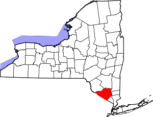 | |
| Towns | ||
| Villages | ||
| CDPs | ||
| Other hamlets | ||