Otis, Colorado
| Town of Otis, Colorado | |
|---|---|
| Town | |
|
Entering Otis from the east. | |
 Location in Washington County and the state of Colorado | |
| Coordinates: 40°9′2″N 102°57′45″W / 40.15056°N 102.96250°WCoordinates: 40°9′2″N 102°57′45″W / 40.15056°N 102.96250°W | |
| Country |
|
| State |
|
| County[1] | Washington |
| Incorporated (town) | March 27, 1917[2] |
| Government | |
| • Type | Statutory Town[1] |
| Area | |
| • Total | 0.4 sq mi (1.1 km2) |
| • Land | 0.4 sq mi (1.1 km2) |
| • Water | 0 sq mi (0 km2) |
| Elevation[3] | 4,360 ft (1,329 m) |
| Population (2000) | |
| • Total | 534 |
| • Density | 1,335/sq mi (485.5/km2) |
| Time zone | Mountain (MST) (UTC-7) |
| • Summer (DST) | MDT (UTC-6) |
| ZIP code[4] | 80743 |
| Area code(s) | 970 |
| FIPS code | 08-56365 |
| GNIS feature ID | 0182989 |

Otis is a Statutory Town in Washington County, Colorado, United States. The population was 534 at the 2000 census.
History
Otis was established in 1882 as a construction campsite for workers building the Burlington & Missouri River rail line from Lincoln Nebr to Denver, Colo.[5] According to tradition, the community was named after W. O. Otis, a pioneer settler.[6] The post office opened in 1886 and the town was platted in 1887.[7]
Geography
Otis is located at 40°9′2″N 102°57′45″W / 40.15056°N 102.96250°W (40.150645, -102.962521).[8]
According to the United States Census Bureau, the town has a total area of 0.4 square miles (1.0 km2), all of it land.
Demographics
| Historical population | |||
|---|---|---|---|
| Census | Pop. | %± | |
| 1920 | 467 | — | |
| 1930 | 529 | 13.3% | |
| 1940 | 498 | −5.9% | |
| 1950 | 532 | 6.8% | |
| 1960 | 568 | 6.8% | |
| 1970 | 521 | −8.3% | |
| 1980 | 534 | 2.5% | |
| 1990 | 451 | −15.5% | |
| 2000 | 534 | 18.4% | |
| 2010 | 475 | −11.0% | |
| Est. 2015 | 475 | [9] | 0.0% |
As of the census[11] of 2000, there were 534 people, 218 households, and 146 families residing in the town. The population density was 1,304.8 people per square mile (502.9/km²). There were 248 housing units at an average density of 606.0 per square mile (233.5/km²). The racial makeup of the town was 97.57% White, 0.19% Native American, 1.69% from other races, and 0.56% from two or more races. Hispanic or Latino of any race were 3.00% of the population.
There were 218 households out of which 33.5% had children under the age of 18 living with them, 53.7% were married couples living together, 9.2% had a female householder with no husband present, and 33.0% were non-families. 30.3% of all households were made up of individuals and 15.6% had someone living alone who was 65 years of age or older. The average household size was 2.45 and the average family size was 3.03.
In the town the population was spread out with 29.8% under the age of 18, 6.7% from 18 to 24, 24.9% from 25 to 44, 20.4% from 45 to 64, and 18.2% who were 65 years of age or older. The median age was 36 years. For every 100 females there were 100.8 males. For every 100 females age 18 and over, there were 90.4 males.
The median income for a household in the town was $31,333, and the median income for a family was $35,000. Males had a median income of $30,089 versus $20,833 for females. The per capita income for the town was $19,719. About 3.9% of families and 7.3% of the population were below the poverty line, including 3.0% of those under age 18 and 16.4% of those age 65 or over.
Climate
According to the Köppen Climate Classification system, Otis has a semi-arid climate, abbreviated "BSk" on climate maps.[12]
| Climate data for Otis, Colorado | |||||||||||||
|---|---|---|---|---|---|---|---|---|---|---|---|---|---|
| Month | Jan | Feb | Mar | Apr | May | Jun | Jul | Aug | Sep | Oct | Nov | Dec | Year |
| Average high °C (°F) | 4 (39) |
7 (44) |
11 (51) |
16 (60) |
21 (70) |
28 (82) |
32 (90) |
30 (86) |
26 (78) |
18 (65) |
10 (50) |
4 (40) |
17 (63) |
| Average low °C (°F) | −11 (13) |
−8 (17) |
−4 (24) |
0 (32) |
6 (42) |
11 (52) |
14 (58) |
13 (56) |
8 (47) |
2 (35) |
−5 (23) |
−10 (14) |
1 (34) |
| Average precipitation mm (inches) | 8 (0.3) |
10 (0.4) |
30 (1) |
43 (1.7) |
71 (2.8) |
58 (2.3) |
66 (2.6) |
58 (2.3) |
30 (1.2) |
23 (0.9) |
15 (0.6) |
10 (0.4) |
422 (16.6) |
| Source: Weatherbase[13] | |||||||||||||
See also
References
- 1 2 "Active Colorado Municipalities". State of Colorado, Department of Local Affairs. Retrieved 2007-09-01.
- ↑ "Colorado Municipal Incorporations". State of Colorado, Department of Personnel & Administration, Colorado State Archives. 2004-12-01. Retrieved 2007-09-02.
- ↑ "US Board on Geographic Names". United States Geological Survey. 2007-10-25. Retrieved 2008-01-31.
- ↑ "ZIP Code Lookup" (JavaScript/HTML). United States Postal Service. Retrieved November 28, 2007.
- ↑ BNSF Track Segments, Version 9, Compiled by Alan Eisenberg, Revised 10 Nov 2005.
- ↑ Dawson, John Frank. Place names in Colorado: why 700 communities were so named, 150 of Spanish or Indian origin. Denver, CO: The J. Frank Dawson Publishing Co. p. 38.
- ↑ Zion, Lee. "Map and Place Name Directory". Washington County Colorado. Retrieved 15 March 2011.
- ↑ "US Gazetteer files: 2010, 2000, and 1990". United States Census Bureau. 2011-02-12. Retrieved 2011-04-23.
- ↑ "Annual Estimates of the Resident Population for Incorporated Places: April 1, 2010 to July 1, 2015". Retrieved July 2, 2016.
- ↑ "Census of Population and Housing". Census.gov. Retrieved June 4, 2015.
- ↑ "American FactFinder". United States Census Bureau. Retrieved 2008-01-31.
- ↑ Climate Summary for Otis, Colorado
- ↑ "Weatherbase.com". Weatherbase. 2013. Retrieved on October 2, 2013.
External links
Municipalities and communities of Washington County, Colorado, United States | ||
|---|---|---|
| Towns | 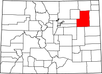 | |
| Unincorporated communities | ||
| Ghost town | ||
