Othona
Coordinates: 51°44′06″N 0°56′24″E / 51.735°N 0.940°E
| Othona | |
|---|---|
|
View looking north towards the Chapel of St Peter-on-the-Wall on the site of the Roman fort | |
 Othona | |
| OS grid reference | TM031081 |
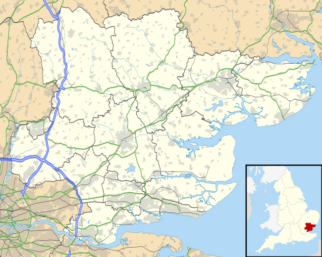
Othona or Othonae was the name of an ancient Roman fort of the Saxon Shore at the location of the modern village Bradwell-on-Sea in Essex, England. The Old English name Ythanceaster for the locality derives from the Roman name.[1]
History
The fort of Othona is in a typical late 3rd century style, and was possibly constructed in during or shortly prior to the Carausian Revolt, making it contemporary with the forts at Dubris, Portus Lemanis and Gariannonum[2] According to the Notitia Dignitatum, which is the only contemporary document mentioning Othona, the fort was garrisoned by a numerus fortensium ("numerus of the brave ones").[3]
Location and construction
Othona's location at the edge of the Dengie Peninsula was ideal for control of the estuaries of the rivers Blackwater and Colne, the latter leading to the important city of Camulodunum (now Colchester).[4] The fort's shape is roughly trapezoidal, with rounded corners. The stone rampart was 4.2 meters thick, indicating a tall superstructure, and enclosed over 2 hectares (4.9 acres). A single exterior ditch surrounded the site. Although some of the Roman building material was reused in the 7th century Chapel of St Peter-on-the-Wall, enough of the rampart survived until the 17th century, when it was described by Philemon Holland as a "huge ruin".[5]
References
Sources
- Fields, Nic (2006). Rome's Saxon Shore - Coastal Defences of Roman Britain AD 250-500 (Fortress 56). Osprey Publishing. ISBN 978-1-84603-094-9.
- Johnston, David E.; et als. (1977). "The Saxon Shore" (PDF). CBA Research Report (18). Retrieved 2007-08-20.
External links
![]() Media related to Othona at Wikimedia Commons
Media related to Othona at Wikimedia Commons

