Osam
| Osam | |
|---|---|
| Country | Bulgaria |
| Basin | |
| Main source |
Levski Peak 1,821 m (5,974 ft) 42°43′10.74″N 24°46′49.26″E / 42.7196500°N 24.7803500°E |
| River mouth |
near Nikopol 40 m (130 ft) 43°42′6.79″N 24°51′10.05″E / 43.7018861°N 24.8527917°ECoordinates: 43°42′6.79″N 24°51′10.05″E / 43.7018861°N 24.8527917°E |
| Basin size | 2,824 km2 (1,090 sq mi) |
| Physical characteristics | |
| Length | 314 km (195 mi) |
| Discharge |
|
The Òsam (Bulgarian: Осъм) is a river in northern Bulgaria. Its drainage basin is in between that of the river Vit to the west and the Yantra system to the east.[1] The river has two main tributaries in its upper course: the Black Osam takes its source from the foot of Levski Peak in the Balkan Mountains, at an altitude of 1,821 m (5,974 ft), while the White Osam has its source on the northern slopes of the Kozya Stena peak. In Troyan, the black and white Osam join. It runs north towards Lovech, then north-east until Letnitsa and Levski, where it turns north-west until it flows into the river Danube 5 km west of the town of Nikopol. The ancient name of the river was Assamus.
References
- ↑ http://www.bluelink.net/water/dunav/osam_n/index_osam_n.htm Поречието на р. Осъм
| Countries |  | |
|---|---|---|
| Cities | ||
| Tributaries | ||
| See also | ||
Capital: Lovech | ||
| Villages |
| 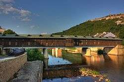 |
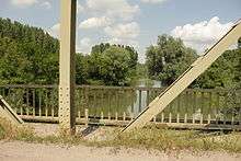
| Landmarks | ||
| Culture |
| |
| Notable people | ||
| Wikimedia Commons has media related to Osam. |
This article is issued from Wikipedia - version of the 6/5/2016. The text is available under the Creative Commons Attribution/Share Alike but additional terms may apply for the media files.