Ortonville, California
| Ortonville, California | |
|---|---|
| Unincorporated community | |
 Ortonville, California | |
| Coordinates: 34°19′17″N 119°17′29″W / 34.32139°N 119.29139°WCoordinates: 34°19′17″N 119°17′29″W / 34.32139°N 119.29139°W | |
| Country | United States |
| State | California |
| County | Ventura |
| Elevation | 148 ft (45 m) |
| Time zone | Pacific (PST) (UTC-8) |
| • Summer (DST) | PDT (UTC-7) |
| Area code(s) | 805 |
| GNIS feature ID | 1661160[1] |
Ortonville is an archaic Populated Place name in an unincorporated community of Ventura County, California, United States. Ortonville is located along California State Route 33 4.8 miles (7.7 km) northwest of Ventura. Ortonville lies north of the unincorporated community Wadstrom and South of the unincorporated community Weldons.
Two mobile home parks are just north of the site of this historical Place name; Canon De Las Encinas Park and Magnolia Park.
References
Municipalities and communities of Ventura County, California, United States | ||
|---|---|---|
| Cities | 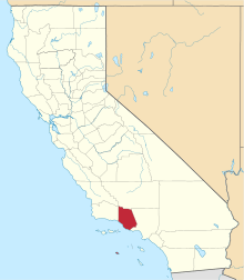 | |
| CDPs | ||
| Unincorporated communities | ||
| Footnotes | ‡This populated place also has portions in an adjacent county or counties | |
This article is issued from Wikipedia - version of the 11/9/2014. The text is available under the Creative Commons Attribution/Share Alike but additional terms may apply for the media files.