Orta, Møre og Romsdal
For other uses, see Orta (disambiguation).
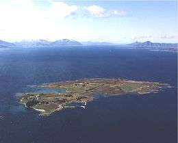 View of Orta | |
 Location in Møre og Romsdal | |
| Geography | |
|---|---|
| Location | Romsdal, Norway |
| Coordinates | 62°46′53″N 6°38′19″E / 62.7814°N 6.6387°ECoordinates: 62°46′53″N 6°38′19″E / 62.7814°N 6.6387°E |
| Area | 1 km2 (0.39 sq mi) |
| Length | 1.5 km (0.93 mi) |
| Width | 1 km (0.6 mi) |
| Coastline | 5.5 km (3.42 mi) |
| Highest elevation | 28 m (92 ft) |
| Highest point | Rambjøra |
| Administration | |
| County | Møre og Romsdal |
| Municipality | Sandøy Municipality |
Orta is an island in Sandøy Municipality in Møre og Romsdal county, Norway. The 1-square-kilometre (250-acre) island lies midway between the islands of Harøya and Gossa in the Harøyfjorden. There are ferry connections from Orta to Sandøya and Finnøya (in Sandøy Municipality) and to Gossa (in Aukra Municipality).[1]
References
This article is issued from Wikipedia - version of the 11/17/2016. The text is available under the Creative Commons Attribution/Share Alike but additional terms may apply for the media files.