Orofino, Idaho
| Orofino, Idaho | |
|---|---|
| City | |
|
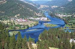
Clearwater River near Orofino | |
|
Location in Clearwater County and the state of Idaho | |
 Orofino, Idaho Location in the United States | |
| Coordinates: 46°29′8″N 116°15′32″W / 46.48556°N 116.25889°WCoordinates: 46°29′8″N 116°15′32″W / 46.48556°N 116.25889°W | |
| Country | United States |
| State | Idaho |
| County | Clearwater |
| Area[1] | |
| • Total | 2.47 sq mi (6.4 km2) |
| • Land | 2.33 sq mi (6.0 km2) |
| • Water | 0.14 sq mi (0.4 km2) |
| Elevation | 1,030 ft (310 m) |
| Population (2010)[2] | |
| • Total | 3,142 |
| • Estimate (2012[3]) | 3,078 |
| • Density | 1,348.5/sq mi (520.7/km2) |
| Time zone | Pacific (PST) (UTC-8) |
| • Summer (DST) | PDT (UTC-7) |
| ZIP code | 83544 |
| Area code(s) | 208 |
| FIPS code | 16-59320 |
| GNIS feature ID | 0396986 |
Orofino ("fine gold" [ore] in Spanish) is a city in Clearwater County, Idaho, along Orofino Creek and the north bank of the Clearwater River. The population was 3,142 at the 2010 census, and the city is the county seat of Clearwater County.[4] It is the major city within the Nez Perce Indian Reservation.
Nearby is the historical "Canoe Camp," where the Lewis and Clark expedition built five new dugout canoes and embarked on October 7, 1805, downstream to the Pacific Ocean. Some 4 miles (6.4 km) north of town is the Dworshak Dam, third-highest dam in the United States, completed in the early 1970s. Nearby is the Dworshak National Fish Hatchery, started to try to compensate for the loss of migratory fish upstream after the dam was constructed.
Originally the name was two words, Oro Fino, applied to a gold mining camp established in 1861 two miles (3 km) south of Pierce; it is now a ghost town. When the United States government opened up the Nez Percé reservation to non-tribal settlers in 1895,[5][6][7][8] thousands of European Americans rushed to lay claims to land. Clifford Fuller set up a trading post on his new homestead. The town (Orofino-on-the-Clearwater) was established the next year.[9] The railroad, later part of the Camas Prairie Railroad, was constructed from Lewiston in 1899.[10]
Orofino is home to state institutions: Idaho State Hospital North and the Idaho Correctional Institution - Orofino. These two facilities are located adjacent to Orofino High School, which includes the junior high or middle school grades. The school mascot is a "Maniac." This is one of only two high schools in the country with that nickname.
Orofino hosts the annual July 4 celebration, as well as the Clearwater County Fair and Lumberjack Days in late summer. Each spring, the annual Boomershoot is held nearby.
Geography
Orofino is located at 46°29′8″N 116°15′32″W / 46.48556°N 116.25889°W (46.485485, -116.258847).[11]
According to the United States Census Bureau, the city has a total area of 2.47 square miles (6.40 km2), of which 2.33 square miles (6.03 km2) is land and 0.14 square miles (0.36 km2) is water.[1]
Due to the area's relatively low elevation, the climate is ranked as among the hottest in the summer and the mildest in the winter throughout the entire state. The moderate winters are also influenced by the city's northwestern location, which places it closer to the Pacific Ocean than many other parts of Idaho. Idaho's all-time highest temperature of 118 °F (48 °C) was recorded at Orofino on July 28, 1934.
According to the Köppen climate classification system, Orofino has a dry-summer continental climate (Köppen Dsb). Due to the warm summers, it nearly qualifies as a continental Mediterranean climate Köppen Dsa).
| Climate data for Orofino, Idaho (1971–2000) | |||||||||||||
|---|---|---|---|---|---|---|---|---|---|---|---|---|---|
| Month | Jan | Feb | Mar | Apr | May | Jun | Jul | Aug | Sep | Oct | Nov | Dec | Year |
| Record high °F (°C) | 62 (17) |
68 (20) |
82 (28) |
98 (37) |
105 (41) |
110 (43) |
118 (48) |
116 (47) |
107 (42) |
92 (33) |
71 (22) |
62 (17) |
118 (48) |
| Average high °F (°C) | 37.7 (3.2) |
45.8 (7.7) |
55.4 (13) |
64.0 (17.8) |
72.0 (22.2) |
79.7 (26.5) |
88.9 (31.6) |
90.2 (32.3) |
78.8 (26) |
63.2 (17.3) |
46.1 (7.8) |
37.3 (2.9) |
63.3 (17.4) |
| Average low °F (°C) | 25.2 (−3.8) |
28.0 (−2.2) |
32.0 (0) |
37.8 (3.2) |
44.1 (6.7) |
50.3 (10.2) |
53.7 (12.1) |
52.9 (11.6) |
45.3 (7.4) |
36.4 (2.4) |
31.1 (−0.5) |
26.2 (−3.2) |
38.6 (3.7) |
| Record low °F (°C) | −11 (−24) |
−9 (−23) |
12 (−11) |
27 (−3) |
28 (−2) |
35 (2) |
41 (5) |
39 (4) |
28 (−2) |
15 (−9) |
1 (−17) |
−15 (−26) |
−15 (−26) |
| Average precipitation inches (mm) | 2.91 (73.9) |
2.66 (67.6) |
2.53 (64.3) |
2.40 (61) |
2.59 (65.8) |
1.67 (42.4) |
1.06 (26.9) |
0.88 (22.4) |
1.24 (31.5) |
1.98 (50.3) |
3.38 (85.9) |
3.29 (83.6) |
26.59 (675.6) |
| Source: NOAA (normals, 1971–2000) [12] | |||||||||||||
Demographics
| Historical population | |||
|---|---|---|---|
| Census | Pop. | %± | |
| 1910 | 384 | — | |
| 1920 | 537 | 39.8% | |
| 1930 | 1,078 | 100.7% | |
| 1940 | 1,602 | 48.6% | |
| 1950 | 1,656 | 3.4% | |
| 1960 | 2,471 | 49.2% | |
| 1970 | 3,883 | 57.1% | |
| 1980 | 3,711 | −4.4% | |
| 1990 | 2,868 | −22.7% | |
| 2000 | 3,247 | 13.2% | |
| 2010 | 3,142 | −3.2% | |
| Est. 2015 | 3,054 | [13] | −2.8% |
2010 census
As of the census[2] of 2010, there were 3,142 people, 1,167 households, and 698 families residing in the city. The population density was 1,348.5 inhabitants per square mile (520.7/km2). There were 1,285 housing units at an average density of 551.5 per square mile (212.9/km2). The racial makeup of the city was 91.7% White, 0.5% African American, 2.5% Native American, 1.4% Asian, 0.3% Pacific Islander, 1.2% from other races, and 2.4% from two or more races. Hispanic or Latino of any race were 4.3% of the population.
There were 1,167 households of which 24.3% had children under the age of 18 living with them, 46.4% were married couples living together, 9.3% had a female householder with no husband present, 4.2% had a male householder with no wife present, and 40.2% were non-families. 34.8% of all households were made up of individuals and 17.5% had someone living alone who was 65 years of age or older. The average household size was 2.17 and the average family size was 2.77.
The median age in the city was 43.7 years. 17% of residents were under the age of 18; 7.2% were between the ages of 18 and 24; 27.3% were from 25 to 44; 28.3% were from 45 to 64; and 20.1% were 65 years of age or older. The gender makeup of the city was 58.3% male and 41.7% female.
2000 census
As of the census[15] of 2000, there were 3,247 people, 1,137 households, and 767 families residing in the city. The population density was 1,349.0 people per square mile (520.2/km²). There were 1,279 housing units at an average density of 531.4 per square mile (204.9/km²). The racial makeup of the city was 93.93% White, 0.37% African American, 2.13% Native American, 0.59% Asian, 0.09% Pacific Islander, 0.99% from other races, and 1.91% from two or more races. Hispanic or Latino of any race were 2.25% of the population.
There were 1,137 households out of which 28.9% had children under the age of 18 living with them, 54.1% were married couples living together, 8.4% had a female householder with no husband present, and 32.5% were non-families. 27.6% of all households were made up of individuals and 12.8% had someone living alone who was 65 years of age or older. The average household size was 2.33 and the average family size was 2.83.
In the city the population was spread out with 20.1% under the age of 18, 7.9% from 18 to 24, 30.4% from 25 to 44, 26.1% from 45 to 64, and 15.6% who were 65 years of age or older. The median age was 40 years. For every 100 females there were 132.9 males. For every 100 females age 18 and over, there were 143.2 males.
The median income for a household in the city was $30,580, and the median income for a family was $36,908. Males had a median income of $30,386 versus $20,968 for females. The per capita income for the city was $14,563. About 7.6% of families and 12.1% of the population were below the poverty line, including 16.3% of those under age 18 and 7.1% of those age 65 or over.
Government and infrastructure
The city government is small due to the limited number of residents.
Major facilities are run by the state, which operates the Idaho State Hospital North here. In addition, the Idaho Department of Correction operates the Idaho Correctional Institution-Orofino here.[16][17]
The United States Postal Service operates the Orofino Post Office.[18]
Transportation
The city is served by US 12, a two-lane undivided highway on the south bank of the Clearwater River, connected to Orofino by a bridge. The highway connects to Lewiston to the west and Missoula, Montana (over Lolo Pass) to the east. The route is known as the "Northwest Passage Scenic Byway," a National Scenic Byway.[19] The population is dependent on cars. Most areas have few or no sidewalks.
Notable residents
- Ben English, novelist. Graduate of Orofino High School, class of 1990[20]
- Cecil Andrus, politician, was born and raised here. He was Governor of Idaho for 14 years and U.S. Secretary of the Interior (1977−1981)
- Helen Chenoweth, politician, U.S. Representative (1995−2001)
- Faith Petric, folk singer and activist
- James Wesley Rawles, writer
References
- 1 2 "US Gazetteer files 2010". United States Census Bureau. Retrieved 2012-12-18.
- 1 2 "American FactFinder". United States Census Bureau. Retrieved 2012-12-18.
- ↑ "Population Estimates". United States Census Bureau. Retrieved 2013-06-03.
- ↑ "Find a County". National Association of Counties. Retrieved 2011-06-07.
- ↑ Hamilton, Ladd (June 25, 1961). "Heads were popping up all over the place". Lewiston Morning Tribune. p. 14.
- ↑ Brammer, Rhonda (July 24, 1977). "Unruly mobs dashed to grab land when reservation opened". Lewiston Morning Tribune. p. 6E.
- ↑ "3,000 took part in "sneak" when Nez Perce Reservation was opened". Lewiston Morning Tribune. November 19, 1931. p. 3.
- ↑ "Nez Perce Reservation". Spokesman-Review. December 11, 1921. p. 5.
- ↑ "Why they call it Orofino". Lewiston Morning Tribune. February 26, 1933. p. 4.
- ↑ Idaho for the Curious, by Cort Conley, ©1982, ISBN 0-9603566-3-0, p.95-97
- ↑ "US Gazetteer files: 2010, 2000, and 1990". United States Census Bureau. 2011-02-12. Retrieved 2011-04-23.
- ↑ "Climatography of the United States NO.81" (PDF). National Oceanic and Atmospheric Administration. Retrieved January 13, 2011.
- ↑ "Annual Estimates of the Resident Population for Incorporated Places: April 1, 2010 to July 1, 2015". Retrieved July 2, 2016.
- ↑ "Census of Population and Housing". Census.gov. Retrieved June 4, 2015.
- ↑ "American FactFinder". United States Census Bureau. Retrieved 2008-01-31.
- ↑ "Locations." Idaho Department of Correction. Retrieved on June 4, 2011. "Idaho Correctional Institution-Orofino (ICIO), 381 West Hospital Drive, Orofino, ID 83544 "
- ↑ "Orofino city, Idaho." U.S. Census Bureau. Retrieved on June 4, 2011.
- ↑ "Post Office™ Location - OROFINO." United States Postal Service. Retrieved on June 4, 2011.
- ↑ Idaho Byways - Northwest Passage Scenic Byway
- ↑ Sanders, Perrin, Goetch. Prospector 1989-1990. 1990, Volume 52, p. 25.
External links
Municipalities and communities of Clearwater County, Idaho, United States | ||
|---|---|---|
| Cities | ||
| Unincorporated communities | ||