Orchard Park (town), New York
| Orchard Park, New York | |
| Town | |
 Village of Orchard Park | |
| Country | United States |
|---|---|
| State | New York |
| County | Erie County |
| Elevation | 866 ft (264.0 m) |
| Coordinates | 42°46′N 78°44′W / 42.767°N 78.733°WCoordinates: 42°46′N 78°44′W / 42.767°N 78.733°W |
| Area | 38.5 sq mi (99.7 km2) |
| - land | 38.4 sq mi (99 km2) |
| - water | 0.1 sq mi (0 km2) |
| Population | 29,054 (2010) |
| Density | 755.8/sq mi (291.8/km2) |
| Incorporated | 1850 |
| Town Supervisor | Dr. Patrick J. Keem (R)
|
| Timezone | EST (UTC-5) |
| - summer (DST) | EDT (UTC-4) |
| ZIP code | 14127 |
| Area code | 716 |
| FIPS code | 36-55277 |
| GNIS feature ID | 0979318 |
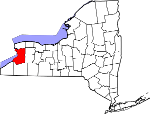
_highlighted.svg.png) Location in Erie County and the state of New York.
| |
 Location of New York in the United States
| |
| Website: www | |
Orchard Park is a town in Erie County, New York, United States, and a suburb southeast of Buffalo. As of the 2010 census the population was 29,054.[1] This represents an increase of 5.13% from the 2000 census figure.[2] The town contains a village also named Orchard Park. Orchard Park is one of the "Southtowns" of Erie County.
History
In 1803, Didymus C. Kinney and wife Phebe (Hartwell) purchased land and built a cabin in the southwest corner of the township, which has since been turned into a museum. The following year, a migration of Quaker settlers began.
The town was separated from the town of Hamburg in 1850 and was first named "Ellicott", after Joseph Ellicott, an agent of the Holland Land Company. Within months, the name was changed to the town of "East Hamburgh". Around 1934, the town was renamed "Orchard Park" after its principal settlement.
In the early 1900s, a large fire burned down most of the central part of the village of Orchard Park around South Buffalo Street.
The Buffalo, Rochester and Pittsburgh Railroad Station and the Johnson-Jolls Complex are listed on the National Register of Historic Places.[3]
Geography
Orchard Park is located at 42°46′N 78°44′W / 42.767°N 78.733°W (42.7622, -78.7414).[4] The village of Orchard Park is 14 miles (23 km) southeast of downtown Buffalo.
According to the United States Census Bureau, the town has a total area of 38.52 square miles (99.76 km2), of which 38.44 square miles (99.56 km2) is land and 0.08 square miles (0.21 km2), or 0.21%, is water.[1]
Major routes
U.S. Route 219 passes through the west part of the town and forms junctions with U.S. Route 20A (Quaker Street) and NY 179 (Milestrip Road).
U.S. Route 20 (Southwestern Boulevard) passes through the north part of the town and forms a junction with NY 277 and NY 240 (Orchard Park Road).
Adjacent towns and cities
- Town of West Seneca - north
- City of Lackawanna - northwest
- Town of Hamburg - west
- Town of Boston - south
- Town of Colden - southeast
- Town of Aurora - east
- Town of Elma - northeast
| Historical population | |||
|---|---|---|---|
| Census | Pop. | %± | |
| 1860 | 2,136 | — | |
| 1870 | 2,270 | 6.3% | |
| 1880 | 2,409 | 6.1% | |
| 1890 | 2,304 | −4.4% | |
| 1900 | 2,350 | 2.0% | |
| 1910 | 2,636 | 12.2% | |
| 1920 | 3,120 | 18.4% | |
| 1930 | 4,234 | 35.7% | |
| 1940 | 5,453 | 28.8% | |
| 1950 | 8,491 | 55.7% | |
| 1960 | 15,876 | 87.0% | |
| 1970 | 19,978 | 25.8% | |
| 1980 | 24,359 | 21.9% | |
| 1990 | 24,632 | 1.1% | |
| 2000 | 27,637 | 12.2% | |
| 2010 | 29,054 | 5.1% | |
| Est. 2014 | 29,545 | [5] | 1.7% |
| Historical Population Figures [6][7] | |||
Demographics
As of the census[8] of 2010, there were 28,272 people, 11,553 households, and 7,656 families residing in the town. The population density was 717.7 people per square mile (277.1/km²). There were 10,644 housing units at an average density of 276.4 per square mile (106.7/km²). The racial makeup of the town was 97.9% White, 0.5% Black or African American, 0.2% Native American, 0.9% Asian, <0.1% Pacific Islander, 0.2% from other races, and 0.6% from two or more races. Hispanic or Latino of any race were 1.0% of the population.
There were 10,277 households out of which 33.7% had children under the age of 18 living with them, 64.3% were married couples living together, 7.6% had a female householder with no husband present, and 25.5% were non-families. 22.1% of all households were made up of individuals and 10.3% had someone living alone who was 65 years of age or older. The average household size was 2.62 and the average family size was 3.09.
In the town the population was spread out with 25.2% under the age of 18, 5.7% from 18 to 24, 25.6% from 25 to 44, 26.8% from 45 to 64, and 16.6% who were 65 years of age or older. The median age was 41 years. For every 100 females there were 92.6 males. For every 100 females age 18 and over, there were 87.7 males.
The median income for a household in the town was $151,227, and the median income for a family was $112,906. About 1.1% of families and 2.4% of the population were below the poverty line.
Communities and locations in the town
- Armor – A hamlet at the west town line.
- Buffalo, Rochester and Pittsburgh Railroad Station - A former railroad station listed on the National Register of Historic Places.
- Chestnut Ridge Park – A popular county park with a wide range of activities, located in the south section of the town on Chestnut Ridge Road (Route 277).
- Duells Corner – A hamlet south of Orchard Park village.
- Ellicott – A hamlet south of Orchard Park village.
- Erie Community College – The official location of the south campus, although most of the campus is in the adjacent town of Hamburg.
- Loveland – A hamlet on the east town line.
- Orchard Park – A village located at the junction of Routes 240 and U.S. 20A.
- New Era Field – The home stadium of the NFL's Buffalo Bills lies on the western edge of the town.
- Webster Corners – A hamlet north of the village of Orchard Park by the intersection of Webster and Orchard Park Roads.
Education
The Orchard Park Central School District operates four K-5 elementary schools (Eggert, Ellicott, South Davis, and Windom), Orchard Park Middle School, and Orchard Park High School. The mascot for the Orchard Park's athletic teams is a Quaker.
Bryant & Stratton College is located in Orchard Park.
Erie Community College (ECC) is at the western town line.
Orchard Park also has a number of private, Catholic schools, including Nativity and St. John Vianney. Our Lady of the Sacred Heart (pre-k through 8), closed in 2014 after exhaustive research conducted by the Diocese of Buffalo regarding demographics, finances and educational relevance.[9]
Culture
Art
The annual Quaker Arts Festival, an outdoor art and craft show, is held each year on the third weekend of September, on the campus of Orchard Park Middle School. It was organized in the 1960s by Orchard Parkers John Coleman of The Suburban Press and Chet Seymour of the Orchard Park Presbyterian Church, and was originally held on the grounds of the Orchard Park Presbyterian Church. In its early days, the festival was cosponsored by the newspaper and the church. The festival is now cosponsored by the Orchard Park Jaycees and Bee Publications.
Music
Since 1985, under the direction of the Orchard Park Council of the Arts, local businesses and the town of Orchard Park sponsor free outdoor musical entertainment throughout the summer at the pavilion bandstand on the grounds of the middle school.
Organized in 1949, the Orchard Park Symphony Orchestra, composed of more than 70 volunteer musicians, performs four regular concerts each year in the high school auditorium.
The Orchard Park Chorale was founded in 1975 under the sponsorship of the Adult Education Program of the Orchard Park School District. Its more than fifty singers perform regularly at the Orchard Park Presbyterian Church.
Food
Orchard Park is home to Taffy's Hot Dog Stand at the corner of U.S. Route 20 and NY Rtes 240 & 277. Teds Hot Dogs is located about a 1/8 of a mile north. Duffs, Zebbs, Homegrown Bistro, Mangia and The Byrd House are other restaurants in town. The town is also home of the 3000th Tim Hortons restaurant location as well as Spot Coffee and Panera. Additional Orchard Park restaurants include Mighty Taco, a Buffalo-area chain restaurant, Charlie the Butcher, located adjacent to a Noco gas station, and the pizzerias Capelli's and Ricotta's, located within walking distance from each other on N. Buffalo Rd. National chains include and are not limited to Red Robin, Denny's, McDonalds and Wendy's.
Media
Print newspapers
- The Orchard Park Bee - Weekly
- The Sun - Weekly
Sports
- New Era Field, the home stadium of the NFL Buffalo Bills is located in Orchard Park.
- The Orchard Park High School football team won the 2008 and 2011 New York State Public High School Class AA Championship.
- The Orchard Park High School baseball team won the 1988 State Championship.
- The Orchard Park High School volleyball team won the 2008 New York State Championship.
- The 1993 and 1994 Orchard Park Little League Baseball team won the New York State Championship. They recently won five Section titles in three summers with one team winning three in the 10u, 11u, and 12u divisions.
- The Orchard Park Little League has baseball and softball divisions at all levels.
- The Orchard Park Starz girls' travel softball program is made up exclusively by Orchard Park players and competes in the Metro Girls' Softball Association.
- The Orchard Park Youth Basketball Association (OPYBA)
- The Orchard Park Little Loop Football
- The Orchard Park Sox, an adult men's baseball team
- The Orchard Park Shock, a flag football team established in 2008
- The Orchard Park wrestling club sent wrestlers to nationals in 2011 and 2012
Notable people
- Dave Barrett, Correspondent, CBS News - Radio Network (OPHS, 1972)
- Jim Burt, former NFL nose tackle for the San Francisco 49ers and New York Giants
- Wray Carlton, former AFL halfback with the Buffalo Bills who scored the first-ever touchdown for the Bills
- Jon Corto, former Buffalo Bills player
- Brian Dux, former professional basketball player
- John Gurtler, sportscaster
- Eric Herman, children's music entertainer
- Dave Hollins, former Major League Baseball player (Phillies, Minnesota Twins, Mariners)
- Rick James (1948–2004), musician
- Jim Kelly, former Buffalo Bills player
- John Koelmel, president of Buffalo Sabres HarborCenter
- Brooke Lauren, film and TV producer
- Lex Luger a.k.a. Lawrence ("Larry") Wendell Pfohl, former professional wrestler
- Travis Mayer, Olympic medalist in freestyle skiing
- Brian Moorman, NFL punter for the Buffalo Bills
- John Murphy, the play-by-play announcer for the Buffalo Bills
- Danny Neaverth, disc jockey and TV personality
- Lonnie Nielsen, professional golfer
- Ron Pitts, former NFL player
- Rex Ryan, coach of the Buffalo Bills
- William Sadler, actor; Saturn Award winner
- Josh Thomas, defensive end for the NFL Indianapolis Colts
- Mary Travers, executive director of the Family Justice Center of Erie County
- Craig Wolfley, former NFL offensive lineman for the Pittsburgh Steelers and Minnesota Vikings
- Ron Wolfley, former NFL fullback for the Arizona Cardinals and Cleveland Browns, current radio analyst for Arizona Cardinals
References
- 1 2 "Geographic Identifiers: 2010 Demographic Profile Data (G001): Orchard Park town, Erie County, New York". U.S. Census Bureau, American Factfinder. Retrieved March 2, 2016.
- ↑
- ↑ National Park Service (2010-07-09). "National Register Information System". National Register of Historic Places. National Park Service.
- ↑ "US Gazetteer files: 2010, 2000, and 1990". United States Census Bureau. 2011-02-12. Retrieved 2011-04-23.
- ↑ "Annual Estimates of the Resident Population for Incorporated Places: April 1, 2010 to July 1, 2014". Retrieved June 4, 2015.
- ↑ " Thirteenth census of the United States, 1890, 1900, 1910" Department of Commerce and Labor. (1910), page 350. Retrieved 2013-02-16.
- ↑ "Land Use Study" (PDF). Town of Orchard Park. June 2002. p. 81. Retrieved February 16, 2013.
- ↑ "American FactFinder". United States Census Bureau. Retrieved 2008-01-31.
- ↑ Miner, Dan. "Reporter". Buffalo Business First. Buffalo Business First. Retrieved 18 March 2016.
External links
- Town of Orchard Park official website
- Orchard Park GIS: Orchard Park
 Orchard Park travel guide from Wikivoyage