Omega Airport
| Omega Airport | |||||||||||
|---|---|---|---|---|---|---|---|---|---|---|---|
| IATA: OMG – ICAO: FYOE | |||||||||||
| Summary | |||||||||||
| Serves | Omega | ||||||||||
| Elevation AMSL | 3,350 ft / 1,021 m | ||||||||||
| Coordinates | 18°01′45″S 22°11′20″E / 18.02917°S 22.18889°ECoordinates: 18°01′45″S 22°11′20″E / 18.02917°S 22.18889°E | ||||||||||
| Map | |||||||||||
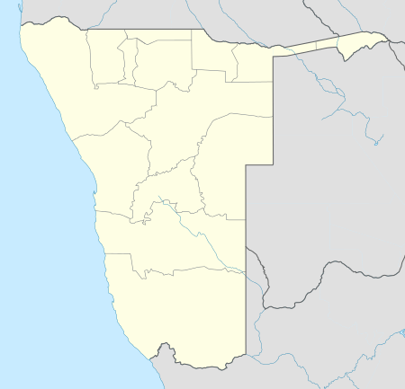 Omega Location of the airport in Namibia | |||||||||||
| Runways | |||||||||||
| |||||||||||
Omega Airport (IATA: OMG, ICAO: FYOE) is a former military[3] airport serving the village of Omega in the Kavango East Region of Namibia.
See also
 Aviation portal
 Namibia portal
- List of airports in Namibia
- Transport in Namibia
References
- ↑ Google Maps - Omega
- ↑ Airport information for OMG at Great Circle Mapper.
- ↑ SADF Omega Base
External links
- OpenStreetMap - Omega
- OurAirports - Omega
- Google Earth
This article is issued from Wikipedia - version of the 12/5/2016. The text is available under the Creative Commons Attribution/Share Alike but additional terms may apply for the media files.