Olivet, Michigan
| Olivet, Michigan | |
|---|---|
| City | |
 Location of Olivet inside Eaton County | |
| Coordinates: 42°26′29″N 84°55′27″W / 42.44139°N 84.92417°WCoordinates: 42°26′29″N 84°55′27″W / 42.44139°N 84.92417°W | |
| Country | United States |
| State | Michigan |
| County | Eaton |
| Founded | 1844 |
| Government | |
| • Mayor | Gary Peterson |
| Area[1] | |
| • Total | 1.02 sq mi (2.64 km2) |
| • Land | 1.02 sq mi (2.64 km2) |
| • Water | 0 sq mi (0 km2) |
| Elevation | 945 ft (288 m) |
| Population (2010)[2] | |
| • Total | 1,605 |
| • Estimate (2012[3]) | 1,609 |
| • Density | 1,573.5/sq mi (607.5/km2) |
| Time zone | Eastern (EST) (UTC-5) |
| • Summer (DST) | EDT (UTC-4) |
| ZIP code | 49076 |
| Area code(s) | 269 |
| FIPS code | 26-60580[4] |
| GNIS feature ID | 0634039[5] |
| Website | http://www.cityofolivet.org/ |
Olivet is a city in Eaton County in the U.S. state of Michigan. The population was 1,605 at the 2010 census. Olivet College is located in the city.
Geography
According to the United States Census Bureau, the city has a total area of 1.02 square miles (2.64 km2), all land.[1]
Demographics
| Historical population | |||
|---|---|---|---|
| Census | Pop. | %± | |
| 1870 | 526 | — | |
| 1880 | 520 | −1.1% | |
| 1890 | 790 | 51.9% | |
| 1900 | 800 | 1.3% | |
| 1910 | 627 | −21.6% | |
| 1920 | 500 | −20.3% | |
| 1930 | 566 | 13.2% | |
| 1940 | 604 | 6.7% | |
| 1950 | 887 | 46.9% | |
| 1960 | 1,185 | 33.6% | |
| 1970 | 1,629 | 37.5% | |
| 1980 | 1,604 | −1.5% | |
| 1990 | 1,604 | 0.0% | |
| 2000 | 1,758 | 9.6% | |
| 2010 | 1,605 | −8.7% | |
| Est. 2015 | 1,610 | [6] | 0.3% |
2010 census
As of the census[2] of 2010, there were 1,605 people, 426 households, and 247 families residing in the city. The population density was 1,573.5 inhabitants per square mile (607.5/km2). There were 483 housing units at an average density of 473.5 per square mile (182.8/km2). The racial makeup of the city was 89.8% White, 6.8% African American, 0.2% Native American, 0.6% Asian, 0.7% from other races, and 1.9% from two or more races. Hispanic or Latino of any race were 3.1% of the population.
There were 426 households of which 30.8% had children under the age of 18 living with them, 38.0% were married couples living together, 14.3% had a female householder with no husband present, 5.6% had a male householder with no wife present, and 42.0% were non-families. 26.5% of all households were made up of individuals and 6.6% had someone living alone who was 65 years of age or older. The average household size was 2.52 and the average family size was 3.04.
The median age in the city was 21.7 years. 15.4% of residents were under the age of 18; 47.7% were between the ages of 18 and 24; 15.9% were from 25 to 44; 15% were from 45 to 64; and 6% were 65 years of age or older. The gender makeup of the city was 52.4% male and 47.6% female.
2000 census
As of the census[4] of 2000, there were 1,758 people, 474 households, and 293 families residing in the city. The population density was 1,735.0 people per square mile (672.0/km²). There were 488 housing units at an average density of 481.6 per square mile (186.6/km²). The racial makeup of the city was 84.30% White, 9.61% African American, 1.65% Native American, 1.65% Asian, 0.06% Pacific Islander, 1.76% from other races, and 0.97% from two or more races. Hispanic or Latino of any race were 2.10% of the population.
There were 474 households out of which 39.2% had children under the age of 18 living with them, 40.1% were married couples living together, 16.9% had a female householder with no husband present, and 38.0% were non-families. 28.1% of all households were made up of individuals and 6.5% had someone living alone who was 65 years of age or older. The average household size was 2.58 and the average family size was 3.20.
In the city the population was spread out with 22.0% under the age of 18, 41.5% from 18 to 24, 20.3% from 25 to 44, 11.8% from 45 to 64, and 4.5% who were 65 years of age or older. The median age was 22 years. For every 100 females there were 102.1 males. For every 100 females age 18 and over, there were 104.5 males.
The median income for a household in the city was $34,474, and the median income for a family was $40,781. Males had a median income of $30,602 versus $19,904 for females. The per capita income for the city was $11,682. About 8.0% of families and 10.7% of the population were below the poverty line, including 10.2% of those under age 18 and 5.7% of those age 65 or over.
Education
References
- 1 2 "US Gazetteer files 2010". United States Census Bureau. Retrieved 2012-11-25.
- 1 2 "American FactFinder". United States Census Bureau. Retrieved 2012-11-25.
- ↑ "Population Estimates". United States Census Bureau. Retrieved 2013-06-03.
- 1 2 "American FactFinder". United States Census Bureau. Retrieved 2008-01-31.
- ↑ "US Board on Geographic Names". United States Geological Survey. 2007-10-25. Retrieved 2008-01-31.
- ↑ "Annual Estimates of the Resident Population for Incorporated Places: April 1, 2010 to July 1, 2015". Retrieved July 2, 2016.
- ↑ "Census of Population and Housing". Census.gov. Retrieved June 4, 2015.
External links
- Official Website of the City of Olivet
- U.S. Geological Survey Geographic Names Information System: Olivet, Michigan
Municipalities and communities of Eaton County, Michigan, United States | ||
|---|---|---|
| Cities | 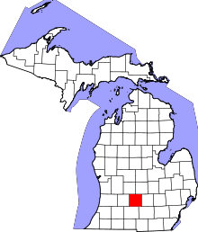 | |
| Villages | ||
| Charter townships | ||
| General law townships | ||
| CDP | ||
| Footnotes | ‡This populated place also has portions in an adjacent county or counties | |