Oldmans Township, New Jersey
| Oldmans Township, New Jersey | |
|---|---|
| Township | |
| Township of Oldmans | |
|
Farm house | |
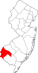
 Oldmans Township highlighted in Salem County. Inset map: Salem County highlighted in the State of New Jersey. | |
 Census Bureau map of Oldmans Township, New Jersey | |
| Coordinates: 39°44′24″N 75°24′42″W / 39.739885°N 75.411655°WCoordinates: 39°44′24″N 75°24′42″W / 39.739885°N 75.411655°W[1][2] | |
| Country |
|
| State |
|
| County | Salem |
| Incorporated | February 7, 1881 |
| Government[3] | |
| • Type | Township |
| • Body | Township Committee |
| • Mayor | Dean Sparks (R, term ends December 31, 2016)[4][5] |
| • Clerk | Melinda Taylor[6] |
| Area[1] | |
| • Total | 20.381 sq mi (52.786 km2) |
| • Land | 19.455 sq mi (50.387 km2) |
| • Water | 0.926 sq mi (2.399 km2) 4.54% |
| Area rank |
141st of 566 in state 9th of 15 in county[1] |
| Elevation[7] | 30 ft (9 m) |
| Population (2010 Census)[8][9][10] | |
| • Total | 1,773 |
| • Estimate (2015)[11] | 1,829 |
| • Rank |
500th of 566 in state 12th of 15 in county[12] |
| • Density | 91.1/sq mi (35.2/km2) |
| • Density rank |
545th of 566 in state 11th of 15 in county[12] |
| Time zone | Eastern (EST) (UTC-5) |
| • Summer (DST) | Eastern (EDT) (UTC-4) |
| ZIP code |
08067 - Pedricktown[13] 08085 - Auburn[14] |
| Area code(s) | 856[15] |
| FIPS code | 3403354810[1][16][17] |
| GNIS feature ID | 0882136[1][18] |
| Website |
www |

Oldmans Township is a township in Salem County, New Jersey, United States. As of the 2010 United States Census, the township's population was 1,773,[8][9][10] reflecting a decline of 25 (-1.4%) from the 1,798 counted in the 2000 Census, which had in turn increased by 115 (+6.8%) from the 1,683 counted in the 1990 Census.[19]
Oldmans Township was incorporated on February 7, 1881, from portions of Upper Penns Neck Township (now Carneys Point Township).[20] The township's name is a corruption of "Alderman's".[21]
It is a dry town, where alcohol cannot be sold, though alcohol is available at the winery in the township.[22][23]
Geography
According to the United States Census Bureau, the township had a total area of 20.381 square miles (52.786 km2), including 19.455 square miles (50.387 km2) of land and 0.926 square miles (2.399 km2) of water (4.54%).[1][2]
Pedricktown (with a 2010 Census population of 524[24]) is a unincorporated community and census-designated place (CDP) located within Oldmans Township.[25][26][27]
Unincorporated communities, localities and place names located partially or completely within the township include Auburn, Dolbows Landing, Jumbo, Magnolia, Oldmans Point, Parkertown and Perkintown.[28]
The township borders Carneys Point Township and Pilesgrove Township. Oldmans Township also borders the Delaware River and Oldmans Creek serves as its border with Logan Township and Woolwich Township in Gloucester County.
Demographics
| Historical population | |||
|---|---|---|---|
| Census | Pop. | %± | |
| 1890 | 1,432 | — | |
| 1900 | 1,382 | −3.5% | |
| 1910 | 1,364 | −1.3% | |
| 1920 | 1,328 | −2.6% | |
| 1930 | 1,431 | 7.8% | |
| 1940 | 1,722 | 20.3% | |
| 1950 | 1,657 | −3.8% | |
| 1960 | 2,913 | 75.8% | |
| 1970 | 2,088 | −28.3% | |
| 1980 | 1,847 | −11.5% | |
| 1990 | 1,683 | −8.9% | |
| 2000 | 1,798 | 6.8% | |
| 2010 | 1,773 | −1.4% | |
| Est. 2015 | 1,829 | [11][29] | 3.2% |
| Population sources: 1890-2000[30] 1890-1920[31] 1890[32] 1890-1910[33] 1910-1930[34] 1900-1990[35] 2000[36][37] 2010[8][9][10] | |||
Census 2010
The 2010 United States Census counted 1,773 people, 652 households, and 502 families residing in the township. The population density was 91.1 per square mile (35.2/km2). The township contained 699 housing units at an average density of 35.9 per square mile (13.9/km2). The racial makeup of the township was 87.48% (1,551) White, 7.73% (137) Black or African American, 0.23% (4) Native American, 0.90% (16) Asian, 0.00% (0) Pacific Islander, 2.31% (41) from other races, and 1.35% (24) from two or more races. Hispanics or Latinos of any race were 6.99% (124) of the population.[8]
Out of a total of 652 households, 31.3% had children under the age of 18 living with them, 58.9% were married couples living together, 11.7% had a female householder with no husband present, and 23.0% were non-families. 17.8% of all households were made up of individuals, and 5.8% had someone living alone who was 65 years of age or older. The average household size was 2.71 and the average family size was 3.04.[8]
In the township, 23.1% of the population were under the age of 18, 7.3% from 18 to 24, 22.9% from 25 to 44, 33.2% from 45 to 64, and 13.4% who were 65 years of age or older. The median age was 42.5 years. For every 100 females the census counted 95.5 males, but for 100 females at least 18 years old, it was 96.4 males.[8]
The Census Bureau's 2006-2010 American Community Survey showed that (in 2010 inflation-adjusted dollars) median household income was $66,016 (with a margin of error of +/- $7,844) and the median family income was $68,077 (+/- $6,044). Males had a median income of $55,565 (+/- $4,420) versus $32,283 (+/- $4,346) for females. The per capita income for the borough was $29,150 (+/- $2,268). About 3.3% of families and 5.2% of the population were below the poverty line, including 7.5% of those under age 18 and 5.8% of those age 65 or over.[38]
Census 2000
As of the 2000 United States Census[16] there were 1,798 people, 654 households, and 517 families residing in the township. The population density was 90.0 people per square mile (34.8/km²). There were 694 housing units at an average density of 34.8 per square mile (13.4/km²). The racial makeup of the township was 86.82% White, 9.62% African American, 0.28% Native American, 0.17% Asian, 2.00% from other races, and 1.11% from two or more races. Hispanic or Latino of any race were 4.17% of the population.[36][37]
There were 654 households out of which 32.6% had children under the age of 18 living with them, 63.9% were married couples living together, 10.9% had a female householder with no husband present, and 20.9% were non-families. 17.0% of all households were made up of individuals and 5.7% had someone living alone who was 65 years of age or older. The average household size was 2.74 and the average family size was 3.07.[36][37]
In the township the population was spread out with 24.6% under the age of 18, 7.3% from 18 to 24, 29.0% from 25 to 44, 27.1% from 45 to 64, and 11.8% who were 65 years of age or older. The median age was 39 years. For every 100 females there were 102.2 males. For every 100 females age 18 and over, there were 102.8 males.[36][37]
The median income for a household in the township was $57,589, and the median income for a family was $64,091. Males had a median income of $45,469 versus $31,705 for females. The per capita income for the township was $22,495. About 6.1% of families and 8.1% of the population were below the poverty line, including 10.2% of those under age 18 and 13.3% of those age 65 or over.[36][37]
Government
Local government
Oldmans Township is governed under the Township form of New Jersey municipal government. The three-member Township Committee is elected directly by the voters at-large in partisan elections to serve three-year terms of office on a staggered basis, with one seat coming up for election each year as part of the November general election in a three-year cycle.[3][39] At an annual reorganization meeting, the council selects one of its members to serves as mayor and another as deputy mayor.
As of 2016, members of the Oldmans Township Committee are Mayor Dean Sparks (R, term on committee ends December 31, 2017; term as mayor ends in 2016), Deputy Mayor George W. Bradford (R, term as deputy mayor and on committee ends in 2016) and Anthony Musumeci Jr. (R, 2018).[4][40][41][42][43][44][45]
Federal, state and county representation
Oldmans Township is located in the 2nd Congressional District[46] and is part of New Jersey's 3rd state legislative district.[9][47][48]
New Jersey's Second Congressional District is represented by Frank LoBiondo (R, Ventnor City).[49] New Jersey is represented in the United States Senate by Cory Booker (D, Newark, term ends 2021)[50] and Bob Menendez (D, Paramus, 2019).[51][52]
For the 2016–2017 session (Senate, General Assembly), the 3rd Legislative District of the New Jersey Legislature is represented in the State Senate by Stephen M. Sweeney (D, West Deptford Township) and in the General Assembly by John J. Burzichelli (D, Paulsboro) and Adam Taliaferro (D, Woolwich Township).[53] The Governor of New Jersey is Chris Christie (R, Mendham Township).[54] The Lieutenant Governor of New Jersey is Kim Guadagno (R, Monmouth Beach).[55]
Salem County is governed by a seven-member Board of Chosen Freeholders who are elected at-large to serve three-year terms of office on a staggered basis, with either two or three seats coming up for election each year. At an annual reorganization meeting held in the beginning of January, the board selects a Director and a Deputy Director from among its members. As of 2014, Salem County's Freeholders (with party, residence, term-end year and committee chairmanship listed in parentheses) are Director Julie A. Acton (R, Pennsville Township, 2016; Administration), Deputy Director Dale A. Cross (R, Pennsville Township, 2014; Public Safety), Bruce L. Bobbitt (D, Pilesgrove Township, 2014; Public Services), Ben Laury (R, Elmer, 2015; Public Works) Beth E. Timberman (D, Woodstown, 2015; Social Services), Robert J. Vanderslice (R, Pennsville Township, 2014; Health and Human Services) Lee R. Ware (D, Elsinboro Township, 2016; Transportation, Agriculture and Cultural Affairs).[56][57] Constitutional officers elected on a countywide basis are County Clerk Gilda T. Gill (2014),[58] Sheriff Charles M. Miller (2015)[59] and Surrogate Nicki A. Burke (2015).[60][61]
Politics
As of March 23, 2011, there were a total of 1,251 registered voters in Oldmans Township, of which 321 (25.7% vs. 30.6% countywide) were registered as Democrats, 385 (30.8% vs. 21.0%) were registered as Republicans and 545 (43.6% vs. 48.4%) were registered as Unaffiliated. There were no voters registered to other parties.[62] Among the township's 2010 Census population, 70.6% (vs. 64.6% in Salem County) were registered to vote, including 91.8% of those ages 18 and over (vs. 84.4% countywide).[62][63]
In the 2012 presidential election, Republican Mitt Romney received 51.0% of the vote (477 cast), ahead of Democrat Barack Obama with 47.9% (448 votes), and other candidates with 1.2% (11 votes), among the 941 ballots cast by the township's 1,320 registered voters (5 ballots were spoiled), for a turnout of 71.3%.[64][65] In the 2008 presidential election, Republican John McCain received 501 votes (51.6% vs. 46.6% countywide), ahead of Democrat Barack Obama with 440 votes (45.4% vs. 50.4%) and other candidates with 12 votes (1.2% vs. 1.6%), among the 970 ballots cast by the township's 1,263 registered voters, for a turnout of 76.8% (vs. 71.8% in Salem County).[66] In the 2004 presidential election, Republican George W. Bush received 516 votes (56.1% vs. 52.5% countywide), ahead of Democrat John Kerry with 396 votes (43.0% vs. 45.9%) and other candidates with 6 votes (0.7% vs. 1.0%), among the 920 ballots cast by the township's 1,228 registered voters, for a turnout of 74.9% (vs. 71.0% in the whole county).[67]
In the 2013 gubernatorial election, Republican Chris Christie received 69.0% of the vote (432 cast), ahead of Democrat Barbara Buono with 28.1% (176 votes), and other candidates with 2.9% (18 votes), among the 633 ballots cast by the township's 1,338 registered voters (7 ballots were spoiled), for a turnout of 47.3%.[68][69] In the 2009 gubernatorial election, Republican Chris Christie received 337 votes (51.4% vs. 46.1% countywide), ahead of Democrat Jon Corzine with 226 votes (34.5% vs. 39.9%), Independent Chris Daggett with 77 votes (11.7% vs. 9.7%) and other candidates with 10 votes (1.5% vs. 2.0%), among the 656 ballots cast by the township's 1,246 registered voters, yielding a 52.6% turnout (vs. 47.3% in the county).[70]
Education
The Oldmans Township School District serves public school students in Kindergarten through eighth grade at Oldmans Township School. As of the 2012-13 school year, the district's one school had an enrollment of 228 students and 19.0 classroom teachers (on an FTE basis), for a student–teacher ratio of 12.00:1.[71]
A majority of public school students in ninth through twelfth grades from Oldmans Township attend Penns Grove High School as part of a sending/receiving relationship with the Penns Grove-Carneys Point Regional School District, with the balance attending Woodstown High School in the Woodstown-Pilesgrove Regional School District.[72][73][74] Students east of Interstate 295 attend Woodstown High School, with all other students attending Penns Grove High School.[75][76] Some students also attend Gloucester Catholic High School in Gloucester City, New Jersey
Transportation

Roads and highways
As of May 2010, the township had a total of 40.89 miles (65.81 km) of roadways, of which 7.12 miles (11.46 km) were maintained by the municipality, 24.32 miles (39.14 km) by Salem County, 7.25 miles (11.67 km) by the New Jersey Department of Transportation and 2.20 miles (3.54 km) by the New Jersey Turnpike Authority.[77]
U.S. Route 130 passes through the northwestern part of the municipality[78] while Interstate 295 travels through the center of the township and includes exit 3.[79]
The New Jersey Turnpike passes through southern Oldmans.[80] Two of the turnpike's service areas, named for people who lived or worked in New Jersey, are located in the township. From south to north, these are the Clara Barton Service Area (named for Clara Barton): southbound, milepost 5.4, and the John Fenwick Service Area (named for John Fenwick; northbound, milepost 5.4).[81]
Public transportation
New Jersey Transit provides bus service between Pennsville Township and Philadelphia on the 402 route.[82][83]
The Spitfire Aerodrome (FAA LID: 7N7) is a small municipal airport located in the township, and is the only one of its kind in Salem County.[84]
Notable people
People who were born in, residents of, or otherwise closely associated with Oldmans Township include:
- Robert W. Camac (1940–2001), thoroughbred horse trainer.[85]
References
- 1 2 3 4 5 6 2010 Census Gazetteer Files: New Jersey County Subdivisions, United States Census Bureau. Accessed May 21, 2015.
- 1 2 US Gazetteer files: 2010, 2000, and 1990, United States Census Bureau. Accessed September 4, 2014.
- 1 2 2012 New Jersey Legislative District Data Book, Rutgers University Edward J. Bloustein School of Planning and Public Policy, March 2013, p. 19.
- 1 2 Township Committee, Oldmans Township. Accessed July 29, 2016.
- ↑ 2016 New Jersey Mayors Directory, New Jersey Department of Community Affairs. Accessed June 14, 2016.
- ↑ Township Clerk, Oldmans Township. Accessed July 29, 2016.
- ↑ U.S. Geological Survey Geographic Names Information System: Township of Oldmans, Geographic Names Information System. Accessed March 8, 2013.
- 1 2 3 4 5 6 DP-1 - Profile of General Population and Housing Characteristics: 2010 for Oldmans township, Salem County, New Jersey, United States Census Bureau. Accessed January 17, 2013.
- 1 2 3 4 Municipalities Grouped by 2011-2020 Legislative Districts, New Jersey Department of State, p. 2. Accessed January 6, 2013.
- 1 2 3 Profile of General Demographic Characteristics: 2010 for Oldmans township, New Jersey Department of Labor and Workforce Development. Accessed January 17, 2013.
- 1 2 PEPANNRES - Annual Estimates of the Resident Population: April 1, 2010 to July 1, 2015 - 2015 Population Estimates for New Jersey municipalities, United States Census Bureau. Accessed May 22, 2016.
- 1 2 GCT-PH1 Population, Housing Units, Area, and Density: 2010 - State -- County Subdivision from the 2010 Census Summary File 1 for New Jersey, United States Census Bureau. Accessed January 17, 2013.
- ↑ Look Up a ZIP Code for Pedricktown, NJ, United States Postal Service. Accessed January 17, 2013.
- ↑ Look Up a ZIP Code for Auburn, NJ, United States Postal Service. Accessed January 17, 2013.
- ↑ Area Code Lookup - NPA NXX for Pedricktown, NJ, Area-Codes.com. Accessed October 30, 2013.
- 1 2 American FactFinder, United States Census Bureau. Accessed September 4, 2014.
- ↑ A Cure for the Common Codes: New Jersey, Missouri Census Data Center. Accessed October 29, 2012.
- ↑ US Board on Geographic Names, United States Geological Survey. Accessed September 4, 2014.
- ↑ Table 7. Population for the Counties and Municipalities in New Jersey: 1990, 2000 and 2010, New Jersey Department of Labor and Workforce Development, February 2011. Accessed January 17, 2013.
- ↑ Snyder, John P. The Story of New Jersey's Civil Boundaries: 1606–1968, Bureau of Geology and Topography; Trenton, New Jersey; 1969. p. 216. Accessed October 23, 2012.
- ↑ Hutchinson, Viola L. The Origin of New Jersey Place Names, New Jersey Public Library Commission, May 1945. Accessed September 15, 2015.
- ↑ New Jersey Division of Alcoholic Beverage Control. New Jersey ABC list of dry towns (May 1, 2013)
- ↑ Giordano, Rita. "More towns catching liquor-license buzz; Moorestown considers ending its dry spell", The Philadelphia Inquirer, June 24, 2007. Accessed February 16, 2014.
- ↑ DP-1 - Profile of General Population and Housing Characteristics: 2010 Demographic Profile Data for Pedricktown CDP, New Jersey, United States Census Bureau. Accessed January 18, 2013.
- ↑ GCT-PH1 - Population, Housing Units, Area, and Density: 2010 - County -- County Subdivision and Place from the 2010 Census Summary File 1 for Salem County, New Jersey, United States Census Bureau. Accessed January 18, 2013.
- ↑ 2006-2010 American Community Survey Geography for New Jersey, United States Census Bureau. Accessed January 18, 2013.
- ↑ New Jersey: 2010 - Population and Housing Unit Counts - 2010 Census of Population and Housing (CPH-2-32), United States Census Bureau, August 2012. Accessed January 18, 2013.
- ↑ Locality Search, State of New Jersey. Accessed May 21, 2015.
- ↑ Census Estimates for New Jersey April 1, 2010 to July 1, 2015, United States Census Bureau. Accessed May 22, 2016.
- ↑ Barnett, Bob. Population Data for Salem County Municipalities, 1810 - 2000, WestJersey.org, January 6, 2011. Accessed January 17, 2013.
- ↑ Compendium of censuses 1726-1905: together with the tabulated returns of 1905, New Jersey Department of State, 1906. Accessed October 30, 2013.
- ↑ Porter, Robert Percival. Preliminary Results as Contained in the Eleventh Census Bulletins: Volume III - 51 to 75, p. 99. United States Census Bureau, 1890. Accessed October 30, 2013.
- ↑ Thirteenth Census of the United States, 1910: Population by Counties and Minor Civil Divisions, 1910, 1900, 1890, United States Census Bureau, p. 338. Accessed January 17, 2013.
- ↑ Fifteenth Census of the United States : 1930 - Population Volume I, United States Census Bureau, p. 718. Accessed January 17, 2013.
- ↑ New Jersey Resident Population by Municipality: 1930 - 1990, Workforce New Jersey Public Information Network. Accessed June 28, 2015.
- 1 2 3 4 5 Census 2000 Profiles of Demographic / Social / Economic / Housing Characteristics for Oldmans township, Salem County, New Jersey, United States Census Bureau. Accessed January 17, 2013.
- 1 2 3 4 5 DP-1: Profile of General Demographic Characteristics: 2000 - Census 2000 Summary File 1 (SF 1) 100-Percent Data for Oldmans township, Salem County, New Jersey, United States Census Bureau. Accessed January 17, 2013.
- ↑ DP03: Selected Economic Characteristics from the 2006-2010 American Community Survey 5-Year Estimates for Oldmans township, Salem County, New Jersey, United States Census Bureau. Accessed January 17, 2013.
- ↑ "Forms of Municipal Government in New Jersey", p. 7. Rutgers University Center for Government Studies. Accessed June 3, 2015.
- ↑ 2016 Municipal Data Sheet, Oldmans Township. Accessed July 29, 2016.
- ↑ The Official Salem County Directory, Salem County, New Jersey, February 4, 2016. Accessed July 29, 2016.
- ↑ Municipalities in Salem County, Salem County, New Jersey Clerk. Accessed July 29, 2016.
- ↑ November 3, 2015 Summary Report Salem County Official Results, Salem County, New Jersey Clerk, updated January 13, 2016. Accessed July 29, 2016.
- ↑ November 4, 2014 Summary Report Salem County Official Results, Salem County, New Jersey Clerk, updated November 24, 2014. Accessed July 29, 2016.
- ↑ November 5, 2013 Summary Report Salem County Unofficial Results, Salem County, New Jersey, updated November 5, 2013. Accessed July 29, 2016.
- ↑ Plan Components Report, New Jersey Redistricting Commission, December 23, 2011. Accessed January 6, 2013.
- ↑ 2016 New Jersey Citizen's Guide to Government, p. 62, New Jersey League of Women Voters. Accessed July 20, 2016.
- ↑ Districts by Number for 2011-2020, New Jersey Legislature. Accessed January 6, 2013.
- ↑ Directory of Representatives: New Jersey, United States House of Representatives. Accessed January 5, 2012.
- ↑ About Cory Booker, United States Senate. Accessed January 26, 2015. "He now owns a home and lives in Newark's Central Ward community."
- ↑ Biography of Bob Menendez, United States Senate, January 26, 2015. "He currently lives in Paramus and has two children, Alicia and Robert."
- ↑ Senators of the 114th Congress from New Jersey. United States Senate. Accessed January 26, 2015. "Booker, Cory A. - (D - NJ) Class II; Menendez, Robert - (D - NJ) Class I"
- ↑ Legislative Roster 2016-2017 Session, New Jersey Legislature. Accessed January 17, 2016.
- ↑ "About the Governor". State of New Jersey. Retrieved 2010-01-21.
- ↑ "About the Lieutenant Governor". State of New Jersey. Retrieved 2010-01-21.
- ↑ Board of Chosen Freeholders, Salem County, New Jersey. Accessed July 27, 2014.
- ↑ 2014 County Data Sheet, Salem County, New Jersey. Accessed July 27, 2014.
- ↑ County Clerk, Salem County Clerk's Office . Accessed July 27, 2014.
- ↑ Sheriff's Office, Salem County, New Jersey. Accessed July 27, 2014.
- ↑ Surrogate's Court, Salem County, New Jersey. Accessed July 27, 2014.
- ↑ The Official 2013 Salem County Directory, Salem County, New Jersey. Accessed July 27, 2014.
- 1 2 Voter Registration Summary - Salem, New Jersey Department of State Division of Elections, March 23, 2011. Accessed January 17, 2013.
- ↑ GCT-P7: Selected Age Groups: 2010 - State -- County Subdivision; 2010 Census Summary File 1 for New Jersey, United States Census Bureau. Accessed January 17, 2013.
- ↑ "Presidential General Election Results - November 6, 2012 - Salem County" (PDF). New Jersey Department of Elections. March 15, 2013. Retrieved December 24, 2014.
- ↑ "Number of Registered Voters and Ballots Cast - November 6, 2012 - General Election Results - Salem County" (PDF). New Jersey Department of Elections. March 15, 2013. Retrieved December 24, 2014.
- ↑ 2008 Presidential General Election Results: Salem County, New Jersey Department of State Division of Elections, December 23, 2008. Accessed January 17, 2013.
- ↑ 2004 Presidential Election: Salem County, New Jersey Department of State Division of Elections, December 13, 2004. Accessed January 17, 2013.
- ↑ "Governor - Salem County" (PDF). New Jersey Department of Elections. January 29, 2014. Retrieved December 24, 2014.
- ↑ "Number of Registered Voters and Ballots Cast - November 5, 2013 - General Election Results - Salem County" (PDF). New Jersey Department of Elections. January 29, 2014. Retrieved December 24, 2014.
- ↑ 2009 Governor: Salem County, New Jersey Department of State Division of Elections, December 31, 2009. Accessed January 17, 2013.
- ↑ District information for Oldmans Township School District, National Center for Education Statistics. Accessed March 4, 2015.
- ↑ Oldmans Township School District 2015 Report Card Narrative, New Jersey Department of Education. Accessed June 1, 2016. "Oldmans sends students in grades 9-12 to the Penns Grove-Carneys Point and Woodstown School Districts, as well as the Academy Programs, and the Salem County Vocational Technical School."
- ↑ Bumpus, Robert L. "Salem County Report on Consolidation and Regionalization", Office of the Executive County Superintendent of Salem County, March 15, 2010, available at the website of the Asbury Park Press. Accessed July 5, 2011. "A contiguous elementary district, Oldmans Township, sends its students primarily to Penns Grove High School and a smaller number of students to Woodstown High School."
- ↑ Salem County Education, Discover Salem County. Accessed October 30, 2013.
- ↑ District Policy Manual - Policy 5117; Attendance at High Schools for General & Special High School Courses of Study, revised October 10, 2007, Oldmans Township Board of Education. Accessed October 30, 2013. "All students residing in the eastern portion of the township bound by bus route #1 east of Route 295 shall attend Woodstown High School.... Those students in the remaining portion of the Township shall attend Penns Grove High School."
- ↑ Woodstown-Pilesgrove Regional School District 2015 Report Card Narrative, New Jersey Department of Education. Accessed May 23, 2016. "This School Report Card provides the school district's constituents with information concerning the district's programs, including test scores, attendance data of students and staff, financial details, and other specifics which together form a comprehensive review of our school district's offerings to the Woodstown-Pilesgrove community as well as the high school sending districts of Alloway, Oldmans, and Upper Pittsgrove."
- ↑ Salem County Mileage by Municipality and Jurisdiction, New Jersey Department of Transportation, May 2010. Accessed October 30, 2013.
- ↑ U.S. Route 130 Straight Line Diagram, New Jersey Department of Transportation, January 1997. Accessed October 30, 2013.
- ↑ Interstate 295 Straight Line Diagram, New Jersey Department of Transportation, January 1997. Accessed October 30, 2013.
- ↑ New Jersey Turnpike Straight Line Diagram, New Jersey Department of Transportation, January 1997. Accessed October 30, 2013.
- ↑ Travel Resources: Interchanges, Service Areas & Commuter Lots, New Jersey Turnpike Authority. Accessed October 30, 2013.
- ↑ Salem County Bus / Rail Connections, New Jersey Transit, backed up by the Internet Archive as of January 28, 2010. Accessed January 16, 2013.
- ↑ South Jersey Transit Guide, Cross County Connection, as of April 1, 2010. Accessed October 21, 2014.
- ↑ Spitfire Aerodrome, New Jersey Department of Transportation. Accessed October 30, 2013.
- ↑ "Trainer Camac, wife shot to death, stepson charged", Thoroughbred Times, December 7, 2001. Accessed May 15, 2008. "Robert Camac, a veteran trainer for over 40 years, was found dead from gunshot wounds along with his wife, Maryann, at the couple's Camac Thoroughbred Horse Farm in Oldmans Township, New Jersey, early Thursday morning."
External links
| Wikimedia Commons has media related to Oldmans Township, New Jersey. |
- Oldmans Township web site
- Oldmans Township School District
- Oldmans Township School District's 2014–15 School Report Card from the New Jersey Department of Education
- School Data for the Oldmans Township School, National Center for Education Statistics
- Pedricktown Website
- Woodstown High School
- Penns Grove-Carneys Point Regional School District
- Penns Grove High School
- AirNav Info on Spitfire Aerodrome