Oksibil, Pegunungan Bintang
| Oksibil | |
|---|---|
| Town | |
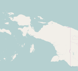 Oksibil Location of Oksibil in Papua | |
| Coordinates: 4°54′24″S 140°37′39″E / 4.90667°S 140.62750°E | |
| Country |
|
| Province | Papua |
| Regency | Pegunungan Bintang |
| Population (2010) | |
| • Total | 4,087 |
| Time zone | WIT (UTC+9) |
Oksibil is a kecamatan (district) in Papua in Indonesia that is also the administrative centre of the Pegunungan Bintang Regency. The district has a population of 4,087 inhabitants, according to the 2010 census.[1]
Transportation
There are few roads in Oksibil that provides means of travel locally. A long road connects to nearby Arimkop and ends to the southeast at a river. The primary means of transportation to and from Oksibil is by air.
Oksibil Airport
| Oksibil Airport | |||||||||||
|---|---|---|---|---|---|---|---|---|---|---|---|
| IATA: OKL – ICAO: WAJO | |||||||||||
| Summary | |||||||||||
| Airport type | Public | ||||||||||
| Serves | Oksibil, Pegunungan Bintang, Indonesia | ||||||||||
| Elevation AMSL | 4,288 ft / 1,307 m | ||||||||||
| Runways | |||||||||||
| |||||||||||
Oksibil Airport (OKL/WAJO) has connecting flights to Jayapura with Trigana Air Service and Wings Air. The airport's runway is 885 metres (2,904 ft) long and is partially marked asphalt (formerly grass) landing strip.[3] The runway can handle Turboprop STOL aircraft but is able to handle larger Turboprop Regional airliner. There are few buildings that acts as a terminal structure as well as a small tower in the tarmac area beside the runway.
Incidents
In August 2015 Trigana Air Service Flight 267 crashed on the mountain side en route to the airstrip killing all 54 on board.
References
- ↑ Biro Pusat Statistik, Jakarta, 2011.
- ↑ http://airportnavfinder.com/airport/WAJO/
- ↑ http://airportnavfinder.com/airport/WAJO/