Okinawa Trough
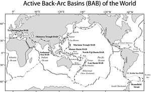
The Okinawa Trough (沖縄トラフ Okinawa Torafu) (also called Chinese: 中琉界沟, literally China-Ryukyu Border Trough[1] ) is a seabed feature of the East China Sea. It is an active, initial back-arc rifting basin which has formed behind the Ryukyu arc-trench system in the West Pacific. It developed where the Philippine Sea Plate is subducting under the Eurasia Plate.[2]
Description
It is a back-arc basin formed by extension within the continental lithosphere behind the far deeper Ryukyu Trench-arc system.[3] It has a large section more than 1,000 metres (3,300 ft) deep and a maximum depth of 2,716 metres (8,911 ft).
The Okinawa Trough still in an early stage of evolving from arc type to back-arc activity.
Implications for the China–Japan maritime boundary
Interpretations

The existence of the Okinawa Trough complicates descriptive issues in the East China Sea.[4] According to Professor Ji Guoxing of the Asia-Pacific Department at Shanghai Institute for International Studies,
- China's interpretation of the geography is that
"...the Okinawa Trough proves that the continental shelves of China and Japan are not connected, that the Trough serves as the boundary between them, and that the Trough should not be ignored ...."[4]
- Japan's interpretation of the geography is that
"...the trough is just an incidental depression in a continuous continental margin between the two countries ... and that any legal effect of the trough should be ignored ...."[4]
Legal Procedure
On August 15, 2013, China’s mission did a presentation to the Commission on the Limits of the Continental Shelf[5] (CLCS) established under the United Nations Convention on the Law of the Sea (UNCLOS). The presentation was on the proposal that demarcates the limits of the outer continental shelf beyond 200 nm in part of the East China Sea.[6] China states that China’s continental shelf in the East China Sea extends to China-Ryukyu Border Trough naturally, which has been over 200 nautical miles away from the mainland baseline of Chinese territorial waters. According to UNCLOS, any country claiming continental shelves beyond 200 nm shall provide relevant scientific evidence to CLCS. To collect solid data, China deployed 14 scientific survey ships, covering an area of 250,000 square kilometers.[7][8]
Notes
- ↑ "Chronology of Defending Diaoyu Islands". Tsinghua University (Beijing) Library. Retrieved 3 June 2013.
横渡中琉界沟黑水沟,进入"琉球大洋",乃因此沟以东属琉球海域,以西包括钓鱼台列屿乃属中国海域。
- ↑ Thakur, Naresh Kumar et al. (2010). Exploration of Gas Hydrates: Geophysical Techniques, p. 119., p. 119, at Google Books
- ↑ Sibuet, Jean-Claude et al. "Back arc extension in the Okinawa Trough," Journal of Geophysical Research, Vol. 92, Issue B13, p. 14041-14063.
- 1 2 3 Ji, Guoxing. (1995). "Maritime Jurisdiction in the Three China Seas," p. 10. UC Berkeley: UC Institute on Global Conflict and Cooperation; retrieved 15 Nov 2010.
- ↑
- ↑ State Oceanic Administration (August 16, 2013). "China Did a Presentation to CLCS on Demarcating Limits of Over-200-nm Outer Continental Shelf of the East China Sea" (in Chinese). Beijing, China.
- ↑ State Oceanic Administration (August 16, 2013). "Legally and Scientifically Sound--Discussions about China's Proposal on Demarcating Outer Continental Shelf in the East China Sea" (in Chinese). Beijing, China.
- ↑ Xinjing Bao (August 16, 2013). "Experts Discusses China's Proposal" (in Chinese). Retrieved August 16, 2013.
References
- Taylor, Brian. (1995). Backarc Basins: Tectonics and Magmatism. New York: Plenum Press. ISBN 9780306449376; OCLC 32464941
- Thakur, Naresh Kumar and Sanjeev Rajput. (2010). Exploration of Gas Hydrates: Geophysical Techniques. Berlin: Springer Verlag. ISBN 9783642142338 ISBN 3642142338; OCLC 646113755