Occidental, California
| Occidental Howards[1] | |
|---|---|
| census-designated place | |
|
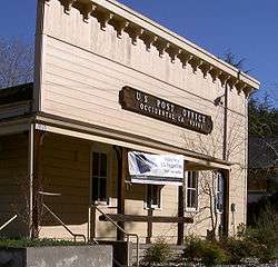
Occidental, California post office | |
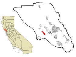 Location in Sonoma County and the state of California | |
 Occidental Location in the United States | |
| Coordinates: 38°24′27″N 122°56′54″W / 38.40750°N 122.94833°WCoordinates: 38°24′27″N 122°56′54″W / 38.40750°N 122.94833°W | |
| Country |
|
| State |
|
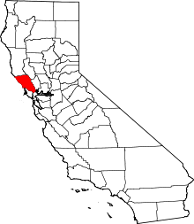
| County | Sonoma |
| Area[2] | |
| • Total | 4.966 sq mi (12.862 km2) |
| • Land | 4.966 sq mi (12.862 km2) |
| • Water | 0 sq mi (0 km2) 0% |
| Elevation[1] | 594 ft (181 m) |
| Population (2010) | |
| • Total | 1,115 |
| • Density | 220/sq mi (87/km2) |
| Time zone | PST (UTC-8) |
| • Summer (DST) | PDT (UTC-7) |
| ZIP code | 95465 |
| Area code(s) | 707 |
| FIPS code | 06-53266 |
| GNIS feature ID | 277568 |
Occidental is a census-designated place (CDP) in Sonoma County, California, United States. The population was 1,115 at the 2010 census, down from 1,272 at the 2000 census.
History
Founded in 1876, Occidental was a stop on the North Pacific Coast Railroad connecting Cazadero to the Sausalito ferry. In return for donating right-of-way to the railroad, a local landowner named "Dutch Bill" Howards received a lifetime railway pass, and the station was named after him.[3]
The railway caused a rapid expansion of the timber industry, and by 1877 there were six sawmills in the Occidental area. Trains also brought vacationers from San Francisco.[3]
Geography
Occidental is located at 38°24′27″N 122°56′54″W / 38.4074146°N 122.9483307°W.[4] The CDP has a total area of 4.97 sq mi (12.9 km2), all land.[5]
Climate
The cooperative National Weather Service station reports that Occidental has cool, wet winters and warm, dry summers.
Average January temperatures range from 41.8 °F (5.4 °C) to 54.5 °F (12.5 °C) and average July temperatures range from 51.4° to 77.9 °F (25.5 °C). The record highest temperature was 103 °F (39 °C) on July 22, 2006, and the record lowest temperature was 28 °F (−2 °C) on March 11, 2006. There are an average of 12.8 days with highs of 90 °F (32 °C) or higher and an average of 2.1 days with lows of 32 °F (0 °C) or lower.
Average annual rainfall is 55.19 inches (1,402 mm). The wettest year was 1983 with 111.21 inches (2,825 mm) and the dryest year was 1976 with 20.75 inches (527 mm). The most rainfall in one month was 36.62 inches (930 mm) in January 1995. The most rainfall in 24 hours was 8.51 inches (216 mm) on January 5, 1966. Average annual snowfall is only 0.2-inch (5.1 mm). The maximum snowfall was 11.0 inches (280 mm) in January 1974.[6]
| Climate data for Occidental, California | |||||||||||||
|---|---|---|---|---|---|---|---|---|---|---|---|---|---|
| Month | Jan | Feb | Mar | Apr | May | Jun | Jul | Aug | Sep | Oct | Nov | Dec | Year |
| Average high °C (°F) | 13 (55) |
14 (57) |
17 (62) |
17 (63) |
21 (70) |
24 (76) |
26 (78) |
26 (78) |
24 (76) |
22 (71) |
16 (61) |
12 (54) |
19 (67) |
| Average low °C (°F) | 6 (42) |
6 (43) |
7 (44) |
7 (44) |
9 (48) |
11 (51) |
11 (51) |
11 (52) |
12 (53) |
11 (51) |
8 (46) |
6 (43) |
8 (47) |
| Average precipitation mm (inches) | 287 (11.3) |
234 (9.2) |
175 (6.9) |
86 (3.4) |
38 (1.5) |
13 (0.5) |
3 (0.1) |
5 (0.2) |
13 (0.5) |
84 (3.3) |
180 (7.1) |
259 (10.2) |
1,377 (54.2) |
| Average precipitation days | 11 | 10 | 11 | 6 | 4 | 1 | 0 | 1 | 2 | 5 | 9 | 11 | 71 |
| Source: Weatherbase [7] | |||||||||||||
Demographics
2010
The 2010 United States Census[8] reported that Occidental had a population of 1,115. The population density was 224.5 people per square mile (86.7/km²). The racial makeup of Occidental was 992 (89.0%) White, 7 (0.6%) African American, 7 (0.6%) Native American, 31 (2.8%) Asian, 0 (0.0%) Pacific Islander, 23 (2.1%) from other races, and 55 (4.9%) from two or more races. Hispanic or Latino of any race were 81 persons (7.3%).
The Census reported that 100% of the population lived in households.
There were 532 households, out of which 134 (25.2%) had children under the age of 18 living in them, 228 (42.9%) were opposite-sex married couples living together, 44 (8.3%) had a female householder with no husband present, 25 (4.7%) had a male householder with no wife present. There were 39 (7.3%) unmarried opposite-sex partnerships, and 14 (2.6%) same-sex married couples or partnerships. 172 households (32.3%) were made up of individuals and 40 (7.5%) had someone living alone who was 65 years of age or older. The average household size was 2.10. There were 297 families (55.8% of all households); the average family size was 2.65.
The population was spread out with 192 people (17.2%) under the age of 18, 52 people (4.7%) aged 18 to 24, 264 people (23.7%) aged 25 to 44, 462 people (41.4%) aged 45 to 64, and 145 people (13.0%) who were 65 years of age or older. The median age was 48.5 years. For every 100 females there were 103.8 males. For every 100 females age 18 and over, there were 99.8 males.
There were 673 housing units at an average density of 135.5 per square mile (52.3/km²), of which 68.6% were owner-occupied and 31.4% were occupied by renters. The homeowner vacancy rate was 4.2%; the rental vacancy rate was 6.6%. 70.3% of the population lived in owner-occupied housing units and 29.7% lived in rental housing units.
The median income for a household in the CDP was $64,714 (+19.8% from 2000), and the median income for a family was $87,759 (+30.0% from 2000). The median per capita income for the CDP was $40,903 (+57.5% from 2000). For comparison, statewide California median per capita income in the 2010 Census was $27,885 (+22.8% from 2000).
2000
As of the census[5] of 2000, there were 1,272 people, 524 households, and 319 families residing in the CDP. The population density was 255/sq mi (99/km²). There were 632 housing units at an average density of 127/sq mi (49/km²). The racial makeup of the CDP was 92.77% White, 0.55% African American, 0.79% Native American, 1.18% Asian, 0.24% Pacific Islander, 1.57% from other races, and 2.91% from two or more races. Hispanic or Latino of any race were 4.64% of the population.
There were 524 households out of which 32.3% had children under the age of 18 living with them, 46.2% were married couples living together, 10.3% had a female householder with no husband present, and 39.1% were non-families. 27.1% of all households were made up of individuals and 5.2% had someone living alone who was 65 years of age or older. The average household size was 2.40 and the average family size was 2.91.
In the CDP the population was spread out with 22.8% under the age of 18, 7.6% from 18 to 24, 27.7% from 25 to 44, 33.3% from 45 to 64, and 8.6% who were 65 years of age or older. The median age was 41 years. For every 100 females there were 99.7 males. For every 100 females age 18 and over, there were 100.0 males.
The median income for a household in the CDP was $54,000, and the median income for a family was $71,375. Males had a median income of $46,806 versus $29,306 for females. The per capita income for the CDP was $25,970. About 7.9% of families and 9.8% of the population were below the poverty line, including 13.7% of those under age 18 and none of those age 65 or over.
Politics
In the state legislature, Occidental is in the 2nd Senate District and in the 1st Assembly District.
Federally, Occidental is in California's 2nd congressional district, represented by Democrat Jared Huffman.[9]
Culture and commerce
Occidental is unique for its high concentration of visionaries and famous artists during recent history, and was the hub of community-centered social movements in the late 1960s and early 1970s, giving rise to nearby communes such as Morningstar, Wheeler Ranch, and Star Mountain.
There was a point in the early 1990s when the town was also a center of the "neo-hippie" movement in Sonoma County, but high property prices and other economic pressures have since driven out the young families that fed this movement.
The large number of craft breweries and wineries in the area have made Barley and Hops Tavern and Sonoma Fine Wine store in downtown Occidental local and tourist destinations.[10][11]
The tool-belt manufacturing company, Occidental Leather started in an Occidental barn and later moved to downtown Occidental.[12]
Notable natives and residents
- Les Claypool
- Nick Gravenites
- Mickey Hart
- Kitarō
- Alicia Bay Laurel
- Terence McKenna
- Robert Nichols, actor[13]
- Max Thieriot lived here prior to moving into his own home in Manhattan Beach.
- Tom Waits
References
- 1 2 U.S. Geological Survey Geographic Names Information System: Occidental
- ↑ "2010 Census U.S. Gazetteer Files – Places – California". United States Census Bureau.
- 1 2 "Occidental". Retrieved 2012-12-27.
- ↑ "US Gazetteer files: 2010, 2000, and 1990". United States Census Bureau. 2011-02-12. Retrieved 2011-04-23.
- 1 2 "American FactFinder". United States Census Bureau. Retrieved 2008-01-31.
- ↑ Western Climatic Center website
- ↑ "Weatherbase.com". Weatherbase. 2013. Retrieved on June 20, 2013.
- ↑ "2010 Census Interactive Population Search: CA - Occidental CDP". U.S. Census Bureau. Retrieved July 12, 2014.
- ↑ "California's 2nd Congressional District - Representatives & District Map". Civic Impulse, LLC. Retrieved March 8, 2013.
- ↑ Delsol, Christine (January 18, 2009). "A coastal escape in tiny Occidental". The San Francisco Chronicle.
- ↑ http://blog.pressdemocrat.com/biteclub/
- ↑ Allday, Erin. Tool-belt artisan master of hide. The Press Democrat, Santa Rosa, CA, Tuesday, July 10, 2001, Business section p. E1.
- ↑ Kovner, Guy (2013-03-26). "Robert Nichols". The Press Democrat. Retrieved 2013-04-09.
External links
| Bodies of water |
|  |
|---|---|---|
| Counties | ||
| Major cities | ||
| Cities and towns 100k–250k | ||
| Cities and towns 50k–99k | ||
| Cities and towns 25k-50k | ||
| Cities and towns 10k–25k |
| |
| Sub-regions | ||